GREENSBORO, N.C. —
Why is there no snow in the forecast?
Many of you may be wondering why the forecast for late Friday night into early Saturday morning is calling for freezing rain instead of sleet or, more importantly, snow.
KNOW: It's all dependent on the varying temperatures of the atmosphere from the ground to the clouds.
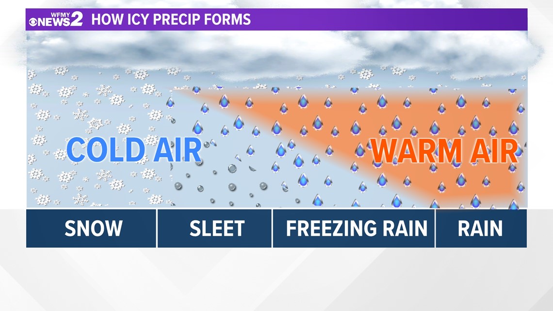
The Difference in Snow, Sleet, Freezing Rain, Rain
Well, we know water freezes at 32 degrees. However, the temperature on the ground is different from the temperature in the air where the precipitation forms.
For snow to be able to fall through the atmosphere and make it to the ground, the air must be below 32 degrees its entire course. They require subfreezing temperatures to form and stay intact on the ground with no melting.
Freezing rain is the result of snowflakes falling through warm air before hitting another cold patch of air. In the cold batch, air supercools the rain before hitting the ground. As it hits the ground, the rain is able to freeze. This includes bridges, decks, powerlines etc.
Sleet goes through a similar process as freezing rain (hits warm air and partially melts before refreezing in cold air batch) but fully refreezes before making it to the round.
This diagram illustrates how each process works:


So, in our case for Saturday in the Triad, freezing rain appears possible due to the temperatures of the atmospheric profile from the ground up. It's important to know that freezing rain can be hazardous for travelling by creating slick spots on roads and bridges, or even simply walking down the porch stairs -- make sure you are staying cautious! For the latest forecast, head on over to this link.


