
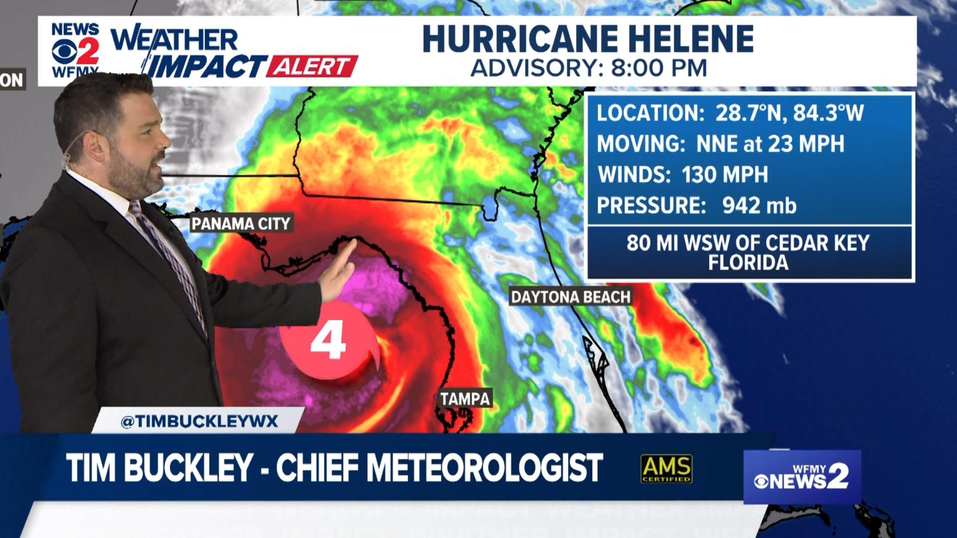
GREENSBORO, N.C. — Hurricane Helene is inland and moving in across the Southeast. The next few hours will feature some bad weather across the Carolinas.
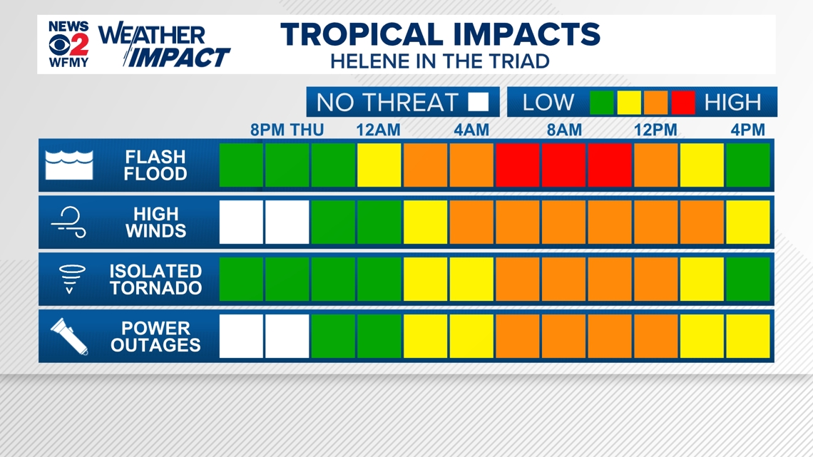
The WFMY News 2 Weather Team is tracking the threat. They've issued a WFMY News 2 Weather Impact Alert day for possible flooding and power outages on Friday.
But when will the storm get here and what should you expect? Here's a timeline to get you ready for the storm.
Here's what to know:
Winds will start to get a bit gusty overnight and rain bands will start to move into the Carolinas around daybreak. We expect it to get quite wet and quite windy toward daybreak with some downpours and wind gusts in the 25-35 mph range.
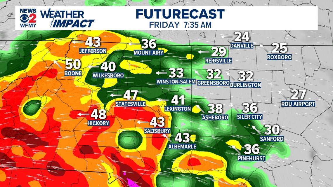
Around Sunrise: Rain arriving, Winds Pick Up

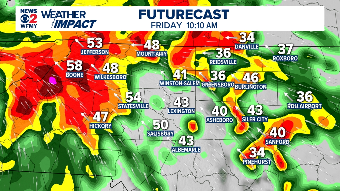
Mid-Morning: Tornado Threat Develops, High Winds & Rain
Heavy rain bands with wind gusts of 35-45 mph are likely Friday morning. This will make for difficult travel with ponding of water or even flash flooding on the roadways along with gusty winds.
There will also be a threat of tornadoes with these tropical rain bands as they move through. Make SURE to have a way to receive warnings.

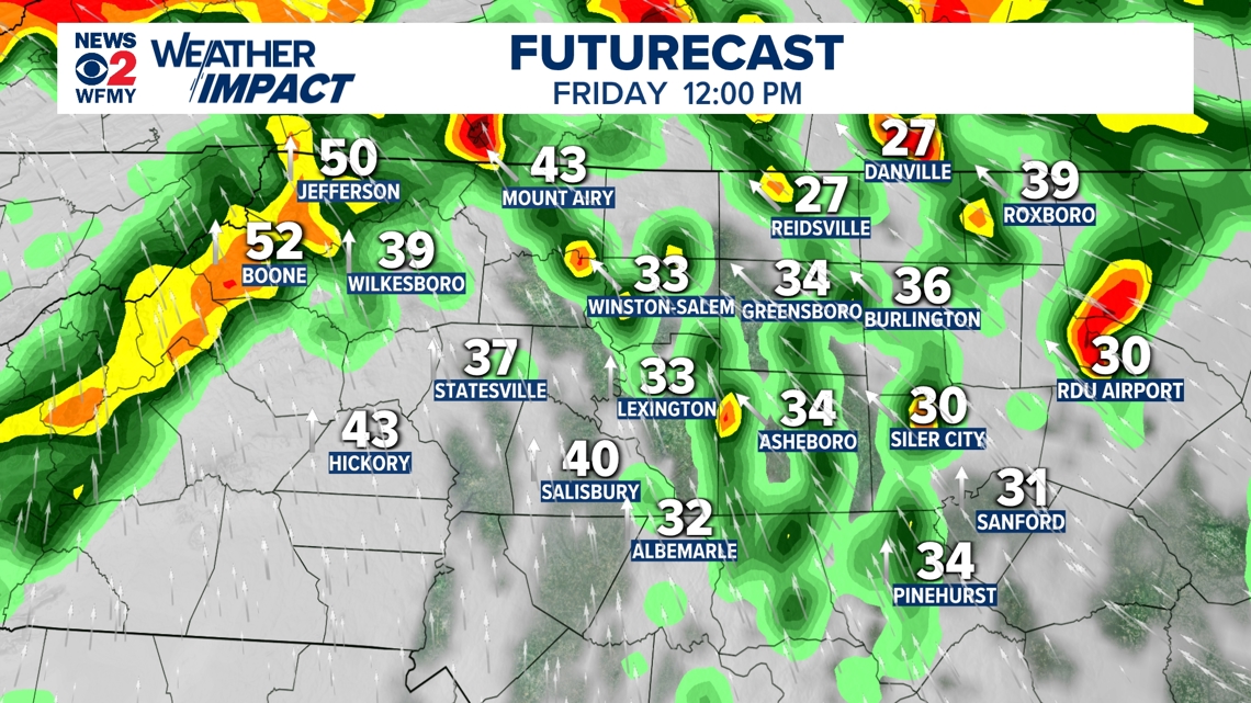
Lunchtime Friday: Rain Bands Taper a Bit, Tornado Threat Lower
By lunchtime, the rain bands will start to weaken a little bit. Winds will still be very gusty. Power outage threat remains. Tornado threat a bit lower.

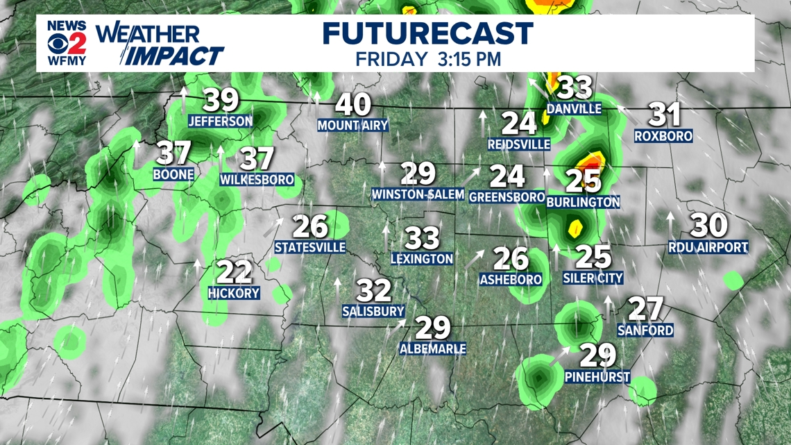
Friday afternoon: Rain mostly done, sun peeks out, breezy
The heavy rain bands will start to come to an end Friday afternoon. It will still be quite breezy. Rain will come to an end from south to north for the afternoon hours with the rain done by evening.

Weather will be nice for Saturday.

.