GREENSBORO, N.C. — Debby brought the Triad the wettest day its seen in almost six years, since Hurricane Michael in 2018. The good news: it has moved out! As Debby moves away it'll drag a cold front across the Piedmont and high pressure will move closer to us over the weekend. We'll begin clearing by midday and through the afternoon with sunshine coming back, too. Creeks and rivers will still rise and could still overflow as rain water starts to drain.
Significant rain from Debby

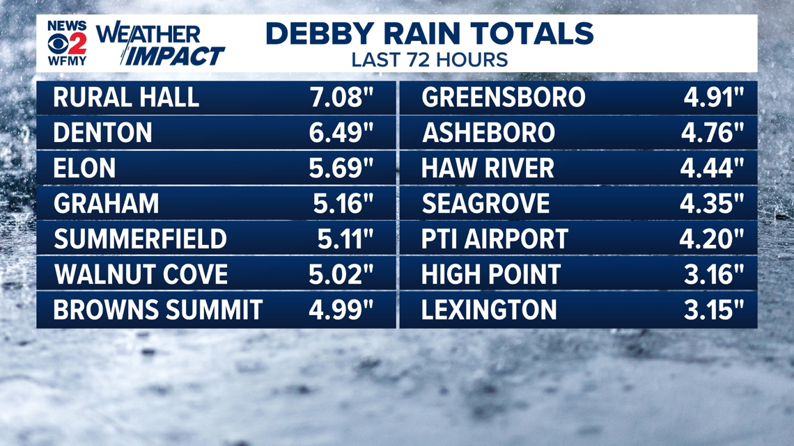
Rainfall across the Piedmont-Triad varied but most places saw between 3-7" of rainfall. To put this in perspective, this is the amount of rain we'd normally see in the span of a month!


Tropical Storm Debby dumped a significant amount of rain, even in comparison to other tropical systems. Not far off from totals from Hurricane Michael & Florence back in 2018. The average rainfall for the month of August is 4.25". After Debby, we're up to 5.15" so far for the month as of August 9th.
Here's a radar estimate in the Triad over the last 48 hours:

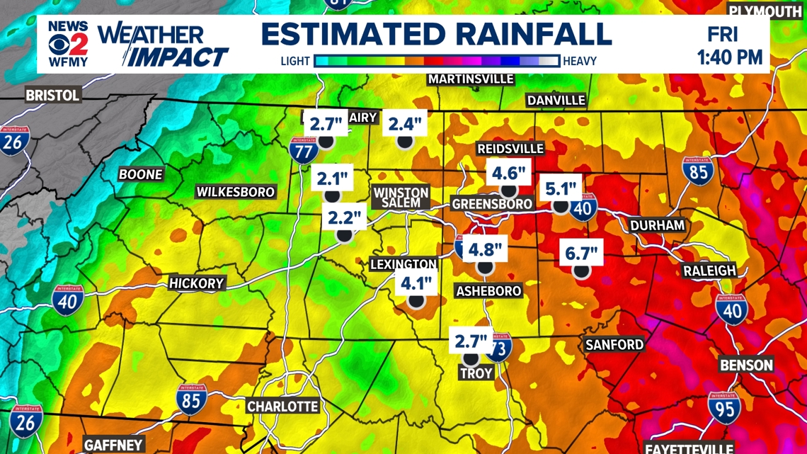
Most of the heaviest rain was for easternmost counties where in some spots over 7"+ was recorded over the past 72 hours.
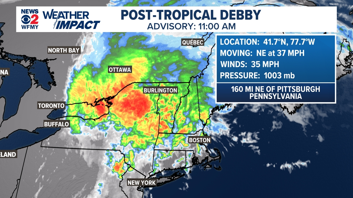
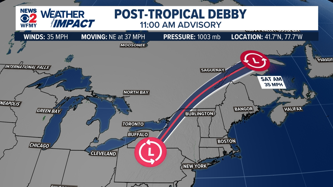
Where is Debby now?
Debby has pushed farther NE and is now a Post Tropical Cyclone, gaining forward speed between 35-40 mph.


Sunshine Returns!
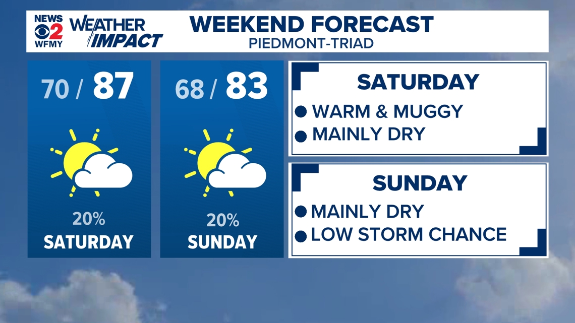
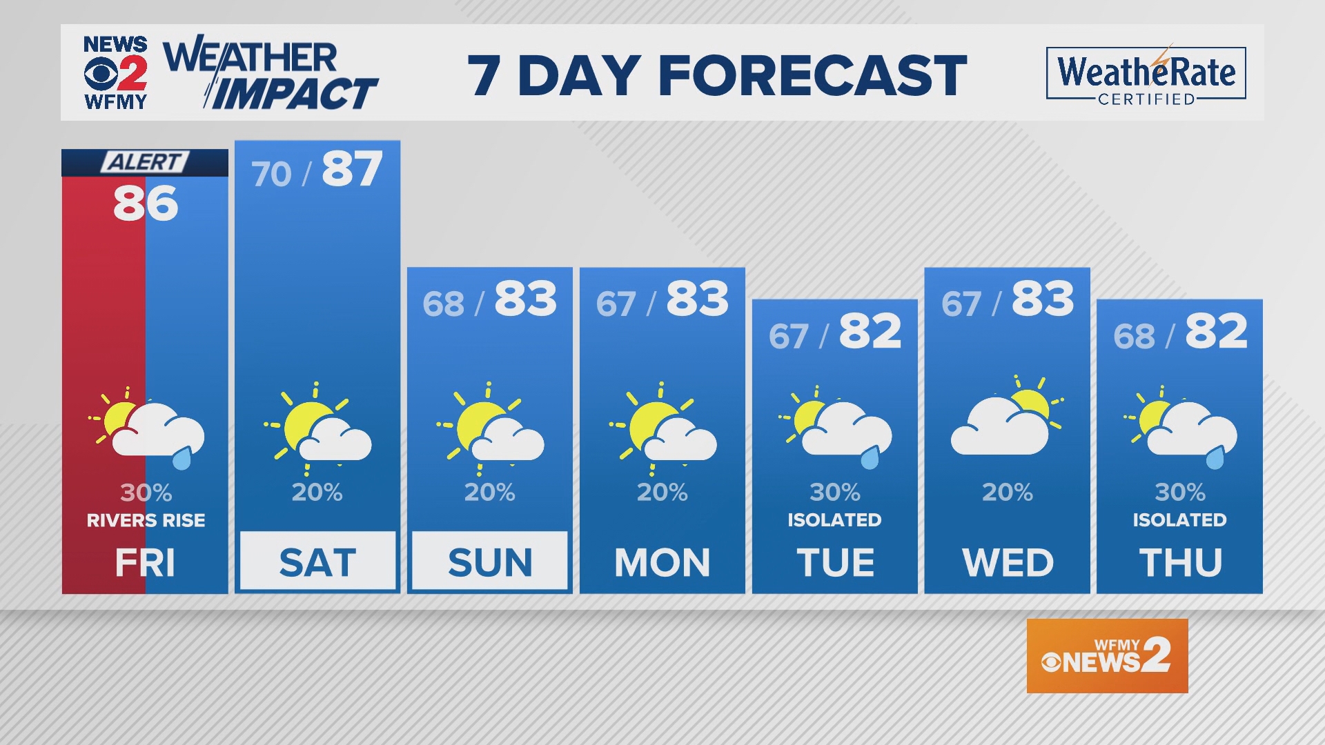
We're finally going to be able to mostly dry things out this weekend, which is very much needed now. Plan on a beautiful weekend with Saturday and Sunday having plenty of sunshine, with highs temperatures in the mid 80s. It is still summer, so a pop up shower or storm isn't totally ruled out, but most of us will stay dry. Mainly dry weather continues into early next week. Temperatures in the low to mid 80s all week.

