
GREENSBORO, N.C. — The WFMY News 2 Weather Team has declared a Weather Impact Alert Day for this Friday, Sept. 27.
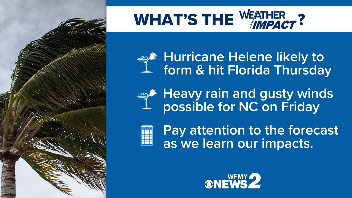
This is because Hurricane Helene is currently forming in the Caribbean Sea. It will form, move into the Gulf of Mexico, and likely land on the Florida panhandle as a major hurricane on Thursday evening. Rain and wind from the storm are likely to be in Piedmont on Friday.
WHEN
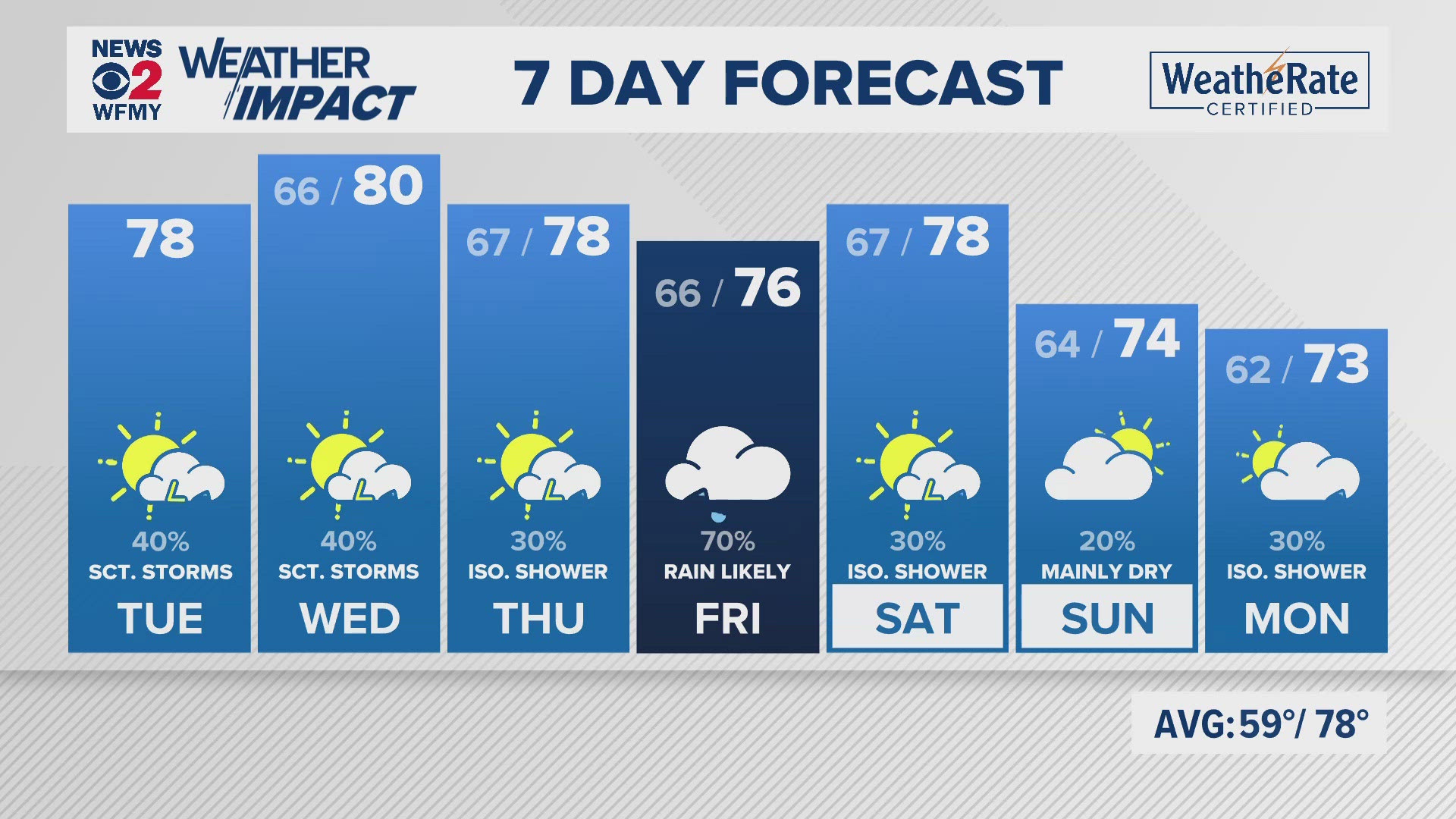
A wet and windy Friday is on the way for our area. Rain from Helene could start arriving as early as Thursday evening, but our most impactful day with rounds of heavy rain is most likely. Winds will likely pick up as well and along with heavy rain may bring down some trees and cause power outages. By Friday night and into the weekend our weather should drastically improve.

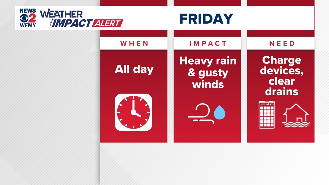
IMPACT
The main impact for our area looks like rounds of heavy rain and possible flooding, along with gusty winds. Right now for the Piedmont Triad, we're forecasting mainly 3-5" of rain. The Foothills and mountains could be especially hit hard with rain, with 5-7"+ possible. These totals may go up or down depending on how the storm tracks once it forms. We'll adjust our forecast as necessary over the next couple of days.
Gusty wind is looking likely for our area, but higher wind gusts are likely in the mountains and to our west. We have a pretty significant risk of flash flooding in the Piedmont, even higher for the Foothills and Mountains. Heavy rain and gusty winds may also spell some power problems as well.

STORM TRACK
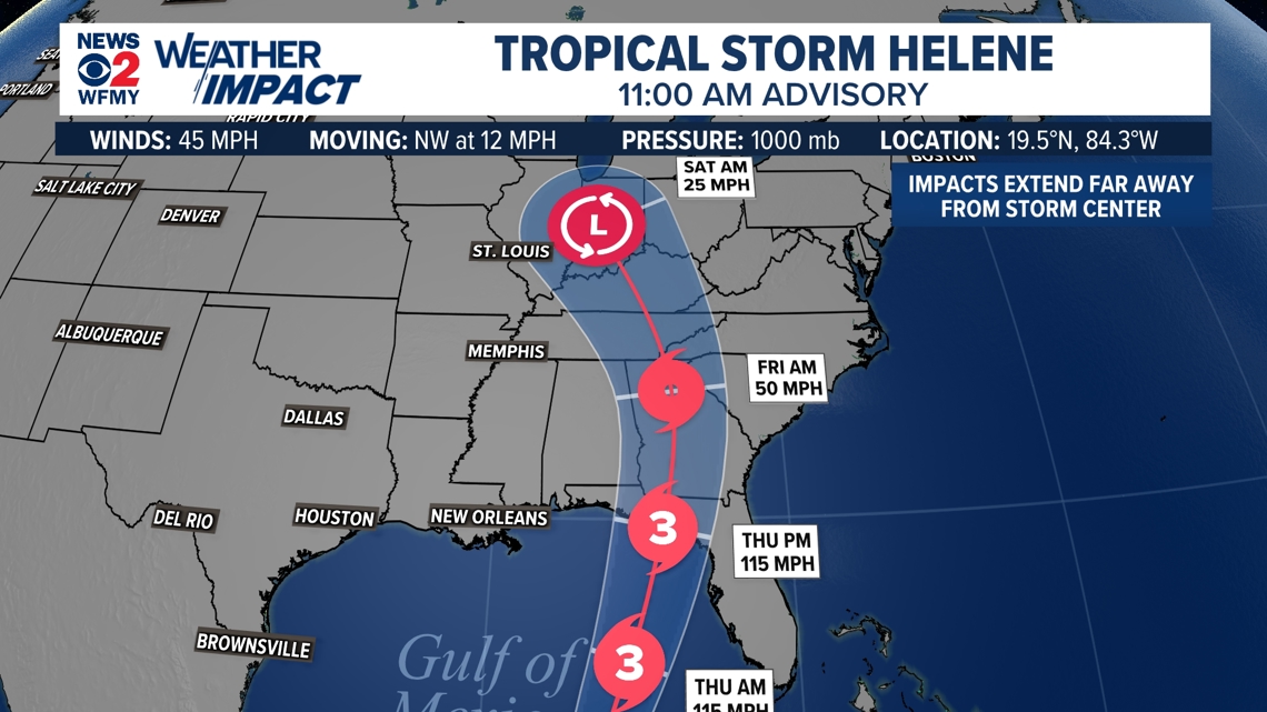
Here's the latest track on Helene. After a landfall in Florida Thursday evening, likely as a major hurricane, the storm will move inland, making a curve to the northwest. This track will be important for determining our impacts even more specifically. Remember, the center of the storm could track anywhere in the cone you see below and impacts can be felt from the storm way outside of the center.
Our area will likely be on the west side of the storm with heavier rain bands and stronger winds.

WHAT YOU CAN DO
- Keep an eye on the latest forecast! This page will be updated with the most up-to-date info.
-Be careful driving! Watch for ponding alongside roads on Friday. It doesn't take much rainwater to hydrophone.
- Make sure you have a way to receive weather alerts and keep devices charged up. It's also a good idea to take a walk around the house and try to clear out drains, or tie down loose lawn furniture.
We'll be sure to keep you updated on air and online as we learn more and finetune the forecast.