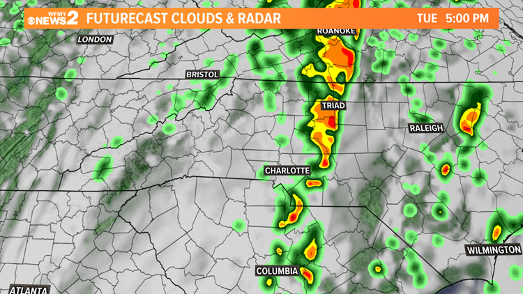
GREENSBORO, N.C. — We want you to pay close attention to the weather today. Our weather team is keeping an eye on the threat for some heavy rain and thunderstorms. It's possible they could produce brief flooding, and even some damaging wind gusts.

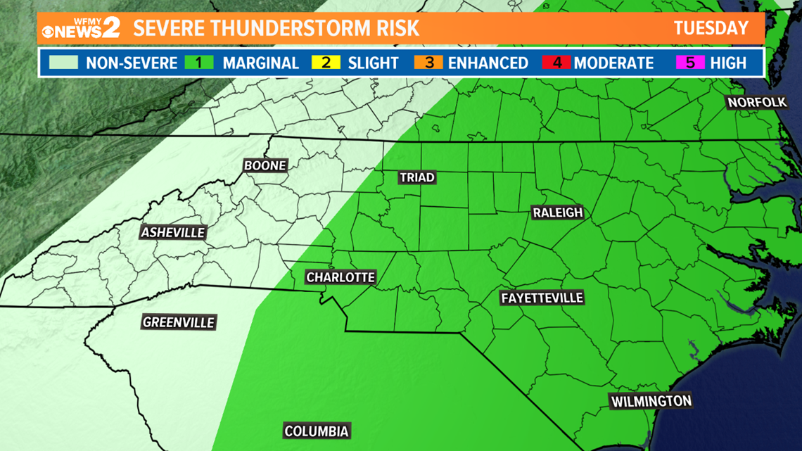
The "Marginal Risk" (Level 1) severe weather outlook has been extended west to include most of the Piedmont.
TIMING:
7am - 10am Tuesday: Mostly clouds, a few showers.
10am - 8pm Tuesday: Most likely timeframe for a line of rain and strong or severe storms to moves through the Triad. Earlier in the West, later in the East.
8pm - 3am Wednesday: Storms move away, some showers left behind.
3am - Midday Wednesday: Rain over, clearing. Sunshine returns by afternoon.
IMPACTS:

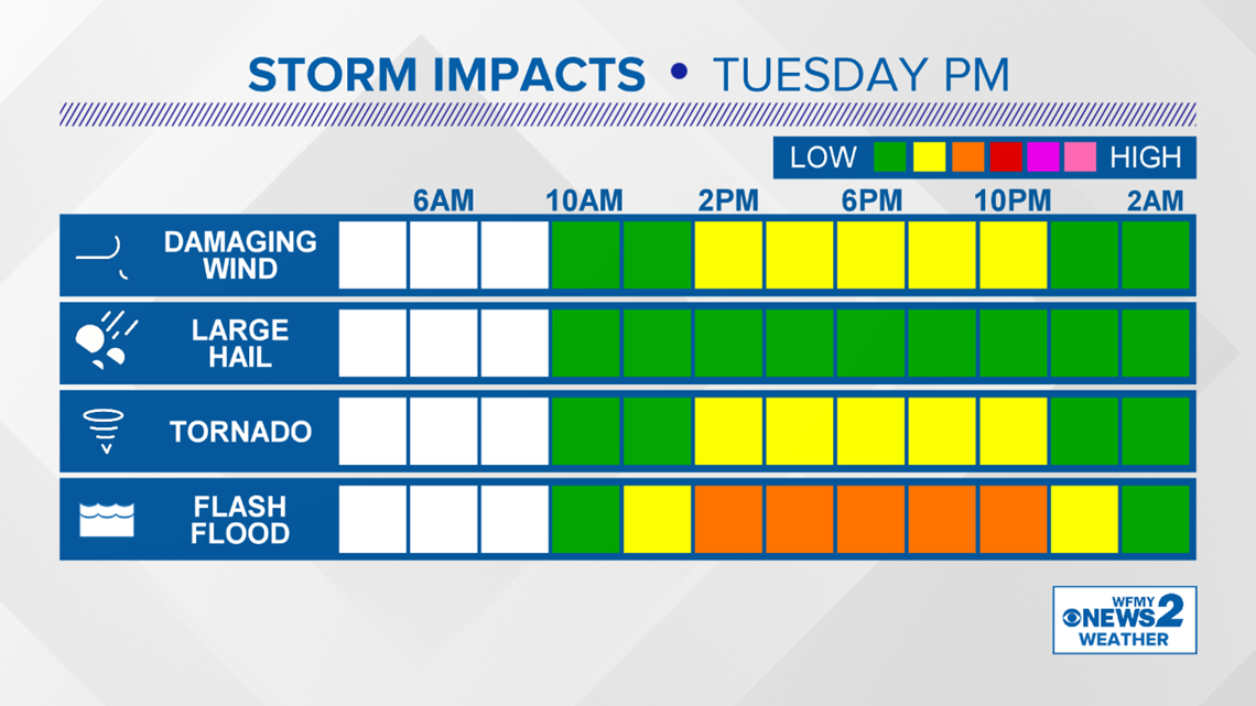
As the line of storms comes through in the afternoon and evening our main concerns will be for damaging winds in strong thunderstorms as well as flash flooding. Some of these storms could drop heavy rain over a short time. There will also be a low threat of a tornado or two across the area.

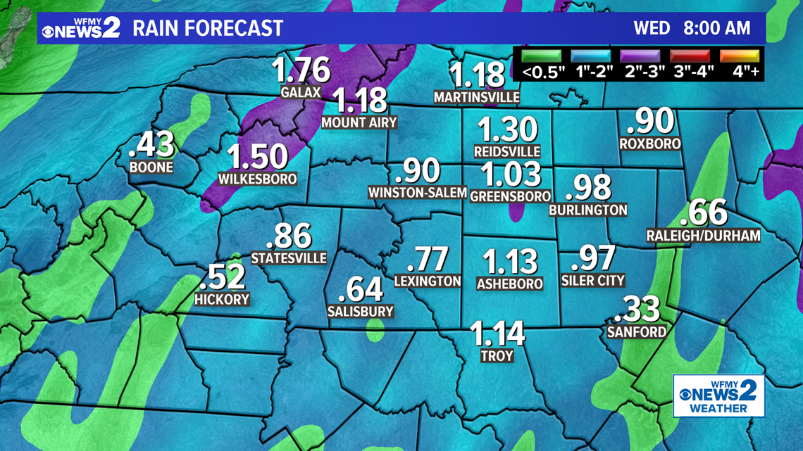
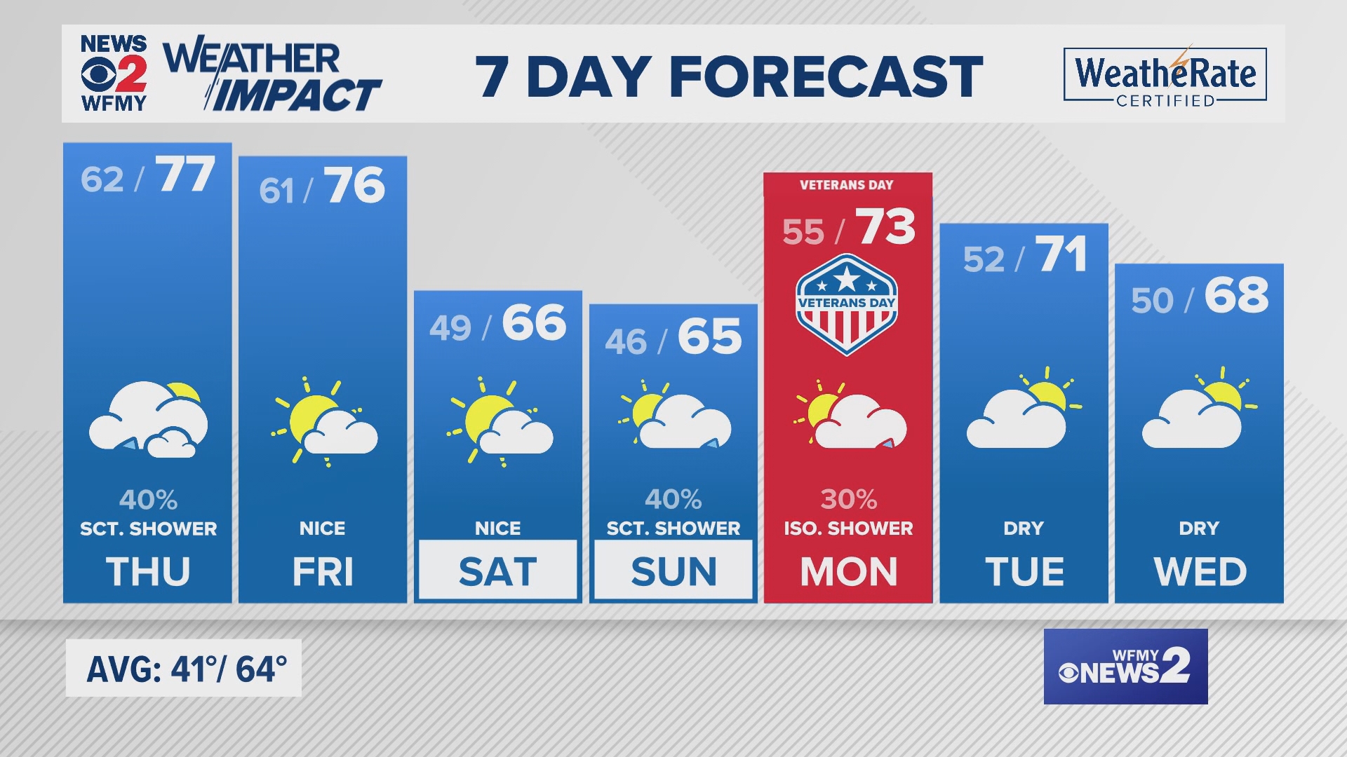
Most of our rain over the next week will come with this line of storms. Generally around .5"-1.5" across the area will be possible with some higher amounts wherever heavier rain sets up.
Stay weather aware on Tuesday and have a plan in place in case storms do get strong or severe. The WFMY Weather Team will be on top of it for you on-air and online.


