A heat dome will bring days of record-challenging temperatures to portions of the West this week, exactly the opposite of what the wildfire-stricken region needs.
The latest outlook from the United States Drought Monitor shows that 92% of the western United States is suffering from some extent of dryness, with over 50% in the severe to exceptional drought category. These conditions are likely to only worsen heading into early October, with no signs of rain on the way.
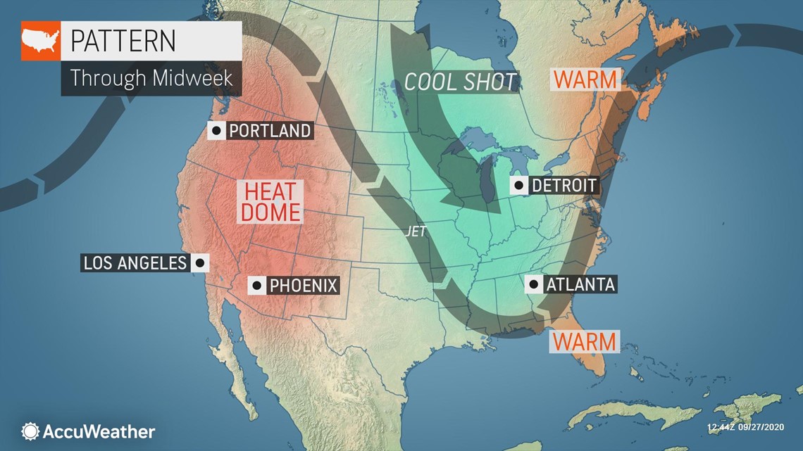
A see-saw pattern in the jet stream featuring a northward bulge in the West and a southward plunge in the central and eastern U.S. will bring a tale of two seasons across the country this week. As November-like air chills portions of the Midwest and Northeast, hot and dry weather will make it feel more like summer in the West.


"Even though it has gone from summer to fall and the calendar is about to flip from September to October, summer heat is not yet over in the West," AccuWeather Meteorologist Ryan Adamson said.
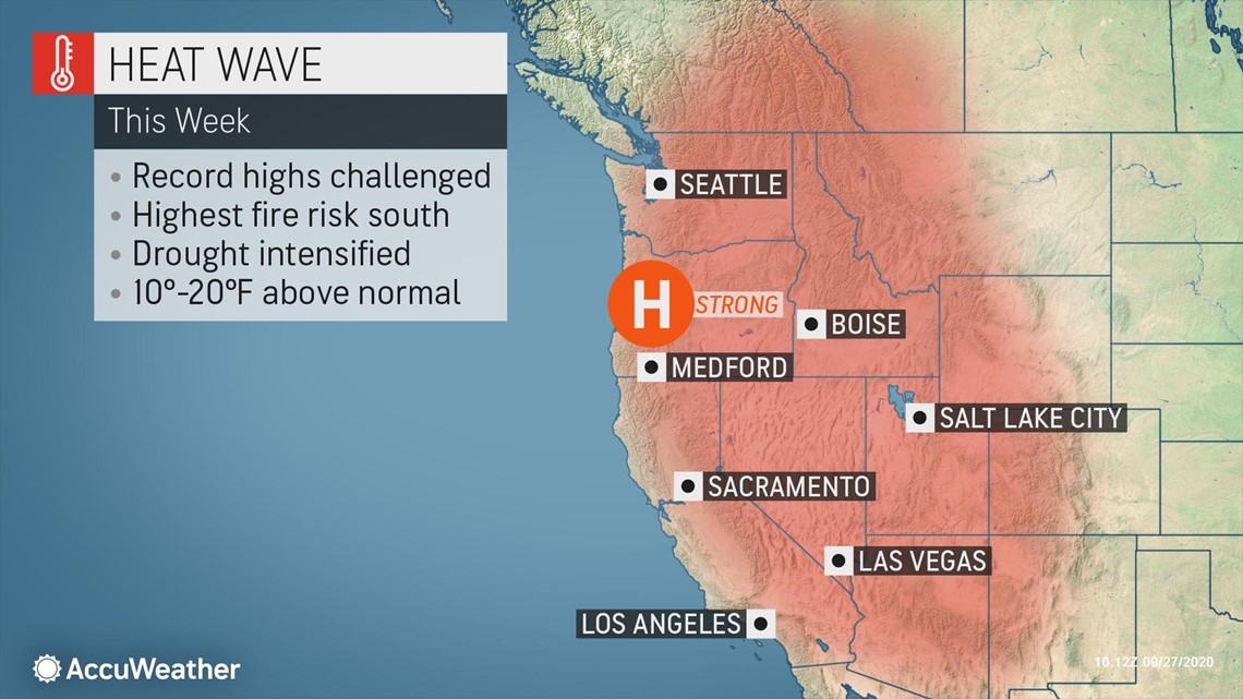
High temperatures will be on the order of 10-20 degrees Fahrenheit above average for the end of September and beginning of October, with widespread 80s and 90s. Across the deserts, lower 100s are likely.
"Heat will be the story throughout the week with an offshore wind at the surface and a large dome of high pressure overhead," AccuWeather Senior Meteorologist and western U.S. blogger Brian Thompson said. These high pressure systems that bring days of high temperatures are sometimes referred to as heat domes.
In some cases, the heat will surge into near-record territory. Medford, Oregon; Reno and Las Vegas, Nevada; and Fresno, Sacramento, Palm Springs and downtown Los Angeles, California, are among the cities that could come close to tying or breaking daily records on one or more occasions this week.
"The Los Angeles area will have temperatures rise to near the 100-degree mark around midweek, which is pretty typical with an offshore wind this time of year," Thompson said.


"Even toward San Diego, highs will rise to near 90 with inland areas closer to 100 later in the week," Thompson said.
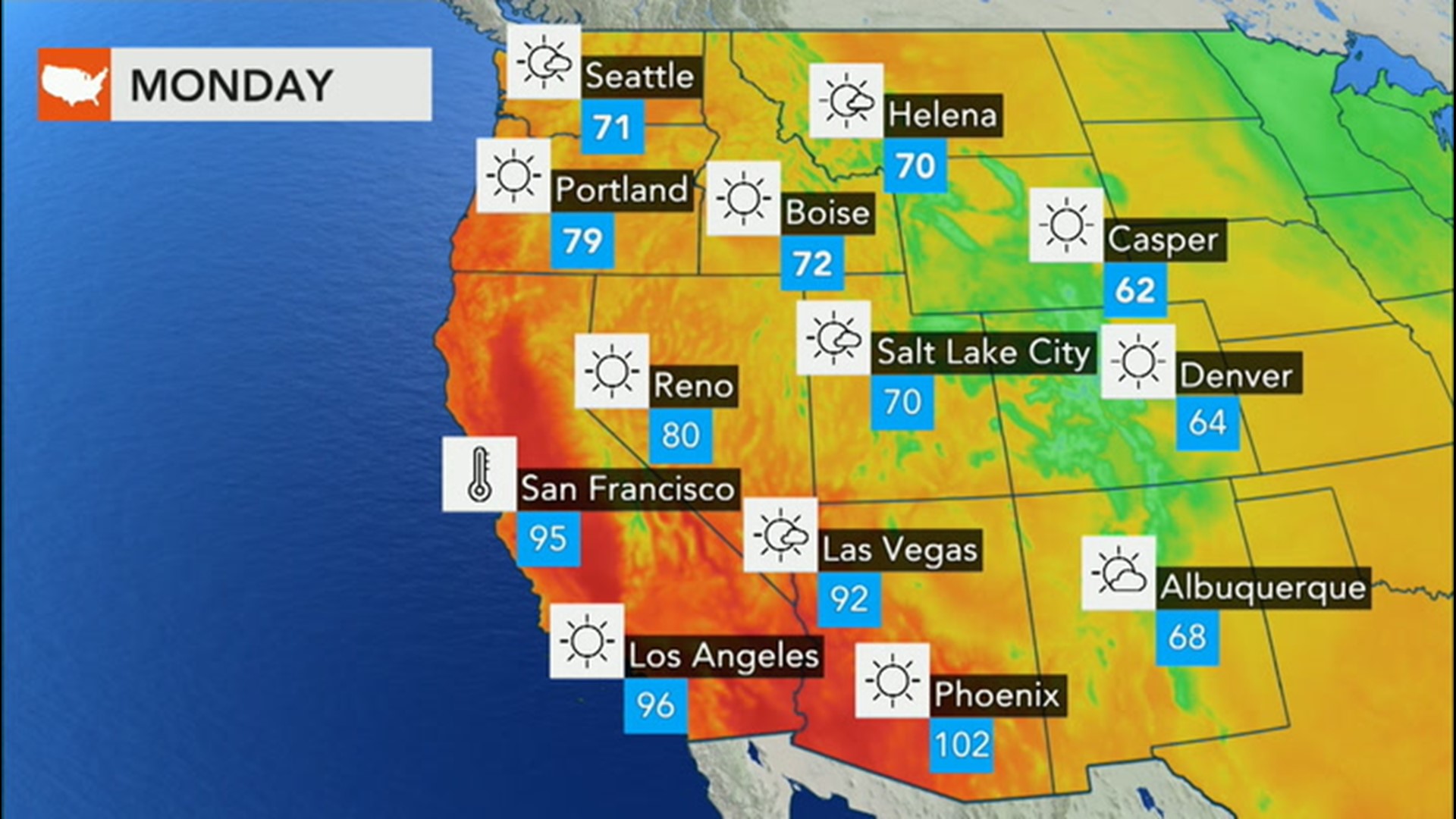
Around San Francisco, the peak of the heat will occur on Monday as strong offshore winds push temperatures into the middle to upper 90s. These same gusty winds are wrecking havoc on the wildfire situation across Northern California. Beyond Monday, the wind will change direction and blow in more from the Pacific Ocean, causing temperatures to fall back into the 80s in the Bay Area.
In Las Vegas, there have been 96 days with a high temperature at or above 100 thus far, making it the second most triple-digit days in a single year. The record is 100 days in 1947. Highs are likely to near the 100-degree mark in the city beginning Wednesday and lasting into the weekend.
Phoenix experienced its 130th day of 100-degree heat on Sunday, beating out 2003 for the second-most triple-digit days in a single year. The all-time record is 143 days in 1989. This city has already had 53 days at or above 110 this year, smashing the previous record of 33 days in 2011. Many more 100-degree days are expected to be tacked on to the city's tally into the weekend, though temperatures are not forecast to reach 110.
Residents and visitors alike are reminded to avoid strenuous outdoor activities during the hottest times of the day to lessen the risk of heat-related illnesses. Those who must work outside should be mindful to take frequent breaks in the shade and drink plenty of water or sports beverages.
Even with winds lessening overall across the West this week, the fire danger will remain elevated given the high heat, low humidity levels and continued dry weather. Thus, precautions will still need to be taken when using any type of power equipment or open flames outside.

