GREENSBORO, N.C. — It's been one of the warmest falls on record across the Carolinas. A reality check is on the way by the end of the week. A major weather change is on the way across the Eastern US and the WFMY News 2 Weather team is tracking it.
Jet Stream About to Shift
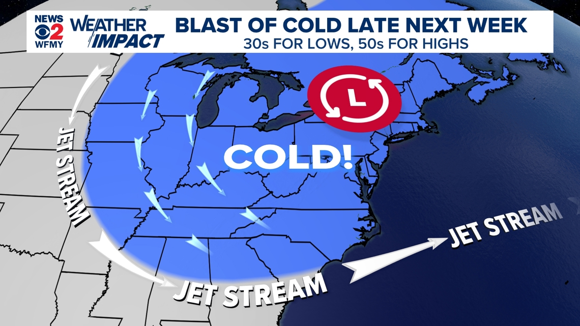
The way the weather pattern has been, the jet stream has been very far north for this time of year. Think of the jet stream as somewhat of a barrier between the warmer air masses and colder air masses across the country. When it moves north, warm air moves north. When it moves south, cold air moves south.
Well, guess which way it's headed? By Wednesday-Thursday of this upcoming week the jet stream is expected to dive southward across the Eastern U.S. For us in the Carolinas, that means a big cold front on the move.
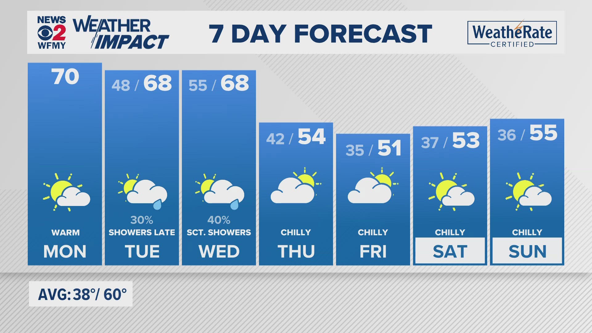
Right now, we're expecting mild weather for Monday, Tuesday, and Wednesday. That front will cross the state on Wednesday, with colder air very likely to flow in behind it.
Simply put, a big cooldown is likely across the entire state late this upcoming week, and it will probably be the coldest air of the season so far.


First Freezes of the Season?
For our area, we still haven't gotten down below 32 degrees. The last time we did that was April 6th back in the spring. On average, we see our first freeze right around Halloween or just before. Not the case this year.
In fact, we're in the running for one of the latest freezes on record this year. With no cold air in sight until after the 20th, we're guaranteed to have at least the 4th longest wait for 32 degrees. The latest first freeze on record is December 1st in 2009.
With this upcoming cold blast it is possible that some 30 degree cold will move into the Carolinas, especially by Friday and Saturday. We'll keep an eye on it.
Mountain Snow Will Be Possible
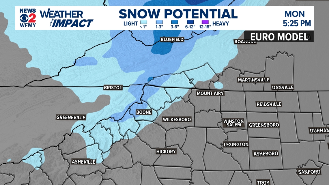
With cold air rushing into the region by Thursday, Friday, and Saturday it appears that it will be a perfect weather pattern for some mountain snowfall. Strong, gusty, cold winds will be blowing from the northwest. We often call this a "northwest flow" setup in weather.
For our region, it means that the winds will hit the Blue Ridge just right and be forced to rise quickly many thousand feet. This often results is snow showers developing and lasting until the pattern changes. In this case, at least some mountain snow appears possible in the Thursday through Saturday timeframe.
It's too early to say how minor or major any mountain snow would be at this point.
Typically the Piedmont stays dry and snow-free in a Northwest Flow event. We'll keep you posted.


