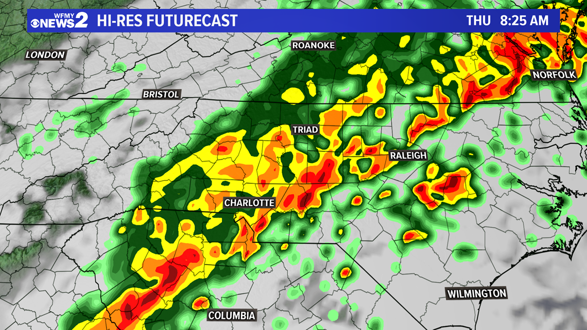
GREENSBORO, N.C. — Keep that rain gear close by throughout Thursday. Tropical moisture will continue moving into the Carolinas from the south, indirectly from Tropical Storm Eta off the coast of Florida. This moisture along with an approaching cold front is working together to bring rounds of heavy rain that we've already seen from time to time today and will continue through Thursday.
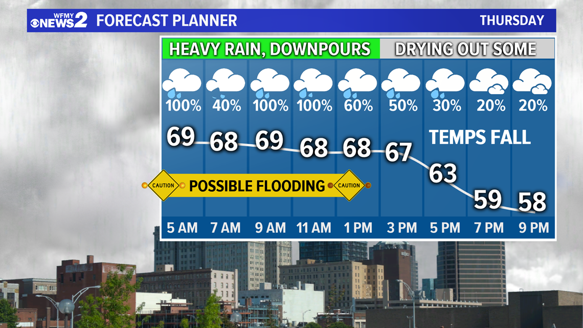
Overnight, rain will continue across the Piedmont and even heavier rain looks to arrive Thursday morning. Heavy, drenching rains will make for a nasty morning commute on Thursday and will likely cause some flash flooding concerns in a few places.


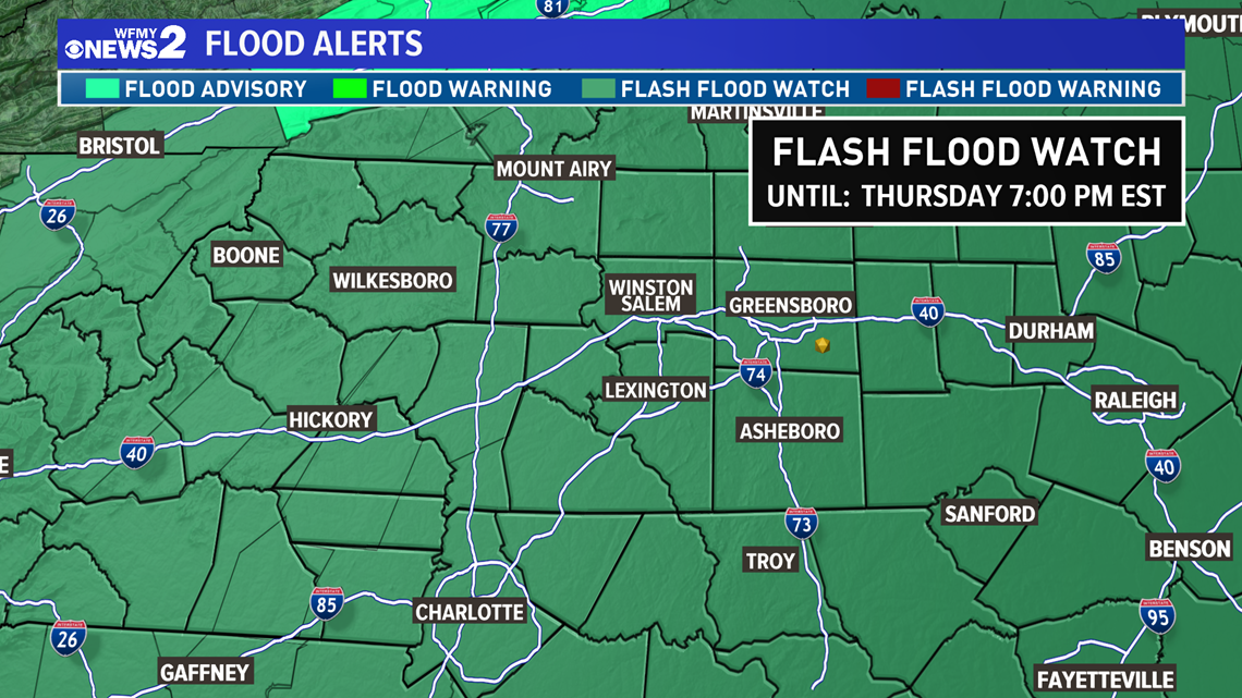
A Flash Flood Watch will remain in effect for the entire state through Thursday as most folks will at least have some risk of Flash Flooding.


The final round of rain Thursday morning will be the heaviest and the most likely to cause flooding, so be extra careful during your morning commute. By midday the rain should be letting up some and we're left with just some areas of light rain and drizzle, then slowing drying out some through the evening.
Behind the cold front temperatures will start to fall in the afternoon, getting back into the 50s Thursday night.


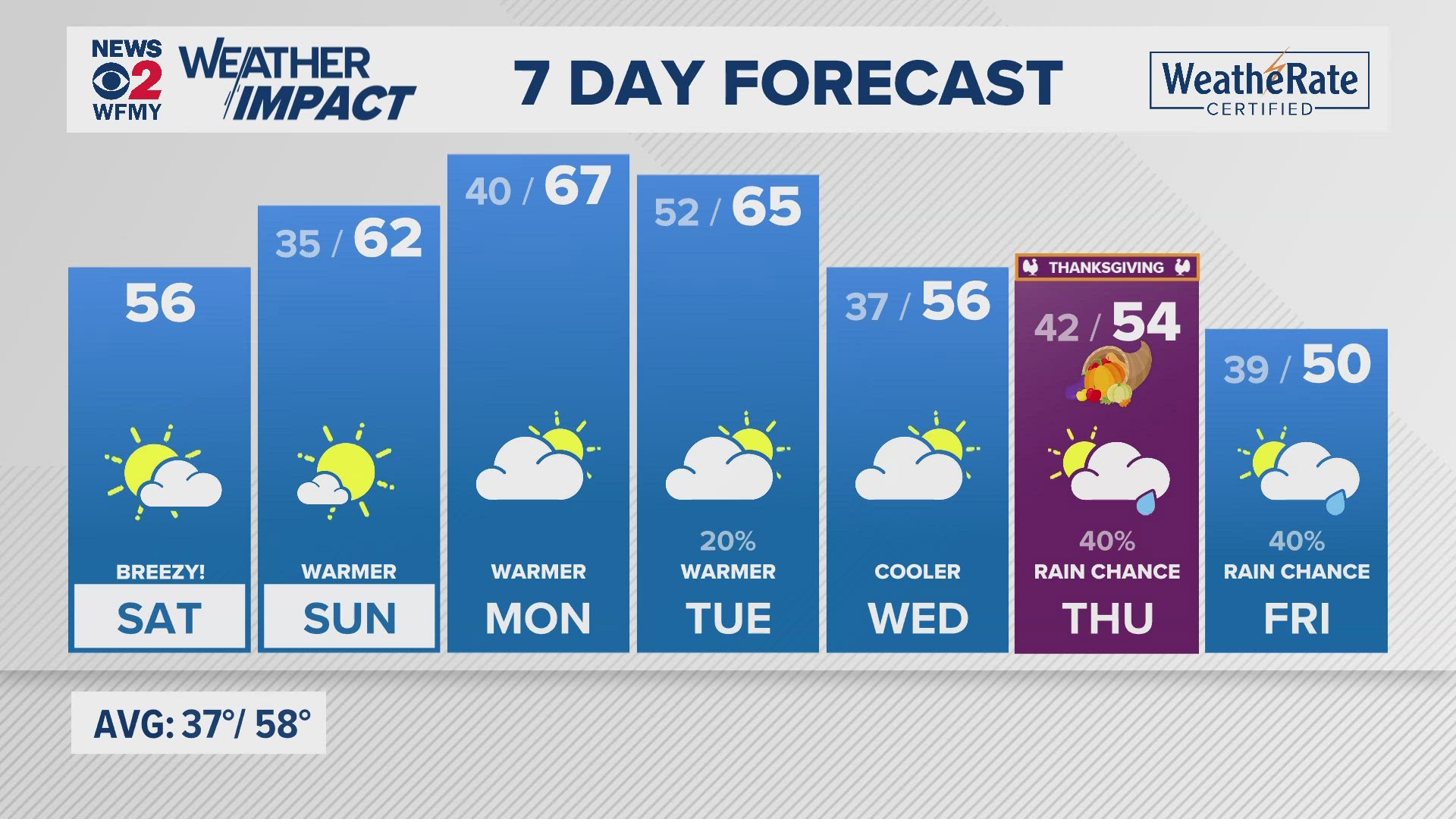
Friday and Saturday should be mainly dry, but the rain chance won't fall all the way to zero.


