
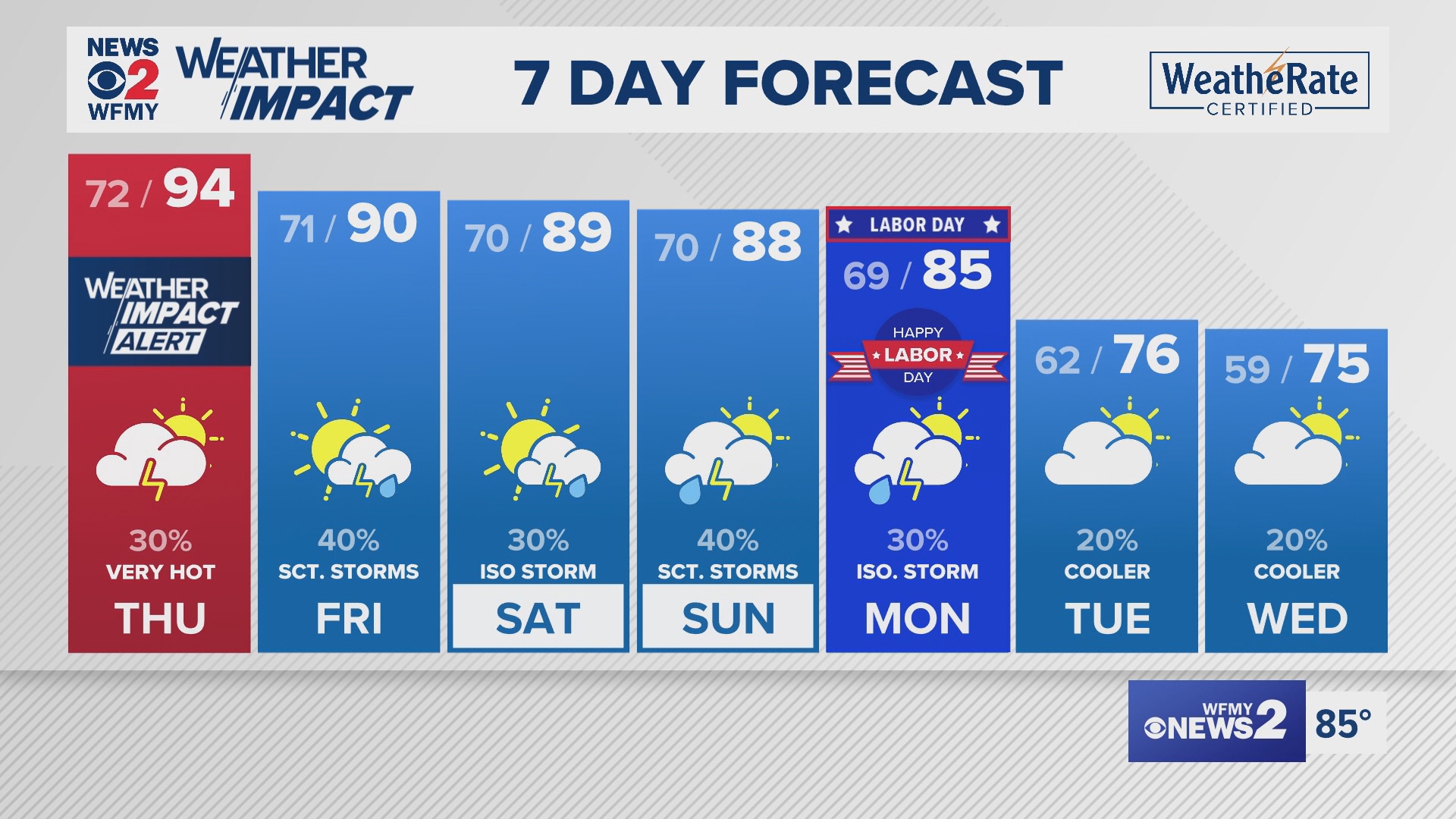
GREENSBORO, N.C. — Abnormally warm temperatures have returned along with summer humidity in the Triad to wrap up the final week of August. We've issued Weather Impact Alert days for Wednesday and Thursday in the Triad due to dangerous heat. Heat indices will approach or exceed 100 degrees once again Thursday. Here's what you need to know:
Another Scorcher Thursday

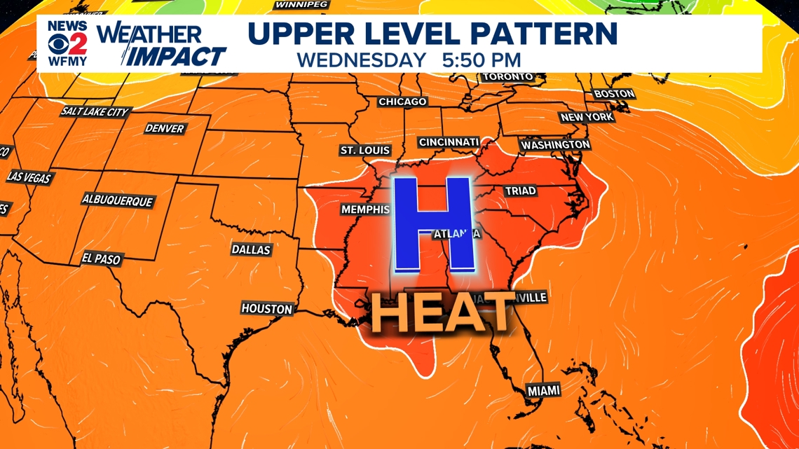
High pressure in the upper atmosphere has built in with an upper-level ridge (often associated with above normal temperatures) across much of the eastern United States. As a result, warmer air has been brought into the region as winds turn southwesterly.
WHEN:

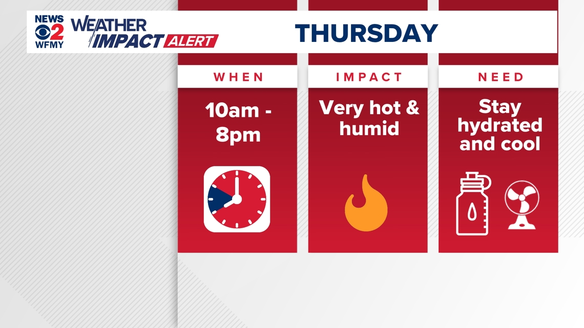
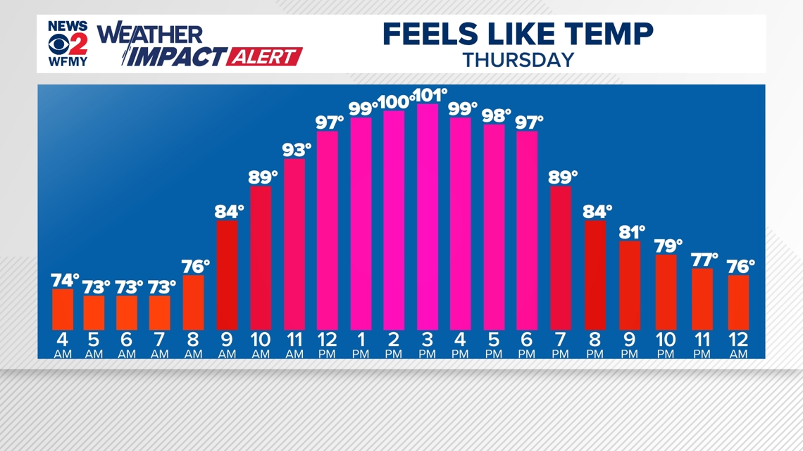
We've issued another Weather Impact Alert Day for Thursday due to dangerous heat expected again. Tuesday we snuck up to 93; Wednesday Greensboro reached 92. Low-to-middle 90s are expected again with heat index values approaching or exceeding 100°.

What can I do?
- Make sure you are staying hydrated! That means drinking water even when you aren't thirsty.
- Take breaks from the sun. Make sure you have a way to cool off -- whether it's a fan or in the A/C.
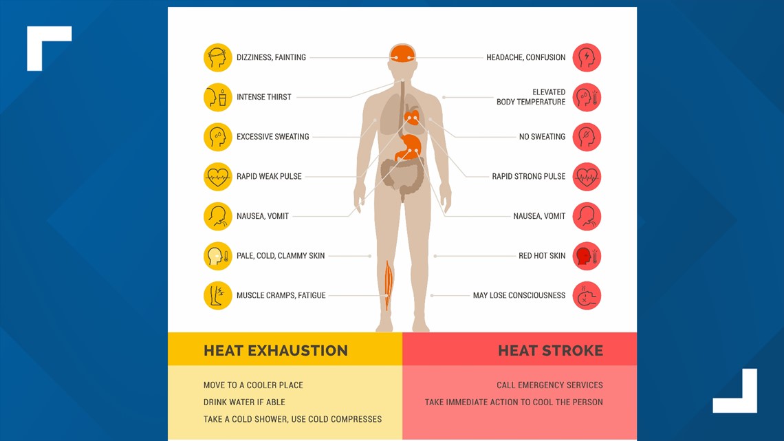
- Know the symptoms of heat exhaustion and heat stroke to keep yourself and others safe.

The good news? We'll cool off back into the upper 80s for the weekend as shower and storm chances return Thursday through the weekend. 70s are appearing more likely by the middle of next week.