

GREENSBORO, N.C. — We've had our hands full rainfall wise the past week from Tropical Storm Debby, to a few surprise storms causing a Flash Flood Emergency late Friday night into early Saturday morning. So far in the month of August, we've had over 6 inches of rain. The average total in the Triad in August is 4.26". We still have a few weeks left with more rain possible!
Watching The Tropics
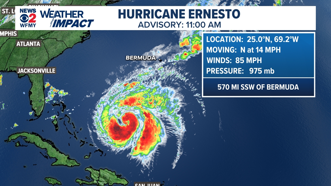
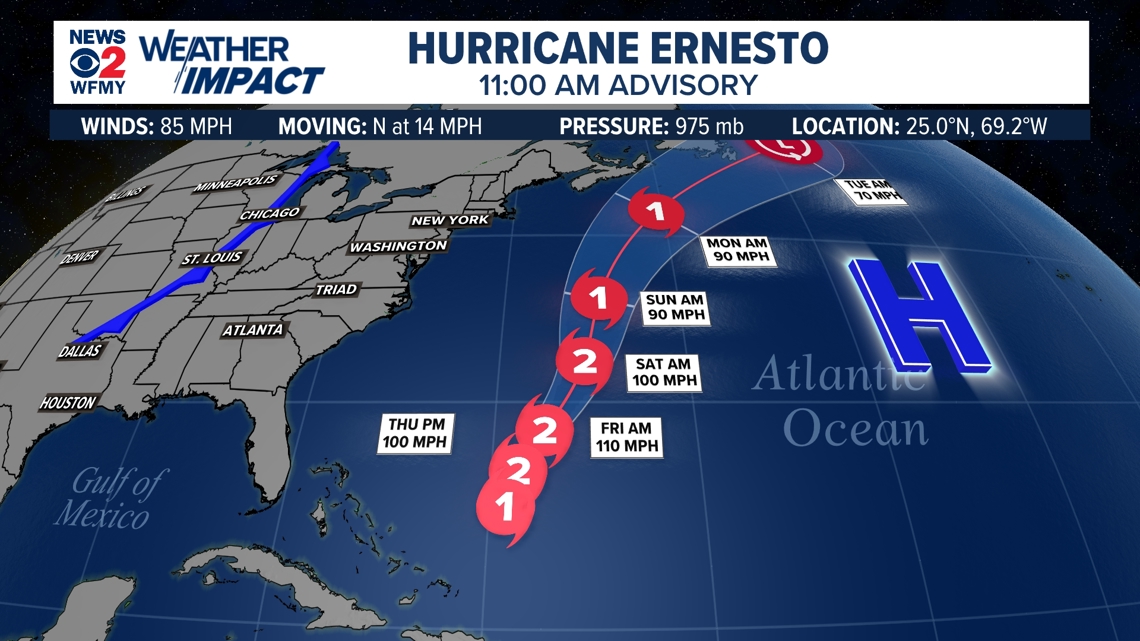
We still have a little under a month until the official peak of the Atlantic Hurricane Season, and the tropics are starting to get busy. We now have Hurricane Ernesto in the Atlantic. The storm has crossed Puerto Rico and the Virgin Islands and will take aim on Bermuda this weekend.


Higher Rip Current risk for the weekend
While direct impacts aren't expected across the Carolinas, oftentimes distant hurricanes can create large swells in the Atlantic and be rip current generators for the coastlines. If Ernesto continues it's forecast track, elevated rip currents could be possible for our coast by the end of the week and into the weekend. If you're planning on going to the NC beaches this weekend, make sure you and your family/friends know how to escape a rip current. If you see red flags posted, no swimming.

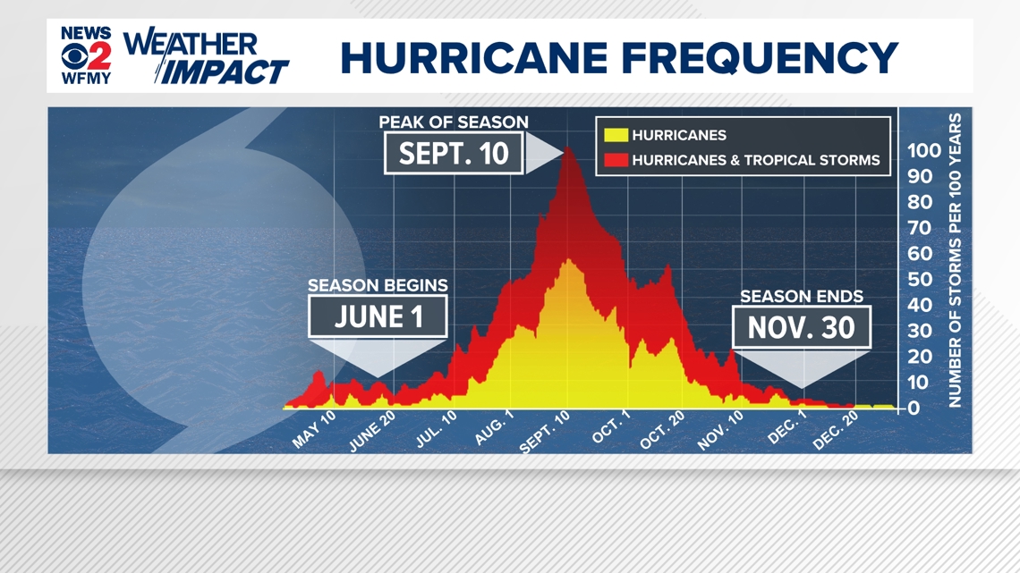
If you've noticed an uptick in activity in the tropics, it's because we are closing in on the peak of the season coming up on September 10th! The Atlantic Hurricane Season will officially end on November 30th.
For now, no other systems are likely to form in the next 7 days in the Atlantic. We'll continue to monitor the tropics closely and keep you informed.