GREENSBORO, N.C. — It's pretty warm and humid out for November... wouldn't you agree? You notice it the moment you roll down the window or step outside. So, why has it been so warm in the Triad?
The current weather setup has allowed for warm, moist air to push into the Carolinas the last few days. High pressure offshore has steered winds in from our south, helping temperatures climb. An upper-level ridge has also built in across much of the Southeast, which allows for above-normal temperatures. Since Tuesday, temperatures have been unseasonably warm in the mid-to-upper 70s.
What about October? Yep! In the last several weeks, October in Greensboro was also much warmer than usual (and drier). The average temperature was 1.6°F above normal.
Record-breaking Highs
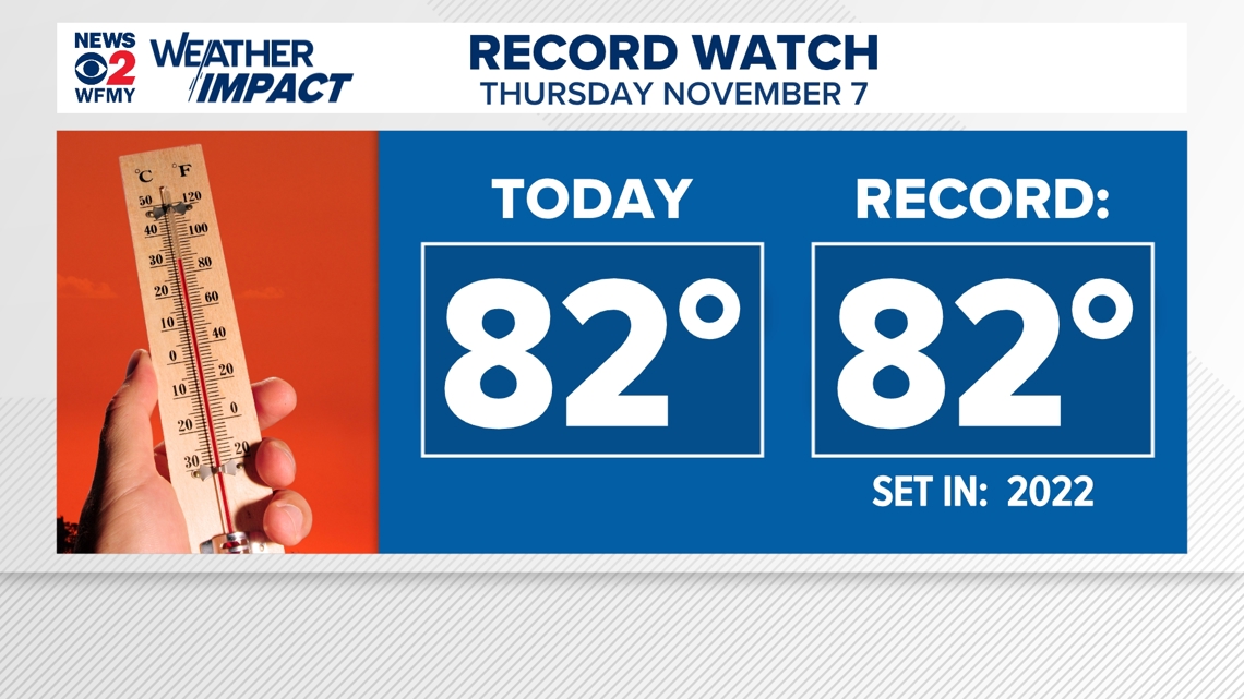
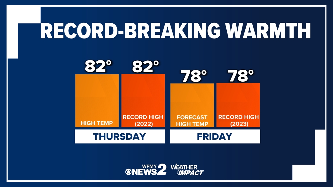
It's official! Thursday's high has tied the record of 82° set back in 2022.


Not only did we tie with the record high, but we broke the record of the warmest low temperature! The old record was 61° set in 2022, we only made it down to 64° this morning! That's our normal high for this time of year! Too warm for you? Don't worry, cooler air is coming soon.
While a cold front will slowly drift across southern states by Saturday, cooler air won't likely greet us until the weekend. Friday's forecast high right on target with the record of 78° (2023) that will likely be matched or beaten as well.


When will fall air return?
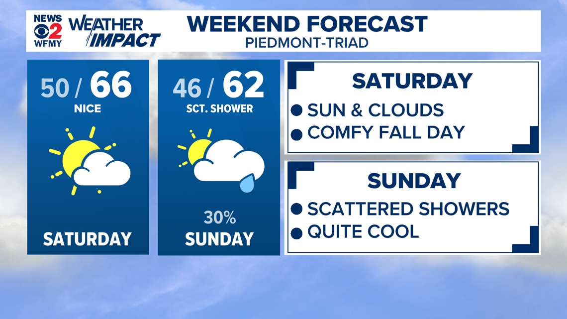
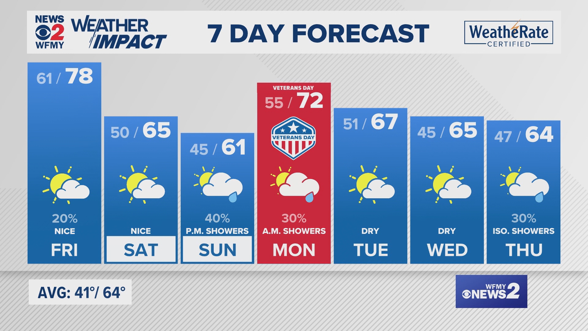
Cooler air is on the way soon! Behind the cold front crossing by Saturday, high pressure will build in for the weekend from our north. Not only will drier, cooler air enter with the front, but winds will shift to come out of the north. This will result in cooler, near normal temperatures in the 60s. With more clouds Sunday, highs will struggle a bit more in the low 60s.


Another cold front will approach from the west Sunday night into Monday, bringing much needed scattered shower chances to our area. As for next week, 70s will return with dry air and sunshine!

