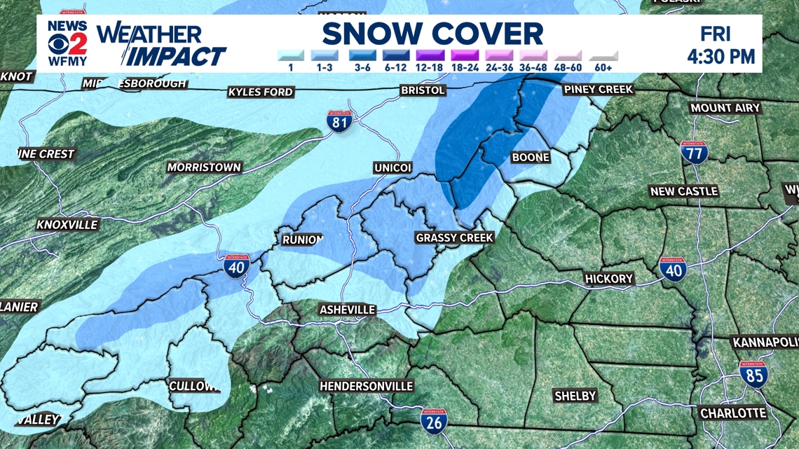
GREENSBORO, N.C. — Winter is definitely in the air around the Carolinas. A blast of cold air for the whole state was dry for most, but not in the mountains. Steady snow showers on Thursday and Friday turned everything winter white in most of the high elevations. How much snow fell? The WFMY News 2 Weather Team has the answer.
Select Snow Totals
This event started on Thursday when the cold air started to arrive. Snow showers were on and off through the morning, afternoon and evening.
Most areas of the mountains picked up 1 to 4 inches of snow. This includes areas above 3,000 feet like Boone, Blowing Rock, and West Jefferson.
Higher elevations saw even more snow. Mountains taller than 5,000 feet saw more than 6 inches in many cases. Beech Mountain reported as much as 9 inches of snow between Thursday and Friday.
Sugar Mountain got enough snowfall that they are opening up their slopes for skiing.


An Early Start to Winter
It's not uncommon for the mountains to get snowfall in November, but this is certainly a change from the past few weeks. This has been one of the warmer falls in recent memory with above average temperatures and later freezing temperatures than normal.
Here in the Piedmont, we recorded our third latest freeze on record, hitting 30 degrees on Friday morning.
If you're heading up to the mountains this weekend you can expect to see some snow still lying around although it will be melting as temperatures start to warm up a bit.


If you aren't able to get out to the mountains this weekend to see the snow, don't sweat it! This is just the first of the season. Remember, you can always head over to this link for our latest forecast.

