
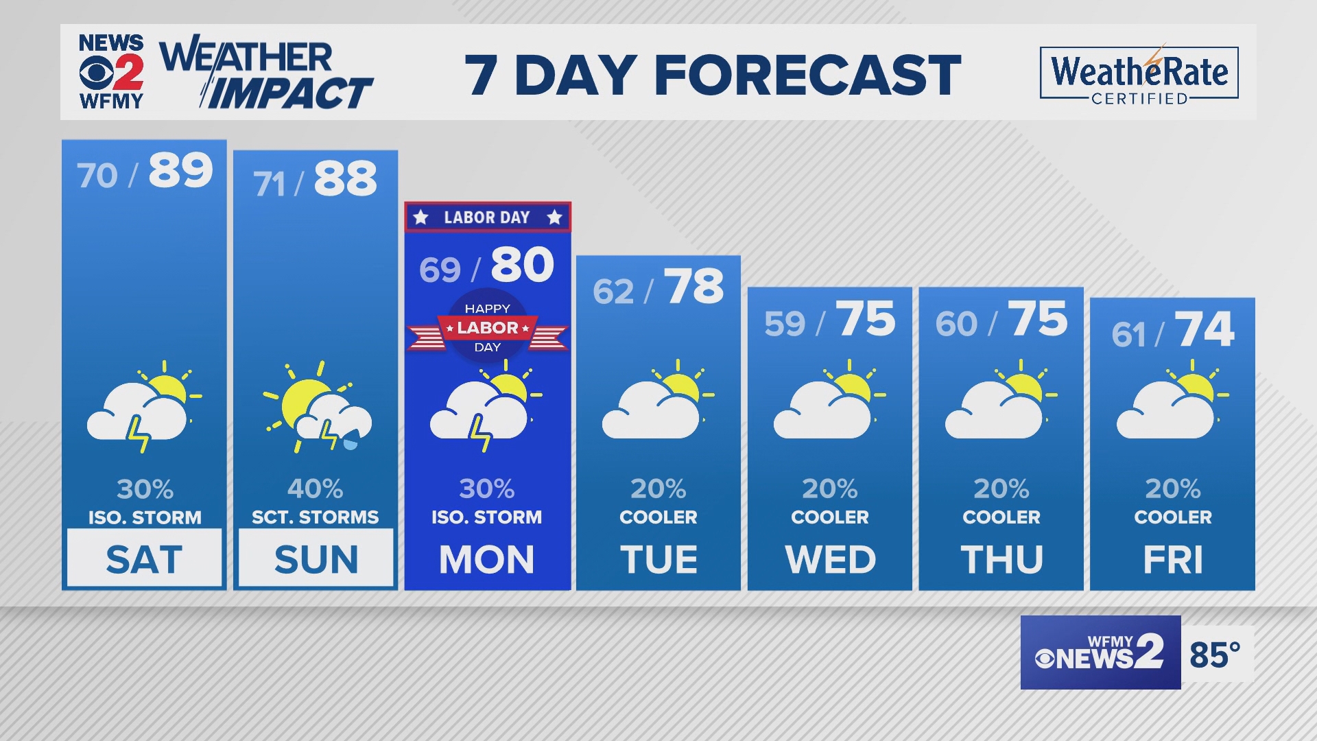
GREENSBORO, N.C. — We've had a scorching last few days across the Piedmont courtesy of an upper-level ridge and high pressure building in across the SE United States. We've sat in the low-to-middle 90s since Tuesday, including hitting 95 degrees on Thursday. 95 degrees is the hottest day we've had in the Triad since July 15th! The good news: cooler air is on the way! However, more rain and storm chances will come first.
Labor Day Weekend
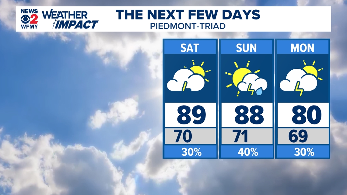
It's been a bumpy ride Friday with severe storms continuing to pop-up across the Triad through 8pm. Storms brought plenty of hail, wind, and localized flooding to many areas. For the rest of the weekend, expect a mix of sun & storm chances.

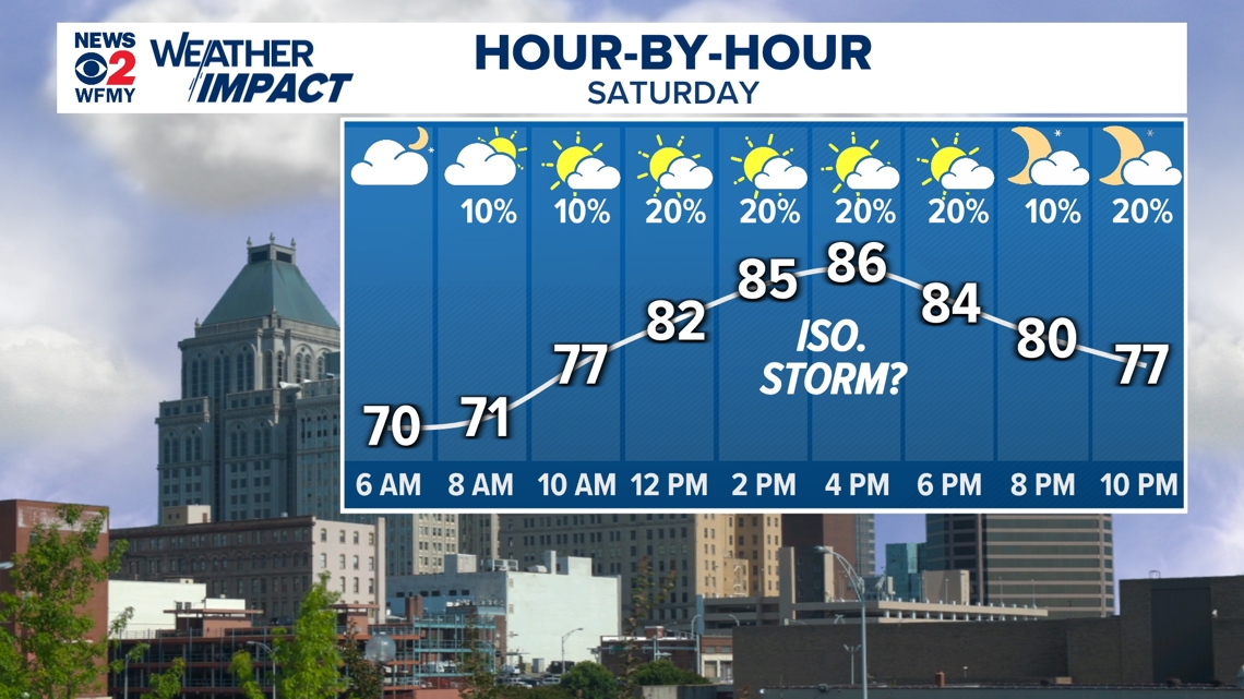
Saturday
Saturday will likely be drier than Sunday due to the timing of a cold front approaching the area. There will still be a chance for an isolated shower or storm in the afternoon and evening, but mainly dry conditions will prevail through the day. Still, it's worth keeping your phone close for weather notifications and watching the radar.

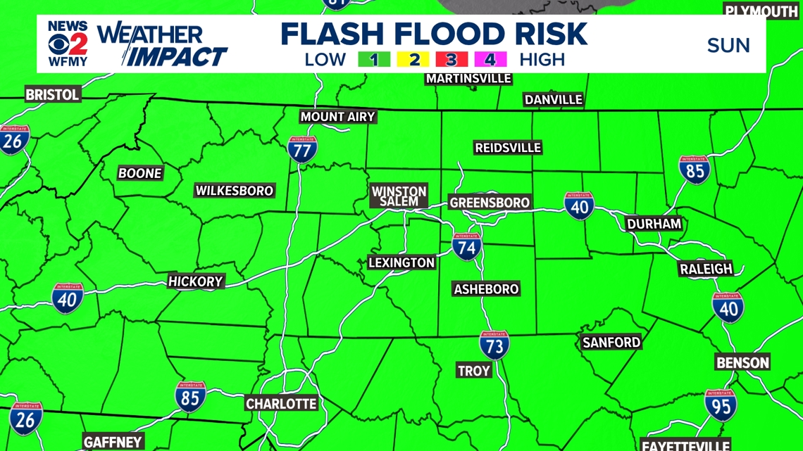
Sunday
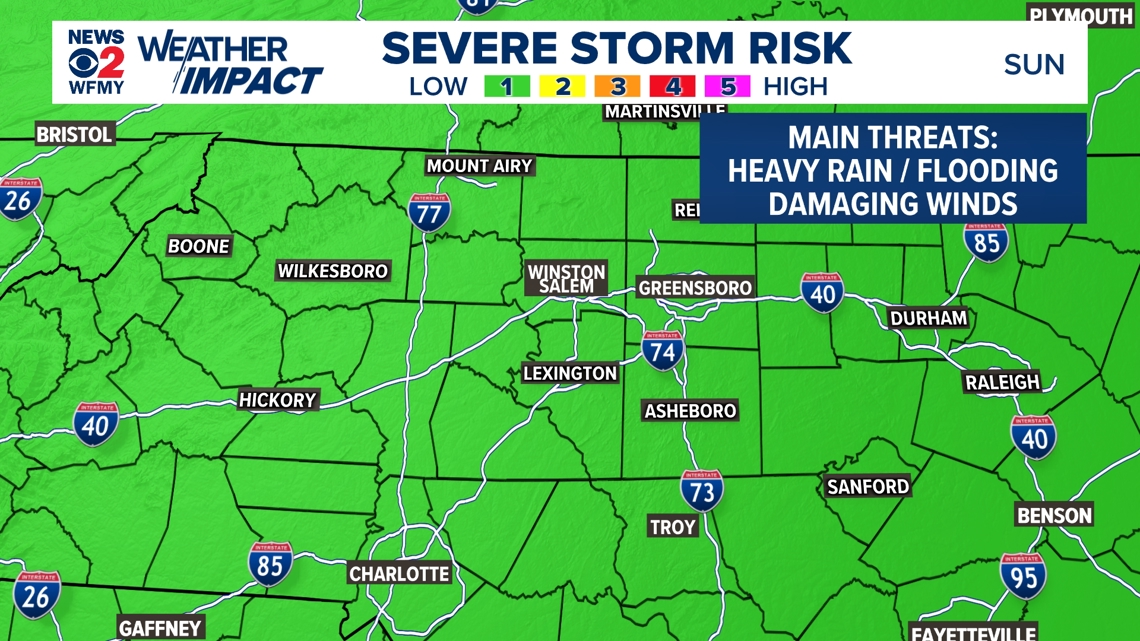
Sunday will feature more opportunities for showers and storms ahead of an approaching front. In fact, all of the Piedmont is under a Marginal Risk (1/5) for severe storms. This means isolated severe storms are possible. The main threats will be damaging winds and locally heavy rainfall. Timing of storms will likely be in the afternoon through evening. If you're planning on spending time outdoors, maybe consider doing it on the front half of the day before storm chances rise.


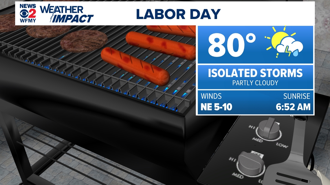
Labor Day
Monday / Labor Day will be a little cooler as a front sweeps through with isolated showers but a lot of dry time for outdoor activities. Highs will likely fall in the lower 80s -- a noticeable difference! You'll still want to keep an eye on the radar for grilling out, laying by the pool, or any activity.

Fall-like 70s return!
Following Labor Day weekend, we'll begin to reap the benefits of the cold front which includes cooler temperatures + lower humidity! Dewpoints will fall in the comfortable 50s by Tuesday of next week.

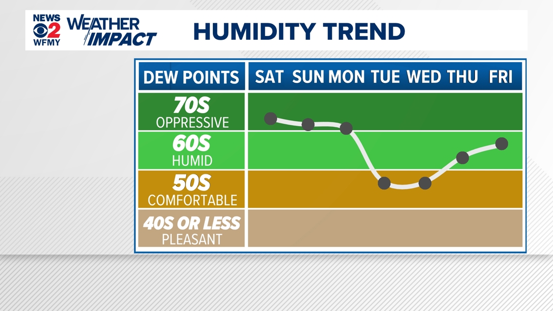
Temperatures will be more fall-like in the mid-to-upper 70s in the afternoons. Expect cool, crisp mornings in the deep 50s! For a more detailed look at the forecast for next week, head on over to this link.