GREENSBORO, N.C. — It's no secret that the Carolinas hasn't seen much of a winter. Sure, there was bitterly cold air for Christmas week, but when it comes to ice and snow - there's been hardly any!
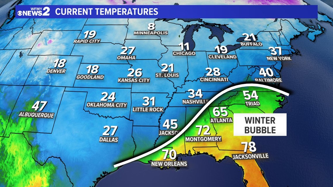
This week, it seems most of the South is dealing with a headache from ice and snow. But, still the Carolinas are warm enough to avoid any problems. What gives? WFMY News 2 Chief Meteorologist Tim Buckley joked that we have a "winter bubble" of sorts happening right now.
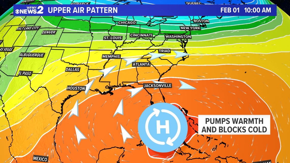
"If you look at the temperature map, it looks like there's a forcefield blocking any winter weather from the Southeast right now," says Tim. "In a sense, that's what's happening. We have the Southeast ridge to thank for that."
So what is the Southeast ridge, and what is this "winter bubble"? Let's explain.
The "Winter Bubble"
Take a look at the chart below and you'll see what we mean. This is a temperature map from Tuesday evening across the Eastern United States. Winter air has covered pretty much the whole country, except for the Southeast. There are a few things that are causing this.
First of all, there is a cold front that is stalled just to our west. That's the line that stretches from Tennessee to Louisiana. But, it's not just that.
The Southeast Ridge is something we see pop-up in our weather pattern that can really put winter on pause across the Carolinas, and the rest of our Southeast states.


This ridge pumps warmth and humidity into the Southeast, which keeps us too warm for winter weather to happen. Not only that, but high pressure areas like this are strong. When weather systems try to advance toward us, they get deflected away.
Don't Forget The Mountains
The Appalachian Mountains are a great part of living in the Carolinas. But, they have a huge influence on our weather. Sometimes, they can make us cooler, but other times they can shield us from advancing cold.
Think back to that "winter bubble" temperature image again. You'll notice that the warmer air is east of the mountains, and the colder air is west. It's hard for that cold air to advance past the very tall mountains unless it has something forcing in.
In this week's weather pattern, that cold air is being held just west of us by the mountains, keeping us a few degrees warmer than we would be otherwise. This can be the difference between rain or ice or snow!


Here are some related stories:

