GREENSBORO, N.C. — It's cold now, and with wet weather on the way it's no surprise we're talking about winter weather in the forecast. The WFMY Weather Team says a wintry mix of freezing rain, sleet, a little snow, and rain is possible for the weekend. Here's what they're tracking.
STORM SETUP:
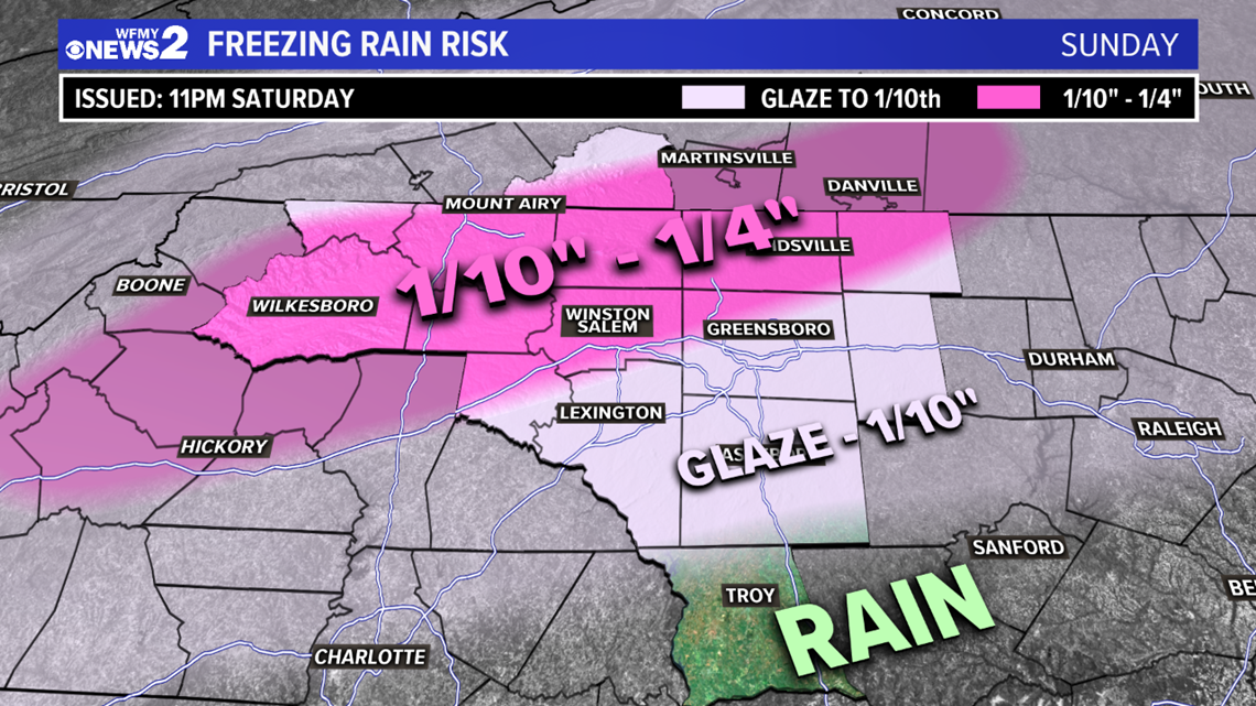
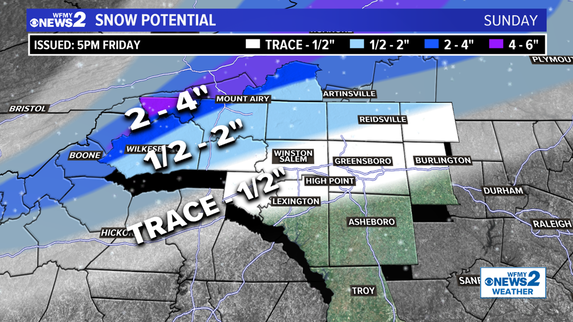
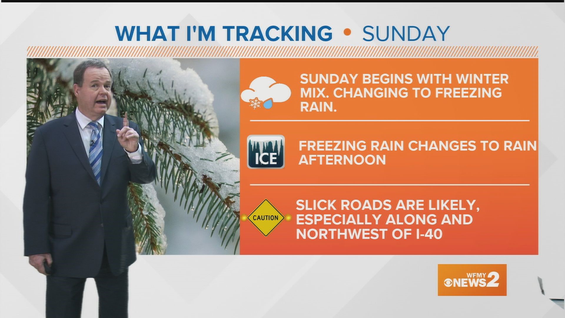
Overnight, the main storm will start to move our way. It will spread precipitation over the Piedmont before sunrise. This will likely start as a wintry mix of snow and sleet, then quickly changing to freezing rain in the Triad, and remaining snow a little longer in the NW Foothills. After daybreak, freezing rain will continue in the Triad creating icy accumulations. In the Foothills, sleet and freezing rain are likely during this time. Icing will come to an end during the afternoon as temperatures rise above freezing and we changeover to rain.
Travelers should exercise caution anytime on Sunday, but especially in the early morning and mid-day hours. Roads will be especially slick to the northwest. Ice could weigh down trees and power lines in these areas as well which may lead to scattered power outages.
TIMING:
- Overnight: Mainly a break in the action. Cold.
- Sunday morning: Precipitation moves in. May begin briefly as snow, but quickly changing to sleet and freezing rain in the Triad. Stays snow a little longer to the north and to the west. Temperatures 30-32.
- Sunday midday: Freezing rain in the Triad, rain to the south, sleet to the north. Icing possible. Temperatures holding nearly steady.
- Sunday afternoon: Freezing rain changing to rain slowly but surely. Icing possible. Temps rising above 32.
HOW MUCH:
This storm will vary based on where you live. Every county will be a little different.
- For the Foothills, you'll get a combination of snow and ice.
- For the Triad, you may get a little snow but mainly some ice and then rain.
- Farther east and farther south, it will be mainly plain rain.


IMPACTS:
- Slick travel is likely in areas that see snow on Sunday morning. Slick travel is possible across the entire area as freezing rain falls and makes bridges and overpasses slick.
- Areas that pick up heavier icing may see scattered downed trees and power outages

