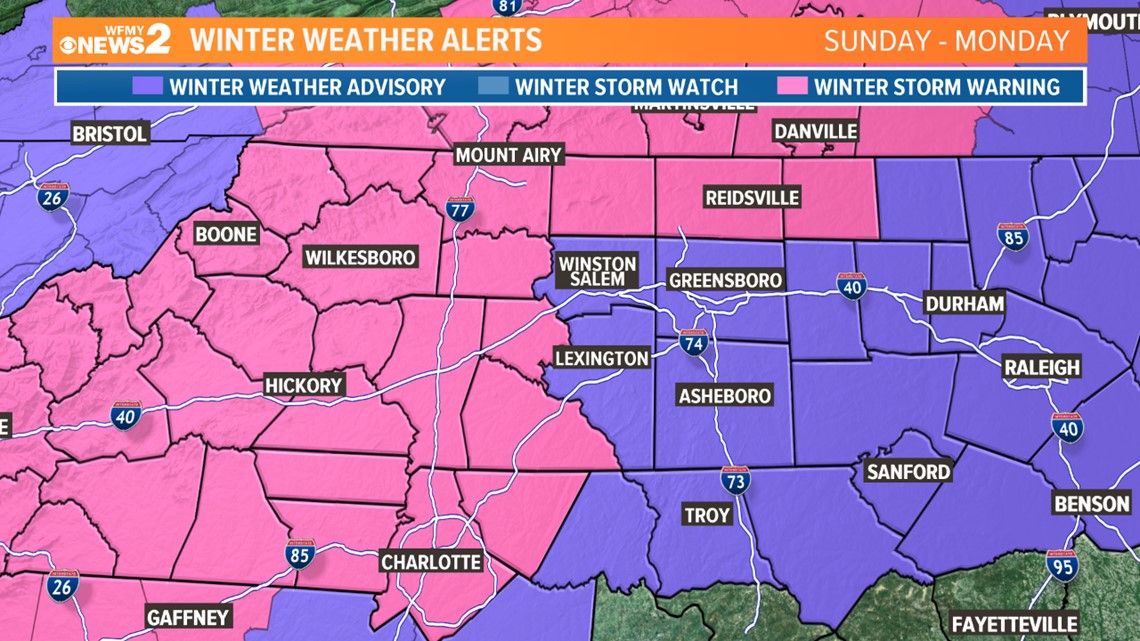
GREENSBORO, N.C. -- After a round of very heavy snow Sunday morning, we're starting to see the worst of the storm move away.
WHAT TO EXPECT NEXT
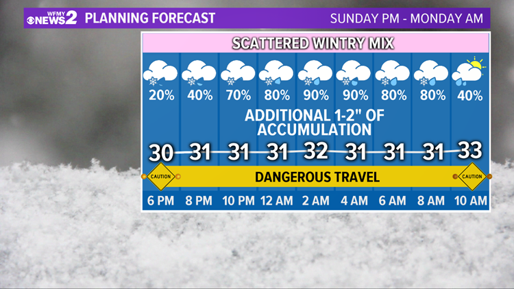
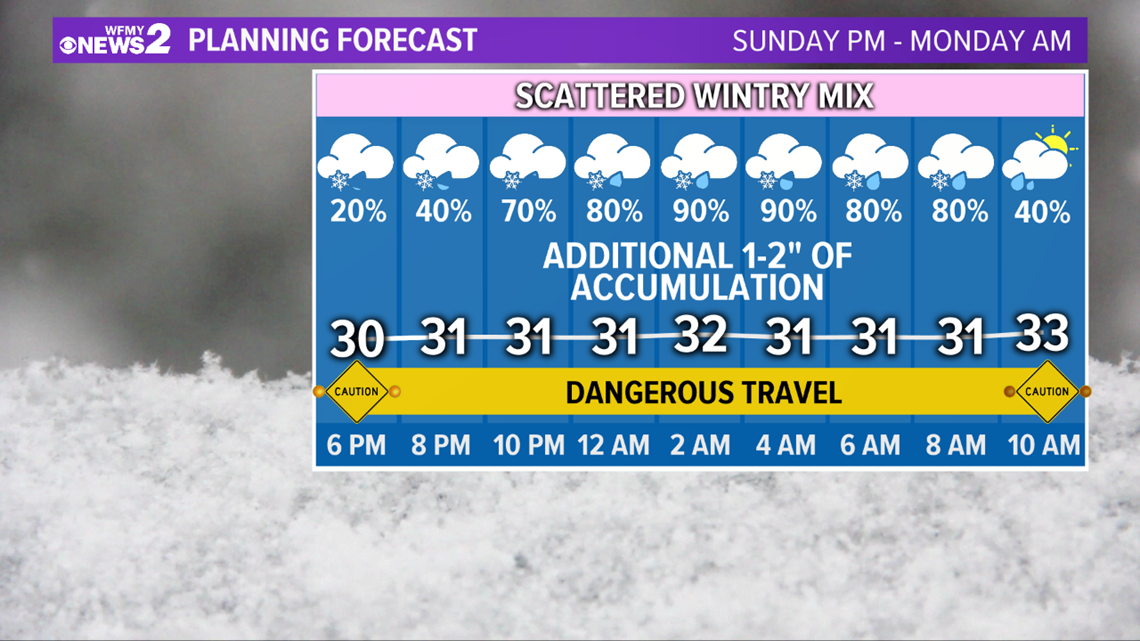
As we head into Sunday night, we'll see a last round of lighter, scattered precipitation develop across the area. This will include a mix of snow, sleet, and freezing rain.

MORE ACCUMULATION
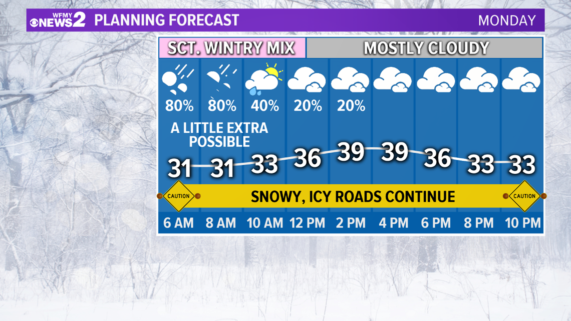
In general, an additional 1-2" of accumulation will be possible tonight through midday Monday. Through Monday afternoon, we'll finally start to clear out.

►Download the WFMY News 2 App: Apple Users, Android Users
ROAD CONDITIONS
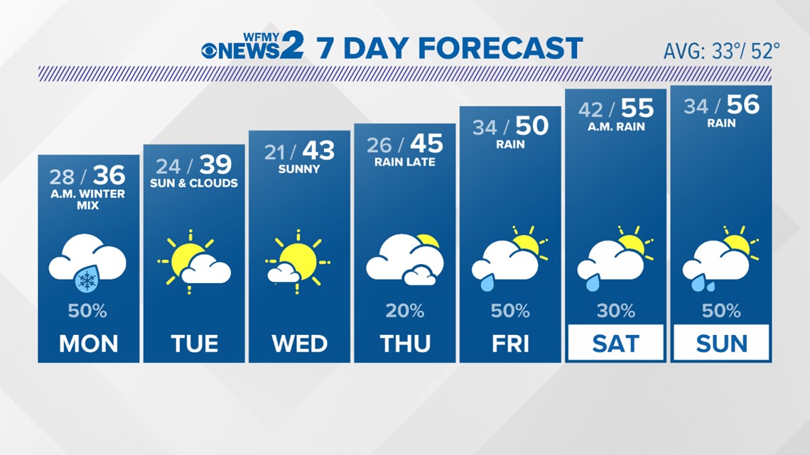
Although the precipitation will be over, roads will still remain dangerous in spots the next several days. We'll see some sun through midweek, then warmer and wetter conditions this weekend.

STORM IMPACTS CONTINUE
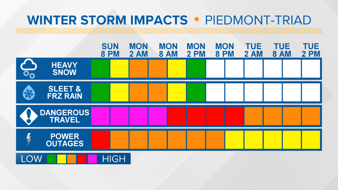
We're likely to see widespread dangerous travel at times through Monday, with neighborhood roads potentially staying rough for several days. Power outages will continue with the storm due to the impacts from the wintry mix.

WINTER STORM WATCHES & WARNINGS
The National Weather Service issued Winter Storm Warnings for all of the Piedmont lasting through Monday. Related: 'Everyone Needs to be Ready' | NC Gov. Roy Cooper's Warning Ahead of Possible Winter Storm

