
GREENSBORO, N.C. — The devastation from Hurricane Helene in the North Carolina mountains is widespread. Record-setting floods and very high winds hit the area in a way that hasn't been seen in this generation.
But why was it so bad so far away from where the storm made landfall in Florida? Is it unusual? WFMY News 2's Chief Meteorologist Tim Buckley is here to explain what weather factors were at play to make the storm happen in the first place and why it was so destructive in the mountains.
Heavy Rain Hit Even Before Helene Did
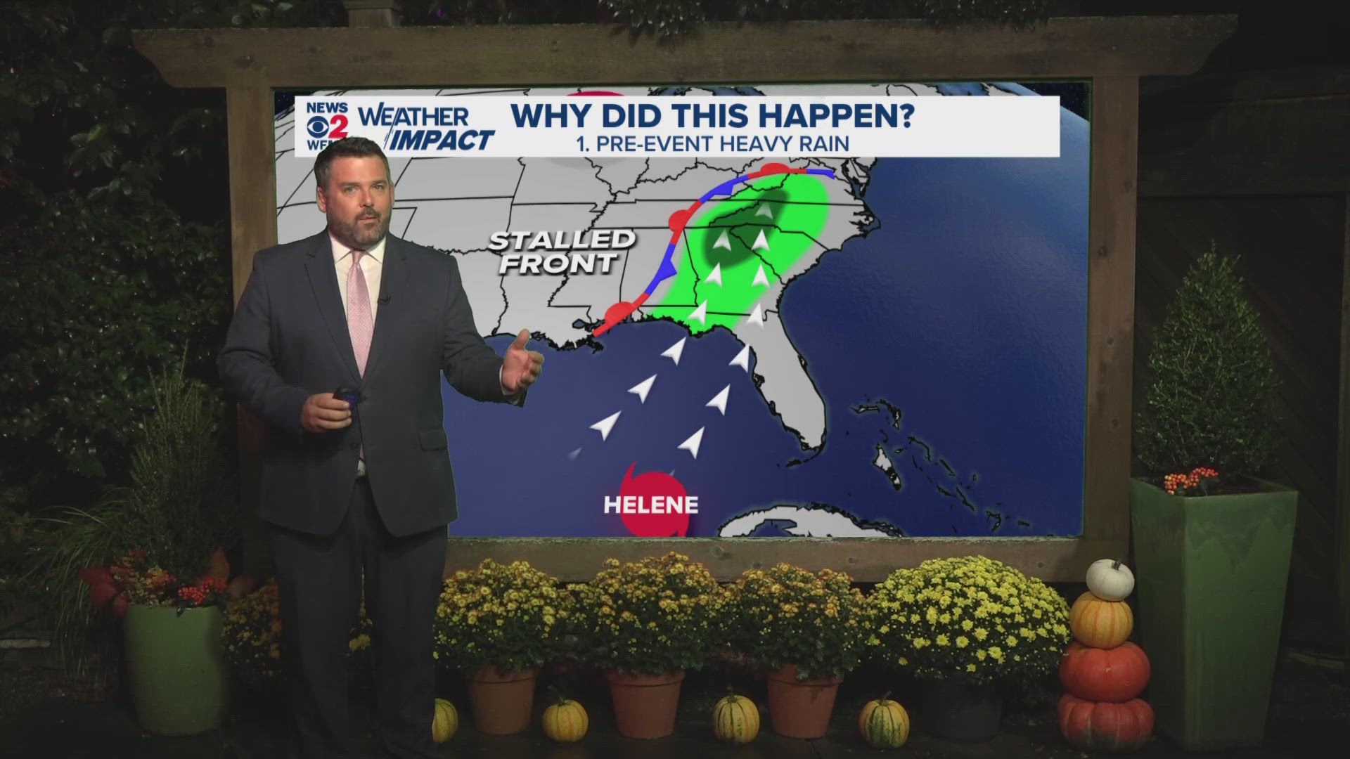
To understand what happened we have to go back before Helene was even nearby. In the days leading up to the hurricane the weather setup featured a stalled front just west of the Appalachian Mountains.
As you'll see below, the front acted as a focal point for tropical moisture to be drawn northward from the south. Simply put, it was sucking up rainfall from the south and bringing it to the mountains and Piedmont of Georgia and the Carolinas.
Everybody in this region saw a good amount of rain over several days but the North Carolina mountains had the highest totals. A widespread 8 to 12 inches was recorded in many areas, which caused creeks, streams, and rivers to rise and flood in some cases. Not only that, but the ground became very saturated leaving little room for additional water.

This "predecessor rain event" made the Appalachians extremely vulnerable to any heavy rain, let alone a major hurricane heading that way like Helene. It made matters much worse.
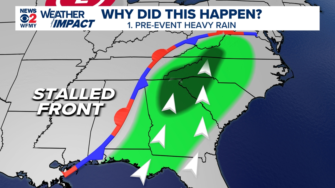
Hurricane Helene Took a "Worst Case" Track for the NC Mountains
Now let's talk about Hurricane Helene. The storm took a track that presented a "worst-case scenario" for the Southern Appalachians for a few reasons.
After Helene entered the Gulf of Mexico as a tropical storm it quickly strengthened into a Category 4 hurricane before hitting land near Florida. Of course, North Carolina is a good distance away from Florida, so why was the worst flooding here?
Helene's remnant eyewall tracked through Georgia at a high rate of speed that didn't allow time for it to weaken much. Then, the storm actually curved inland toward Tennessee as it was "pulled" by another upper-level low-pressure system sitting off to the west. This inland motion was bad news for the mountains.
If you look at the image below you'll notice that on the right-hand side of a storm's track the winds are blowing in the same direction the storm is moving. This is where the strongest winds air. In this case, those winds were hitting the mountains "head on" causing that air to directly rise up thousands of feet of elevation.

When air rises, it enhanced the rate of rainfall and makes for heavier more intense rainbands. When you have mountains that are 3,000-6,500 feet tall that rainfall gets enhanced in a dramatic way and resulted in 20 to 30 inch totals for this area.
This amount of rain can't be handled by anyone, but the terrain of the mountains funnels that water into the valleys and rivers creating dramatic flash flood rises that prove deadly in these situations.
On top of that, the saturated ground doesn't hold trees in place very well. Wind gusts of 50-100 mph easily brought down countless trees and power lines across the region.
Mountains Can Enhance Rainfall, Making it Heavier
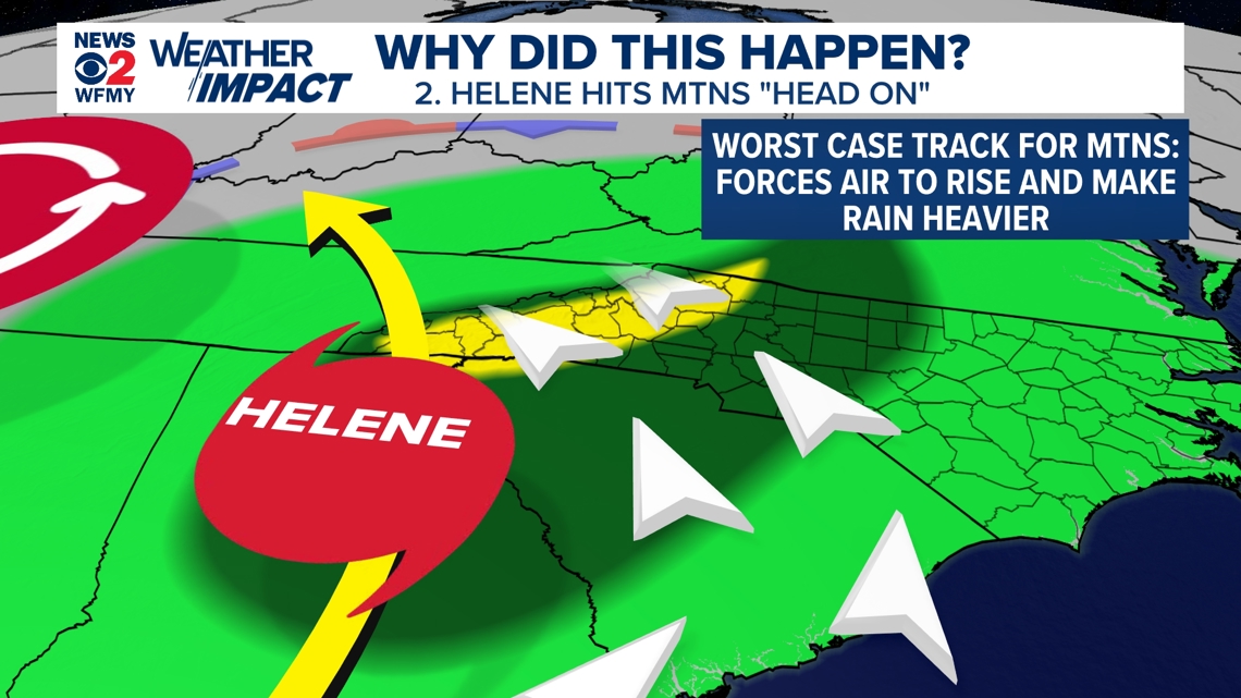
If you'll take a second for a quick weather lesson, mountains can change the weather simply because of their terrain. The tall peaks force air to rise in a way that it doesn't have to otherwise.
When air rises it cools and condenses, making clouds or rain showers. If there is already rain there, the mountains can turn showers into downpours. With a major hurricane running into a mountain range it's a recipe for a flooding disaster.

Tropical systems have hit the mountains hard before but this one is certainly one of the worst in history because of the rainfall ahead of time, the perfect track hitting the mountains "head-on", but also one other factor.
Record Warm Water Can Make Storms Stronger
When Helene entered the Gulf of Mexico, the amount of warmth in the water was off the charts. Hurricanes get their fuel from warmth in the oceans which aids in the rising air needed to fuel thunderstorms that make up the storm.
The chart below helps to display what we call the "ocean heat content" which measures water warmth over a large depth of the ocean. This year, the heat content is higher than has been measured before.
With more warmth in the water, storms can get stronger more quickly. In recent years we've noticed an increase in the percentage of tropical systems that get really strong really quickly - also called "rapid intensification".
Helene got stronger than it would have otherwise if the water wasn't so warm. This can mean higher winds and more rainfall after it hits land.
A warmer climate means more frequent heavy rain events and means that a storm like this one has more water to use for rainfall, enhancing the flood threat.