
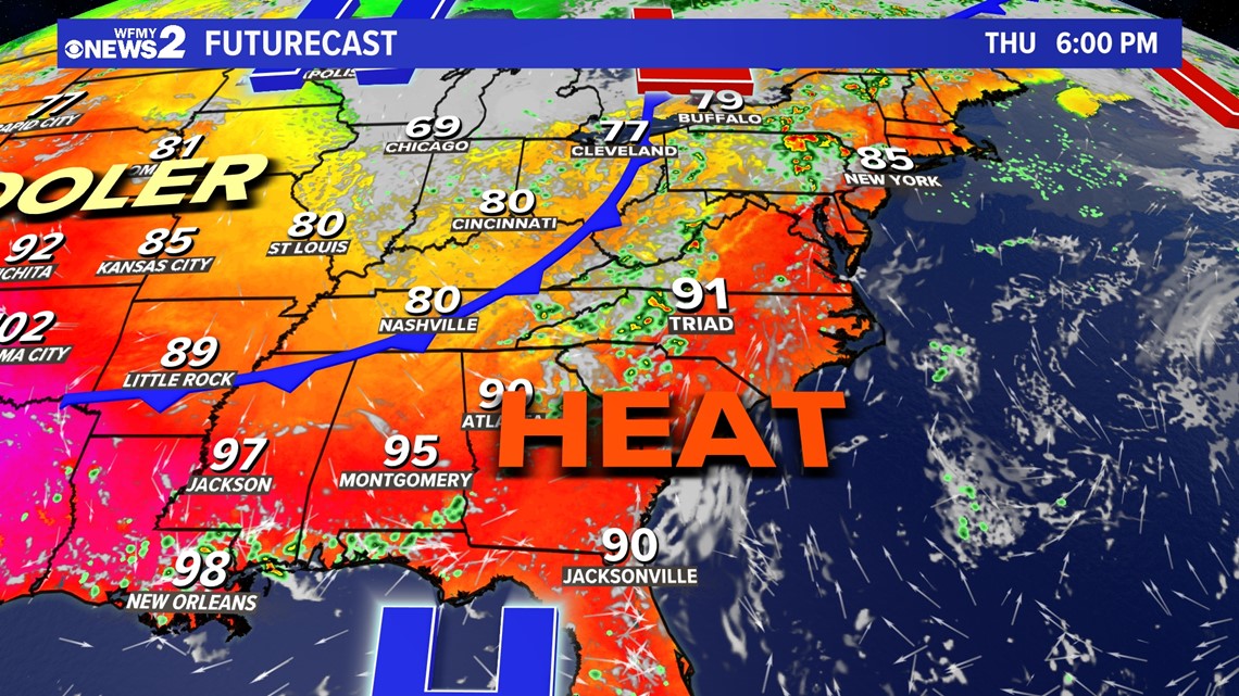
GREENSBORO, N.C. — An upper-level ridge has brought above normal temperatures across the Carolinas for the last several days with more heat expected this Thursday afternoon. Highs are expected to sit in the lower 90s across the area. Friday will also be unseasonably warm with highs deep in the 80s. When will we see relief?

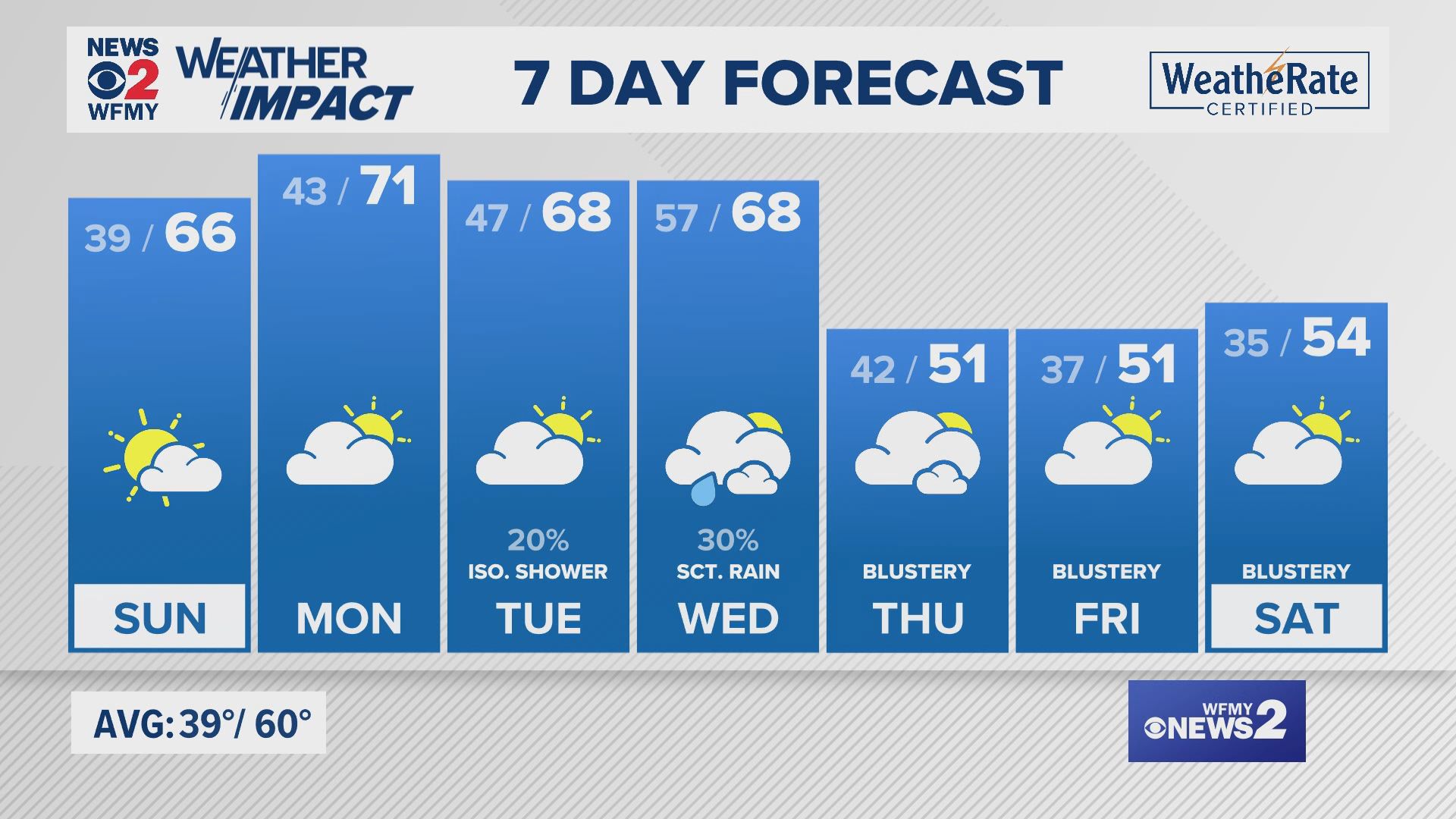
Good news, Triad! A cold front sweeping in from the west will bring in near-normal temperatures with rain and storm chances returning through the weekend. High temperatures will fluctuate in the low-to-mid 80s. Lows will be much more comfortable in the low-to-mid 60s through early next week. Scattered cooling showers are possible Thursday afternoon and evening with potential for locally heavier storms and damaging wind gusts. Saturday will likely feature the highest odds for unsettled weather with a 50% chance of rain and storms. Keep an eye on the radar with your WFMY News 2 App! It's a free download in your app store. Rain chances will begin to drop later this weekend and into early next week.
Looking forward to average highs in the 70s and 60s? Here's a countdown to some of your favorite holidays...
When is the official first day of fall?
September 23 marks the beginning of fall -- taking place at 2:50 a.m. for the Northern Hemisphere, it's also known as the fall equinox. Are you ready for comfortable highs in the 70s? Mid-to-upper 70s mark average highs for the final week of September. Lows will typically sit in the mid-to-upper 50s. By Halloween, high temperatures are back in the 60s with overnight lows in the chilly 40s.
September also is the peak of the Atlantic Hurricane Season.
While air temperatures begin to cool down, water temperatures are at a peak in the Atlantic. Warm surface waters aid in fueling tropical systems for growth and intensity. September is known to be the peak of the Atlantic Hurricane Season. Make sure you are staying up to date on the tropics. The end of the season is November 30. Tap here for the latest on Hurricane Lee.