GREENSBORO, N.C. — It's that time of year when everybody starts asking, "When's it going to snow?"
With the first day of winter right around the corner, it's time to take a look at what the 2022-2023 winter may bring for the Piedmont-Triad. The WFMY News 2 Weather Team has been studying the weather patterns most likely to unfold over the next few months. Here's what they found after doing their research and applying their forecasting experience to our area.
It always starts by looking at global patterns, and this year we're seeing something similar to the last two last years.
IT'S A LA NIÑA YEAR (NOT EL NIÑO)
A lot of times during winter we talk about an El Niño weather pattern, but this year we're talking about the complete opposite, a La Niña pattern. What is it, and why do we care?
During a La Niña weather pattern, the water near the equator in the Pacific Ocean is much colder than normal which can have impacts on our weather all the way on the east coast of the U.S. This is the same pattern we were in the last two years, making this a rare "triple-dip" La Nina year.

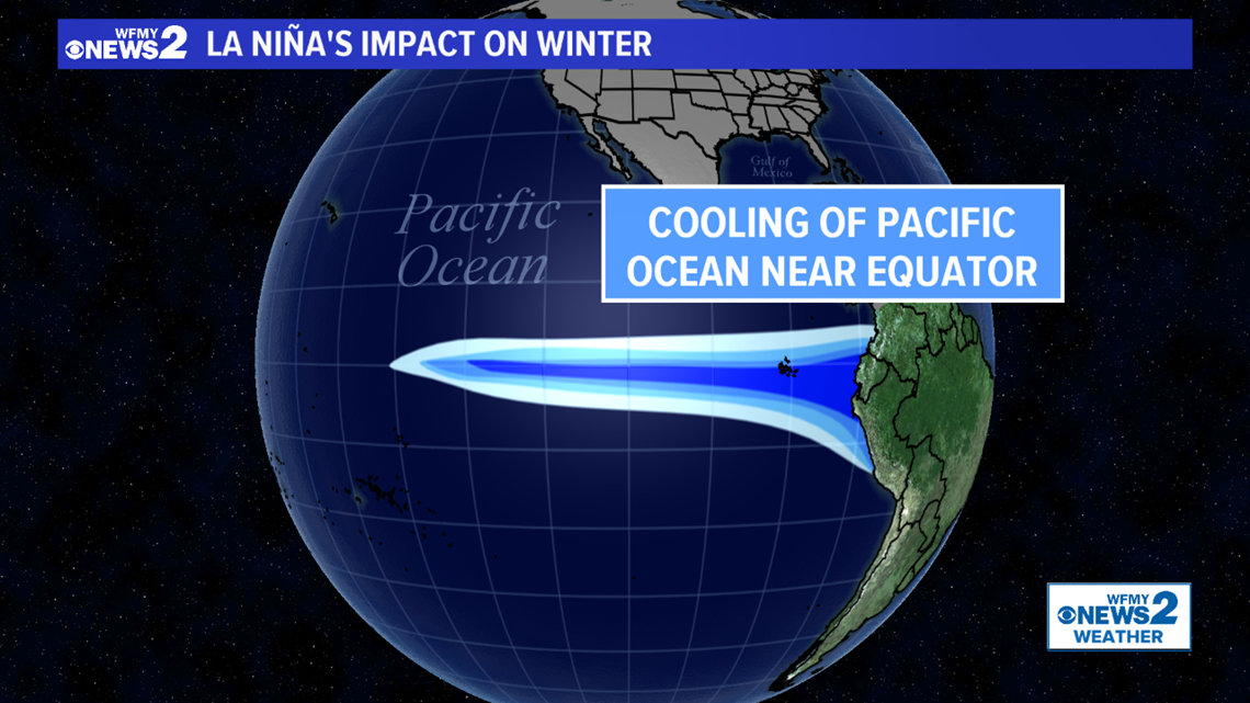
That colder water changes the intensity and location of the subtropical jet stream, which is our storm track that drives weather systems our way. During La Niña it lives farther to the north, meaning not as many storms track toward North Carolina. Simply put, we don't tend to get as many chances for rain and snow.
At the same time, the polar jet stream (which determines how far south Arctic air can roam) tends to be a bit farther to the north as well. This means we typically don't have as many outbreaks of bitterly cold air; although it can still happen on occasion.

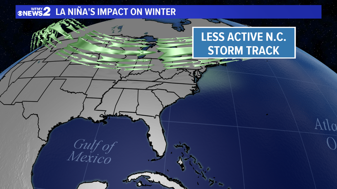
Taking all this into account, in the Carolinas we tend to have drier than average weather during a La Niña winter. Temperatures tend to be near average, but can often be a tad warmer.
Using a climate signal like La Niña is just one aspect of forecasting weather during the winter months. For example, last year's winter didn't behave exactly like a La Nina year, as it had more rainfall. Still, this can be a helpful guide.
WHAT ABOUT PAST LA NIÑA YEARS?
The past can be helpful in predicting the future. We narrowed down some other years with similar characteristics to this year.
From that data, we can draw some conclusions on what the temperatures, precipitation, and snowfall were like. Let's start with precipitation.
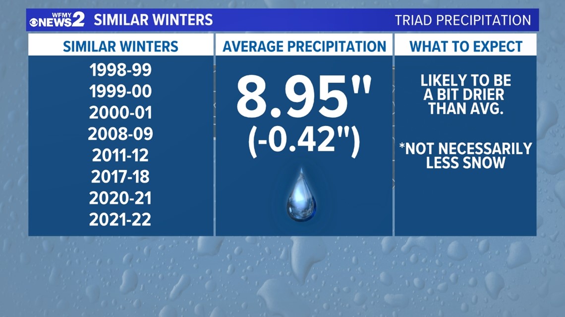
Precipitation during these similar winters tended to be lower than average. This was a fairly strong signal. This makes sense given the fact that the jet stream tends to be a bit farther north, causing storms to miss our area more often than hitting it. Based on this data, we can re-affirm the idea that a La Niña tends to be a drier one for North Carolina, including here in the Piedmont-Triad. Keep in mind, we're talking about overall precipitation here. This doesn't necessarily mean lower snowfall. More on that as we continue.

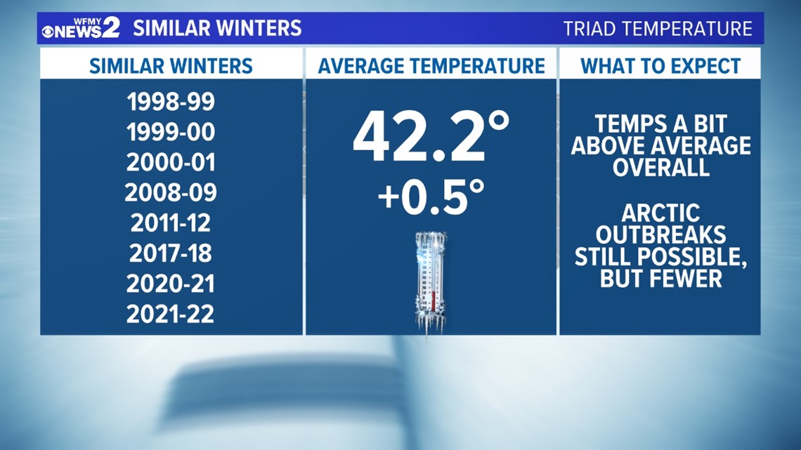
Temperatures in these similar winters tended to a bit warmer than average, with fewer cold outbreaks. This doesn't guarantee that we will be warmer than average. It's also important to keep in mind that winter is always still winter. Even a slightly warmer winter than usual is still "cold".
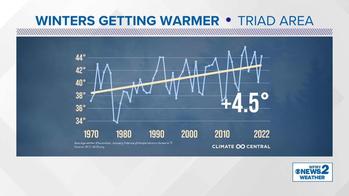
Still, the overall trend points to at or above-average temperatures this year. We must also consider that cold air outbreaks have been becoming less frequent in recent years in a warmer climate.

WHAT ABOUT SNOW?
Snow is always the number 1 question when it comes to winter forecasting, but also the hardest to answer for our area. You see, we don't get snow all that often in our climate, so sometimes the snow total for a whole winter is only based on one or two storms. From a statistical standpoint, past data only offers us so many data points to analyze.
For that reason, you can have a "snowy" winter during a warm year, or a cold year that doesn't have much snow, or a dry year that has a lot of snow, or a wet year that doesn't have much snow. So, our predictions are a guide, but certainly not gospel.
With all the caveats above, we of course looked at past data for snowfall given the weather pattern expected for our upcoming winter. Here's what we found.
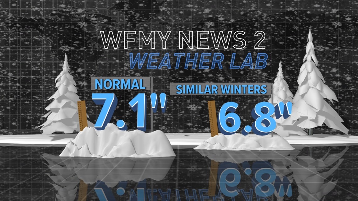
There was a signal for less snowy winters among these La Nina winters. There were a few years that bucked the trend with over 10" of snow, but that was the exception, not the rule.
Given all the signals, we will expect fewer opportunities for snow than average. But, almost every Triad winter on record has some snow! It's just a question of if we can sync up the cold air with moisture once or twice to get a "good one"

WFMY NEWS 2 WINTER FORECAST
We talked about La Niña, and looked at past winters with a similar setup. We also looked at other factors, including climate change, which have a big impact on how our next few months will play out. Here's what we expect.
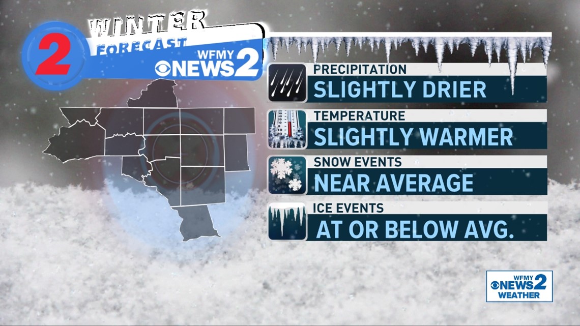
- Below-average precipitation
- A slightly drier winter than usual based on La Niña
- Temperatures slightly above average
- Past winters indicate above average temps. Plus, our long-term climate trend indicates our winters have been warming through the years.
- Snowfall near average
- Past winters indicate a La Niña winter usually means less snowfall, but not always
- Fewer snow/ice events than usual appear likely, but a "big storm" can happen in any year

A LOOK AT HISTORY
Throughout the years, it's often been feast or famine when it comes to snowfall here in the Triad.
The graph below shows all winters going back to 1928. You'll see there's often a lot of "noise" bouncing up and down year to year.
The snowiest winters on record have been between 15 to 25 inches in our area. The least snowy often have only an inch or two -- like the last two years.

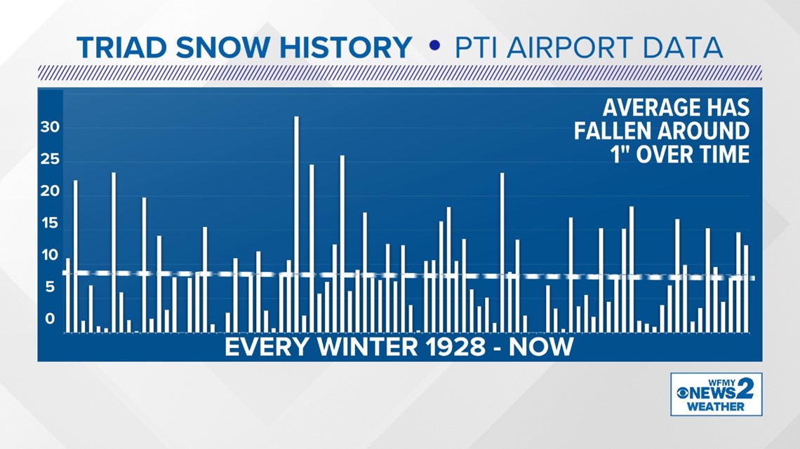
It's also interesting to look at when snow typically falls here in the Triad area. On average, January has been our snowiest month throughout the years. More than 1/3 of our snow has fallen during that month. February is next up, followed by March. Many are surprised to know that March has seen more all-time snowfall than December, even though it's a warmer month on average.
CLIMATE CHANGE
Take a look at the climate trend over the last 50 years. Winter is our fastest warming season. Since 1970 our winter season has warmed about 4.5 degrees. This doesn't mean winter is "warm" but it is less cold.

