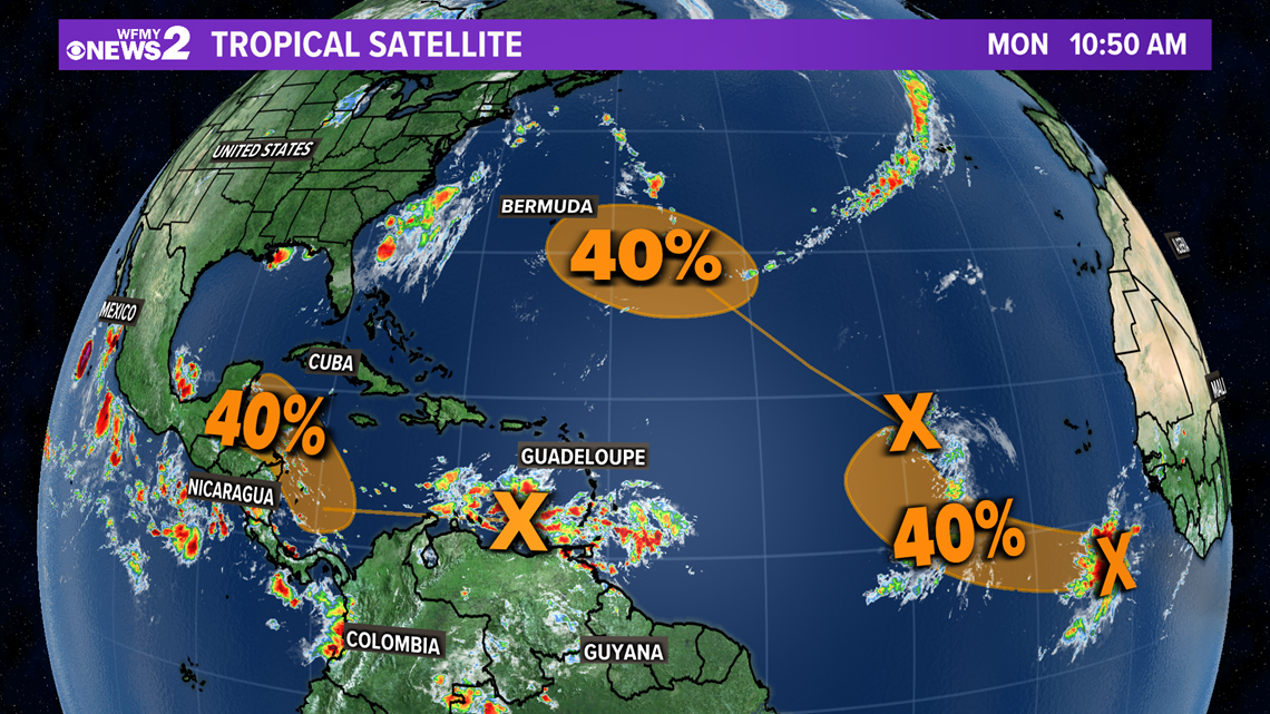
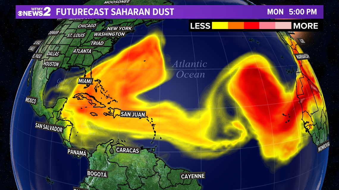
GREENSBORO, N.C. — As of Monday afternoon, Henri continues to brings rounds of rainfall to portions of the New England coast as a tropical depression. In this system's wake, there are now three other disturbances the National Hurricane Center is drawing our eyes to in the southern Atlantic Ocean. All three have a moderate chance (40%) of development over the next 5 days. The two disturbances closest to Africa have been tagged as Invest 97L and 98L; however, there is a large area of Saharan dust sits in between these two areas. Saharan dust makes it difficult for tropical systems to strengthen and organize.


The Saharan dust helps to reduce the moisture and increase the shear, which is not helpful for tropical development. Shear is one of the key factors in disrupting the symmetrical structure of the storm.


As we near mid-September, the tropical activity will begin to increase in the Atlantic basin. Historically, the peak of the season has been on September 14. Tropical activity is more likely to originate near the Cape Verde islands and travel west along the southern Atlantic basin. The Gulf of Mexico and eastern seaboard are also likely locations for tropical activity.
So far this year, there have been eight named storms. If any of these systems upgrade to a tropical storm, the next name of the season is "Ida." NOAA's forecast calls for 15 to 21 named storms this season with 7 to 10 of those upgrading to hurricanes. Grace and Henri are the only two hurricanes that we have had so far this year.


