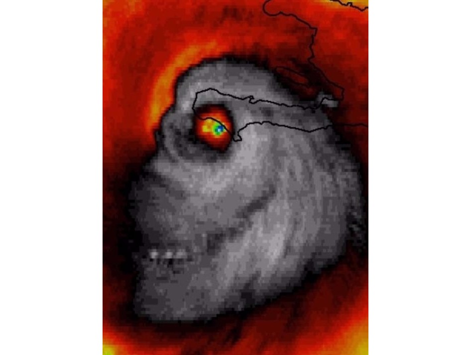
A Weather Channel meteorologist spotted an eerie face in a satellite image of Hurricane Matthew on Tuesday.
Stu Ostro, a senior Weather Channel meteorologist, posted the picture on Twitter on Tuesday and said it was not photoshopped. In the infrared satellite image, taken from NASA Earth Science Office, the eye of the storm looks like an actual eye.
“Sinister-looking face of #HurricaneMatthew at landfall in #Haiti,” Ostro said. "Un-doctored #weather#satellite image."
Sinister-looking face of #HurricaneMatthew at landfall in #Haiti [Un-doctored #weather #satellite image] pic.twitter.com/hrviDVuJ3R
— Stu Ostro (@StuOstro) October 4, 2016
At least 11 deaths have been attributed to the powerful storm as it has marched across the Caribbean this week, five of them in Haiti. With a key bridge washed out there, roads impassable and phone communications down, there was no further word on the dead or injured. At 11 a.m. ET Wednesday, the storm was about 105 miles south of the Bahamas, heading northwest at 12 mph.
Meanwhile, authorities in Florida and South Carolina began evacuating hundreds of thousands of people Wednesday as Hurricane Matthew roared closer to the U.S.
Tropical storm conditions are expected to reach parts of the Florida coast by early Thursday, and hurricane conditions will intensify in some areas later in the day, the National Hurricane Center warned. Matthew had top sustained winds of 120 mph, a Category 3 hurricane, Wednesday morning and could strengthen in coming days, the center said.


