
GREENSBORO, N.C. — Springtime in North Carolina brings warmer weather and with it, the chance for storms. This time of the year there's usually about one system each week that we have to watch for thunderstorms.
Here's what the WFMY News 2 Weather Team is tracking for you this evening:
THE SETUP:
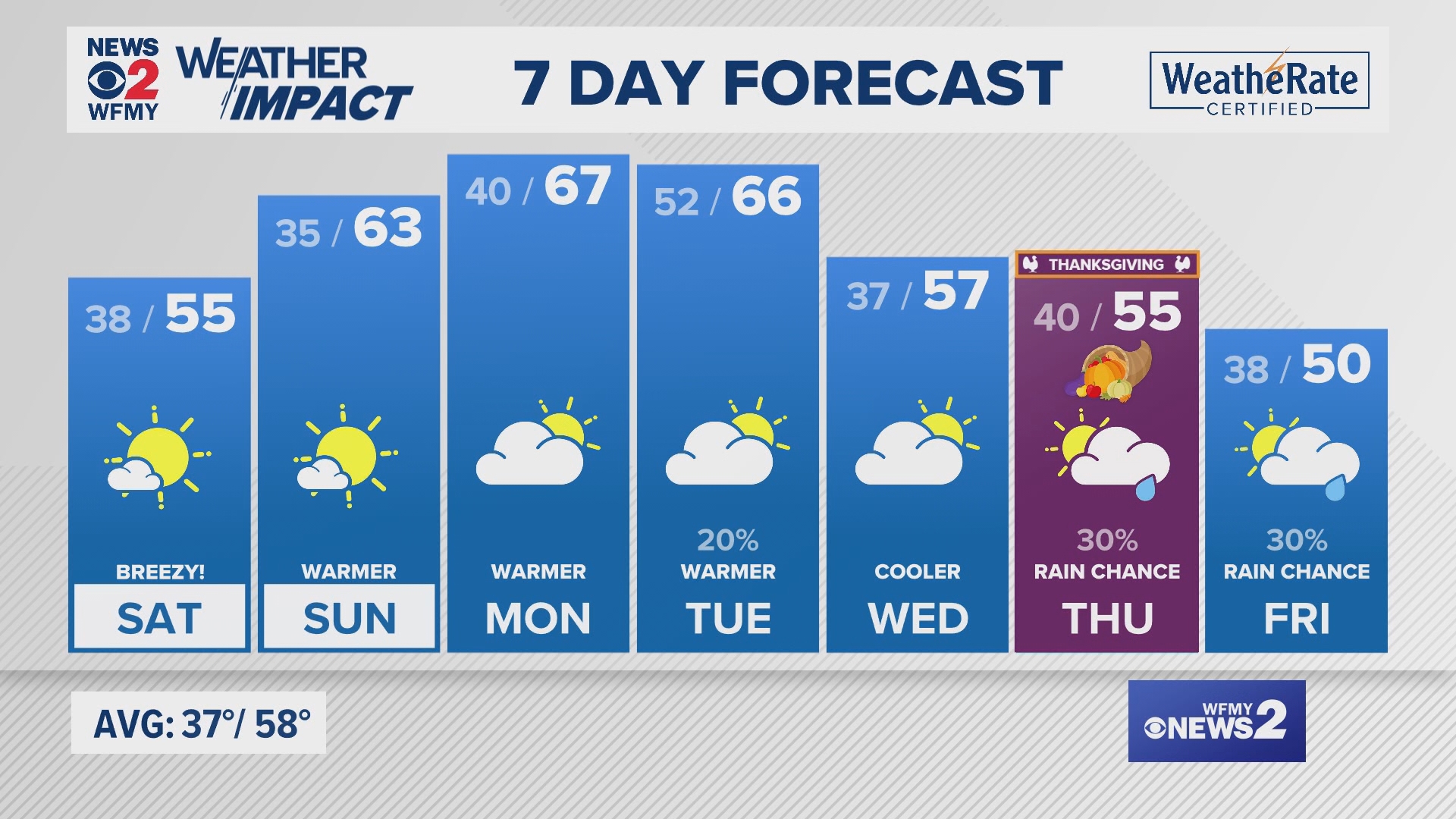
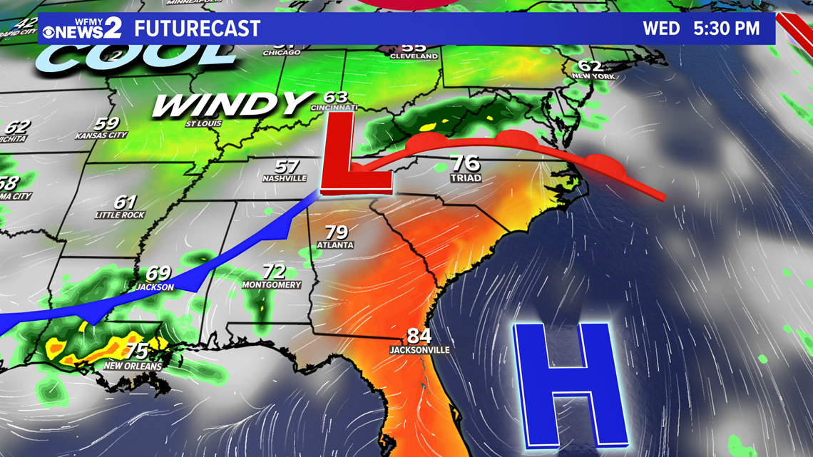
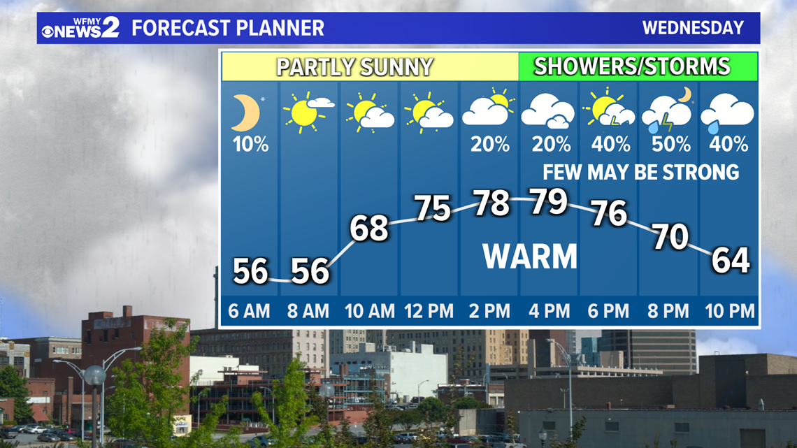
High pressure in control of Piedmont weather for the last couple days is moving offshore. With a strong southerly wind ahead of a cold front on the way, we've warmed up into the 80s this afternoon, but it will be the last day near 80 for a while.
As the area of low pressure moves toward the Piedmont, timing has shifted a little later this evening with scattered showers likely to arrive after 7-8 PM tonight. Warm and humid air could create some "fuel" for storms to form. With the track of the low-pressure area, our neighbors to the north of the Triad and along the NC/VA border may need to watch the closest for a couple strong storms. The cold front will cross the area heading into Thursday and bring drier and cooler weather behind it for Thursday and Friday.

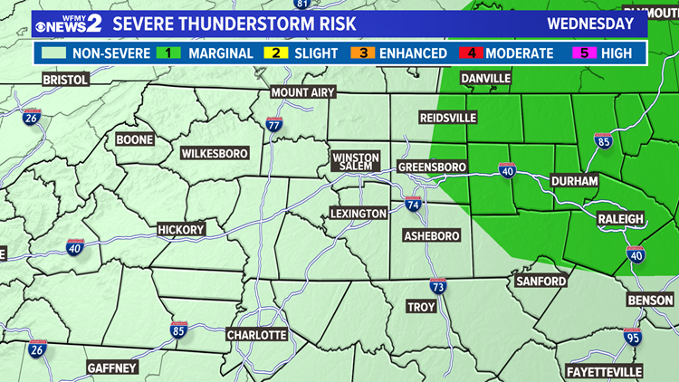
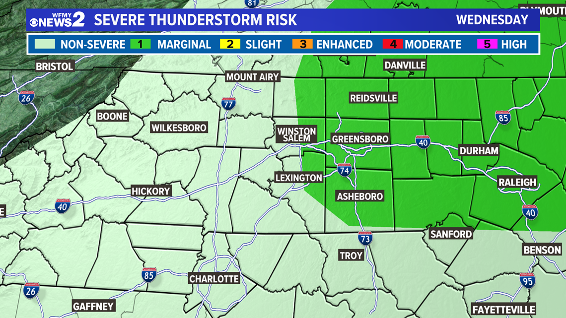
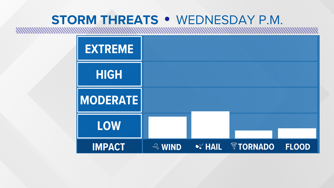
Overall, the severe weather threat is low, with most of the Triad in just a general risk for thunderstorms. To the East of the Triad, there is a level 1 out of 5 for severe weather. Still, we'll watch closely and pay attention.

TIMING:
Mainly 6-8 PM showers are likely to arrive as well as a few thunderstorms. Some storms could be bumpy or even get strong or severe.
After midnight our severe weather threat should be over but some showers will remain overnight heading into Thursday morning. Storms aren't a total guarantee but they're absolutely possible. We're drying out and clearing on Thursday. Thursday will be cooler and windy.

POSSIBLE IMPACTS:
Overall, the severe weather threat is low but we still should be on guard and checking the weather often. If any storms are able to get strong or turn severe, our main concern will be for hail and possibly a damaging wind gust. The tornado risk with this system is very low.

It's a good idea to keep checking up on the forecast and staying in tune with the weather this afternoon.
The WFMY News 2 weather team will be on top of it for you with updates on-air and online throughout the day. You can follow them on social media for updates.
Tim Buckley: @TimBuckley on Twitter
Christian Morgan: @CMorganWX on Twitter