GREENSBORO, N.C. — Text us your storm damage photos at 336-379-5775.
It's springtime in NC and you know what that means— warm weather! Or is it cold weather? Oh, wait...that's right, we have both around here!
We're about to see a dramatic shift in our weather by the second half of the week.
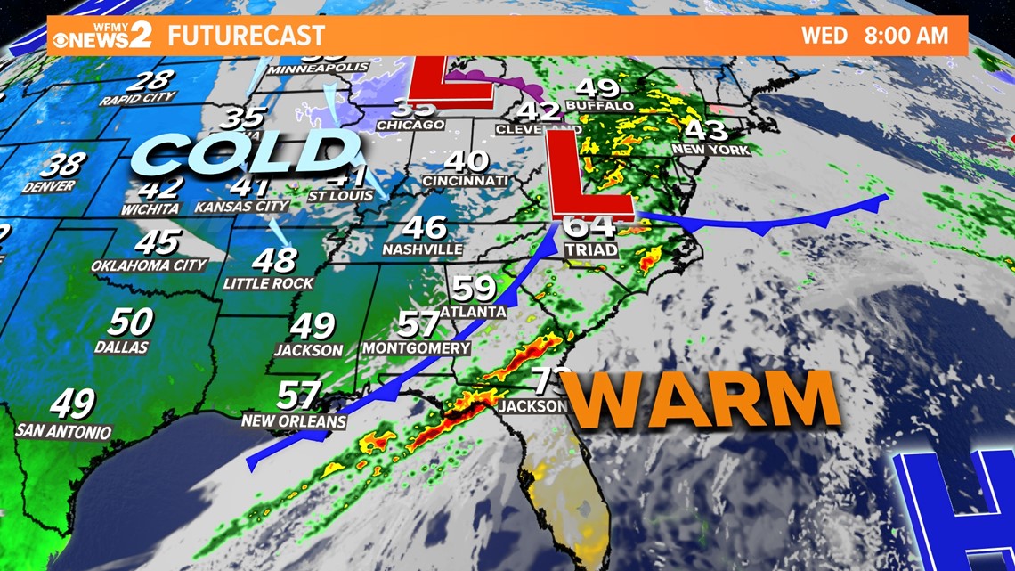
After 80s for the last couple of days, we'll end the work with 50s for highs and even mid-30s for morning lows over the weekend. It'll be windy too! Those big differences can often cause severe weather in our area this time of the year. Wednesday will be our day to watch as a strong cold front approaches from the west.
An area of low pressure will track through the Ohio Valley and to our north and west bringing much more of a concern for severe and dangerous weather to parts of Ohio, Kentucky, and Indiana. That's where most of the energy from this system will be, but for us, as the cold front approaches our area, we'll need to watch for scattered storms and a lower risk of a few strong storms.

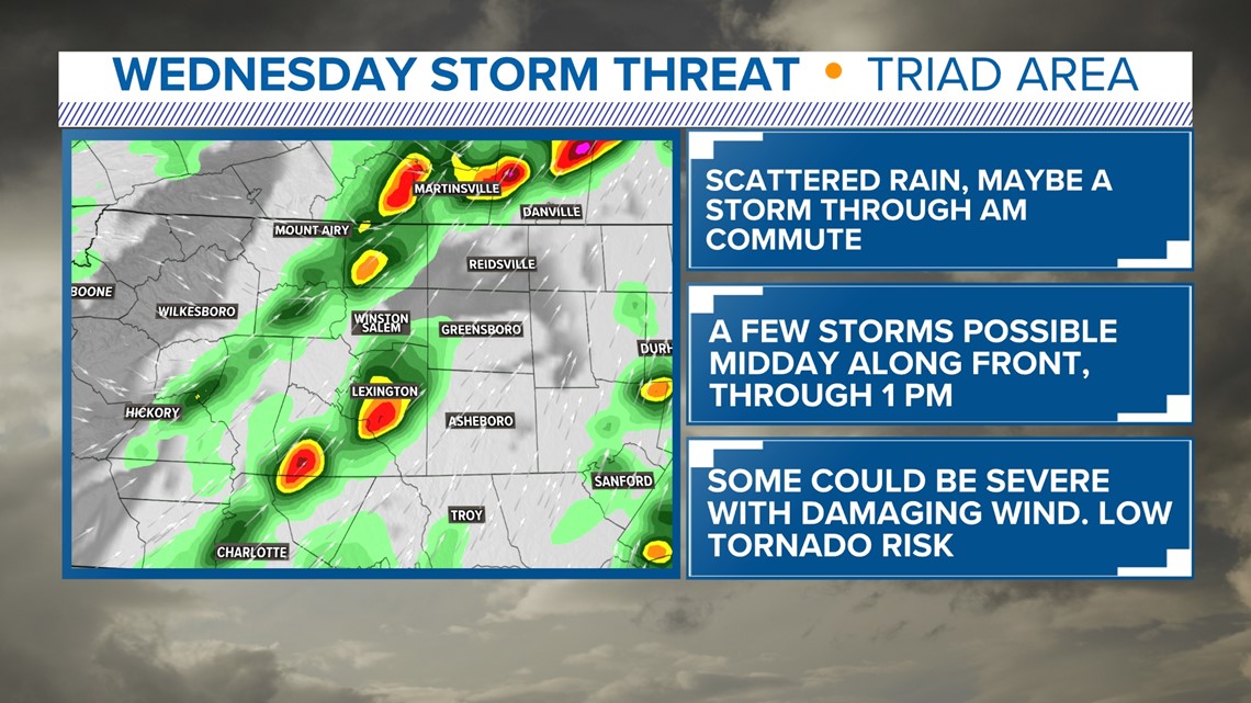

TIMING:

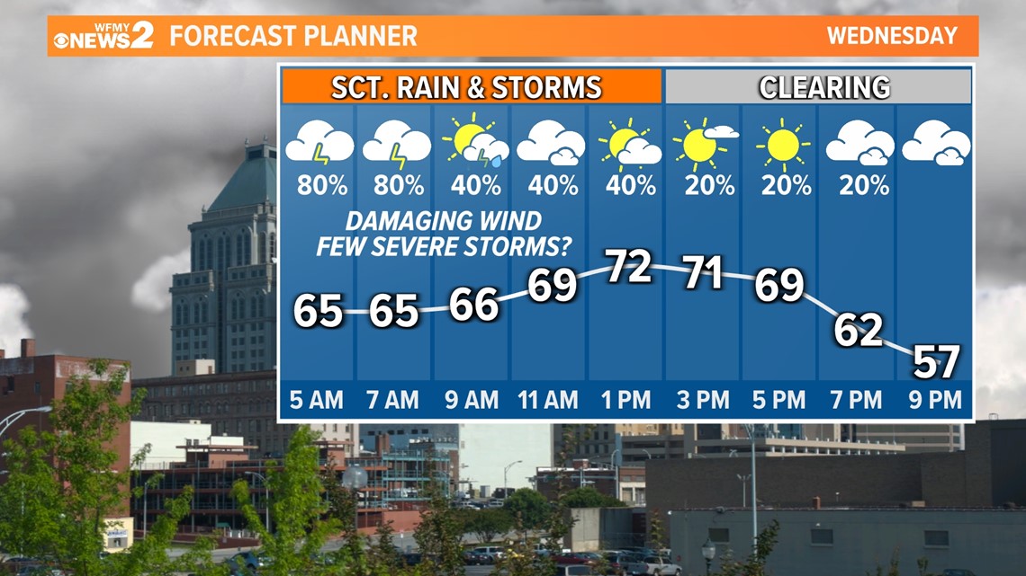
It's a good idea to make note that this isn't typically the afternoon and evening timing we talk about when it comes to storms; instead, it's overnight while you may still be sleeping and through the busy morning commute hours on Wednesday morning.
Our main timing will be 4 AM - 1PM for scattered showers and a strong storm or two. The threat sticks around early into the afternoon as redevelopment of storms is possible along the actual front itself.
THREATS:

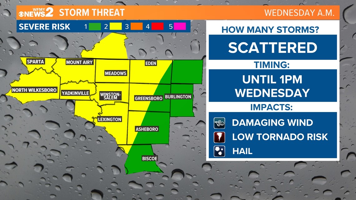
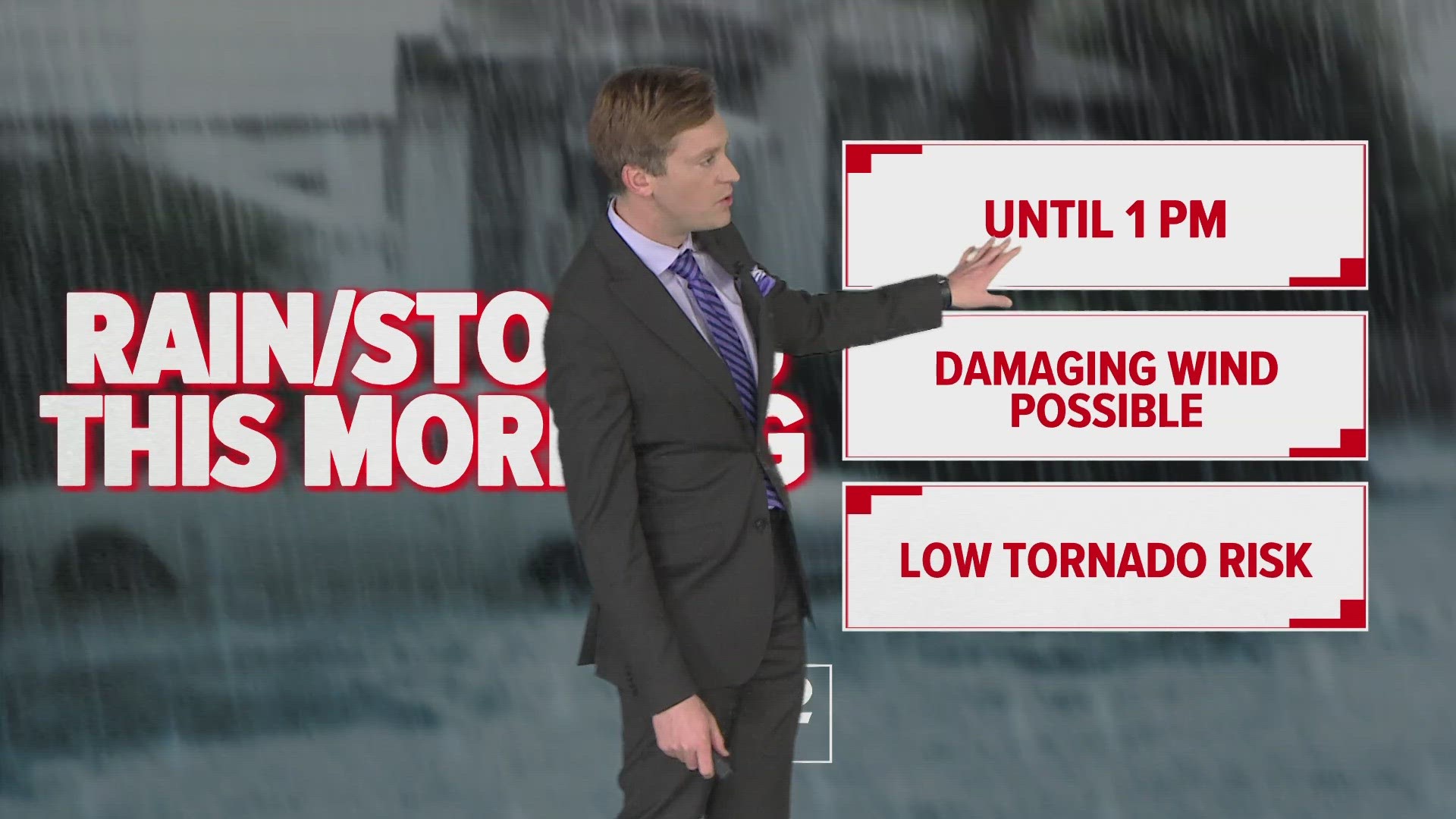
Overall, our risk of severe weather is low, and slightly better back to the west, but we still need to pay attention. A couple of strong or severe storms will be possible for the Piedmont with damaging wind being our main concern.
We'll have a low risk of a tornado across our area as well, so we'll need to watch. Our system won't have a ton of energy, but speedy and changing winds above our heads could be a recipe for a few storms to rotate.
Our severe risk should be done by midday Wednesday morning, then clearing for the afternoon. One thing to keep an eye on is the chance for another few showers or a pop-up storm to form along the actual cold front as it rolls through midday, but sometimes that's difficult to do, so that's not a guarantee either.
WHAT TO DO:
Don't panic! We see several times throughout the year where we need to watch for storms, this is just another one and our weather team will guide you through it! It's a good idea this evening to make sure any loose items are tied down in the backyard and around the house in case of gusty winds overnight and Wednesday morning.
Make sure you can hear warnings or that warnings are set and can wake you up if you're asleep if warnings are issued for bad storms in the middle of the night.
Stay up to date with our News 2 Weather Team for the latest updates!
MORE WAYS TO GET WFMY NEWS 2
Subscribe to our daily newsletter Let’s Get 2 It!
Download the WFMY News 2 APP from your Apple or Google Play store.
ADD THE WFMY+ APP TO YOUR STREAMING DEVICE
ROKU: Add the channel from the ROKU store or by searching for WFMY.
Amazon Fire TV: Search for WFMY to find the free app to add to your account. You can also add the app directly to your Fire TV through your Amazon account.

