GREENSBORO, N.C. — 70s and 80s in the 7-day forecasts with rain chances may raise some eyebrows for folks familiar with Triad Springs. Some of those rain chances have a chance of featuring storms.
Tornadoes are the most violent storms and accompany the strongest thunderstorms. Weather awareness is key as we navigate this season to ensure that you are safe in the event of a severe storm!
Severe storms are not just classified by tornadoes, but also from the hail and wind.
Storms are considered severe if they produce hail of at least an inch in diameter, have winds of 58 mph, or produce a tornado. As we've seen in strong wind events throughout the winter, winds can send almost any outdoor item flying from a lawn chair to a trampoline!
One of the worst cases is when a strong enough wind gusts, knocks down a tree, and the tree lands on an overhead powerline. This scenario leads to power outages and depending on the location, it could keep power out for a long period of time.
Trimming trees and removing old trees is one of the best proactive choices anyone could right now since we are early in the season.


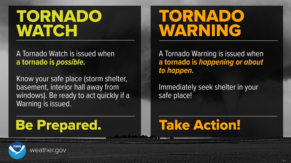
Winds aren't the only worry to prepare for! Increasing your weather knowledge is another way to get ready. Knowing the difference between watch and warning is key in navigating the season. Simply put, watch means be ready, and warning means act now!
A severe thunderstorm watch is issued when a severe thunderstorm is possible and a tornado watch is issued when a tornado is possible.
A severe thunderstorm warning is issued when a severe thunderstorm is moving through your area and a tornado warning is issued when a tornado is either radar-indicated or on the ground.
Radar-indicated tornadoes are what you might often hear your favorite meteorologist reference on tv! These tornadoes have not been confirmed on the ground but based on weather tools like our radar, we can determine a high chance that a tornado is likely in a specific area.
Of course, it must be confirmed to be verified, but you should never wait for confirmation to take action! Tornadoes happen so rapidly that waiting can cost a life.


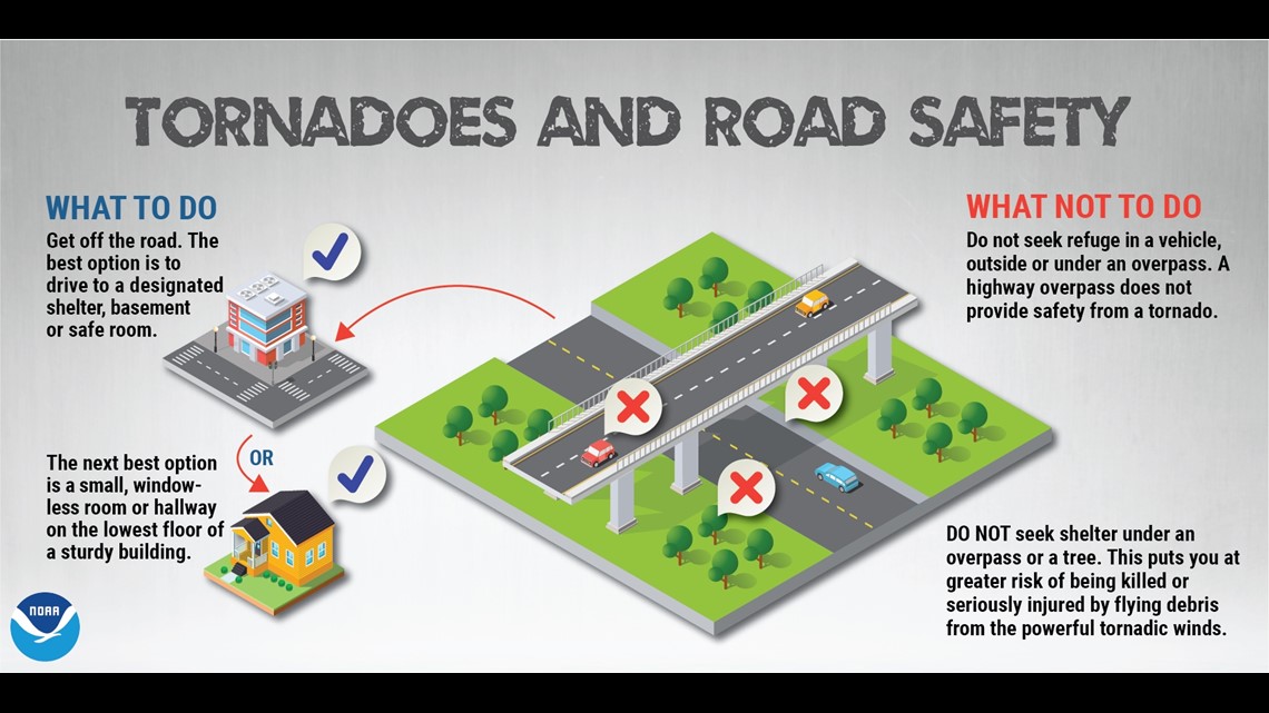
Safety is key! Cars are not the safest place to be in during severe weather. Find the closest building or if you're already in one, get to the basement or a room on the lowest level with the least windows.
Storms that produce tornadoes are not simple events and there is still so much ongoing science today trying to figure out how exactly these violent things work! We do know that there are different types of tornadoes.
The Triad is most familiar with spotting supercell tornadoes. These tornadoes are produced in supercell thunderstorms, which are well-developed thunderstorms.
Landspouts are narrow, rope-like funnel clouds that spiral out of the base of a cloud, but there is no apparent updraft. The updraft is the spinning rotating air that moves into the cloud.
A waterspout is more common along the Carolina coast. These are landspouts that occur over water. Other common whirls of circulation include gustnadoes, dust devils, and fire whirls.

