GREENSBORO, N.C. — Nicole brought heavy rain, gusty winds, and the threat of tornadoes to the Piedmont-Triad today. Now, it's moving out. Weather will be improving toward the late evening hours with light rain and drizzle slowly tapering off.
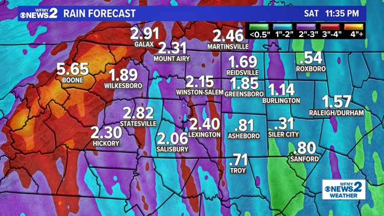
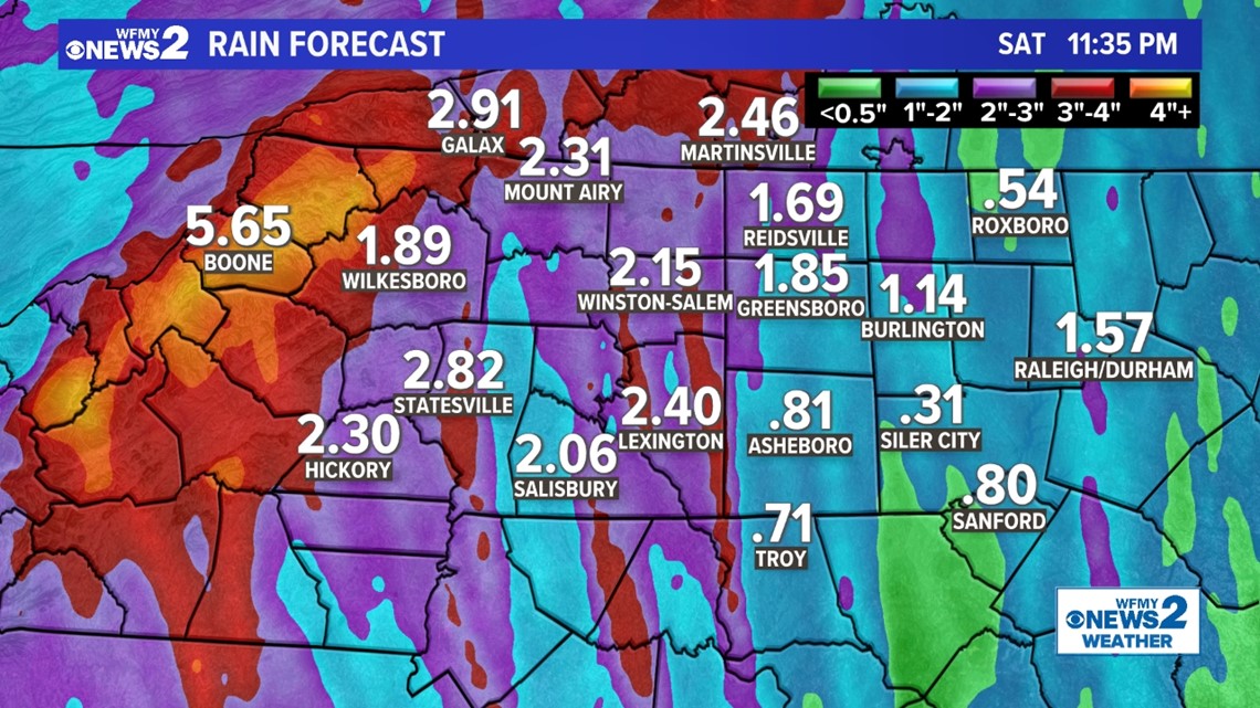
Gusty winds were in the 25-40 mph range today. Rain totals were in the 1 to 2 inch range. We did not see any flooding locally, but the NC mountains sure did. Wind damage wasn't seen either, even though a few tornado warnings happened this morning. A funnel cloud was spotted in Siler City.
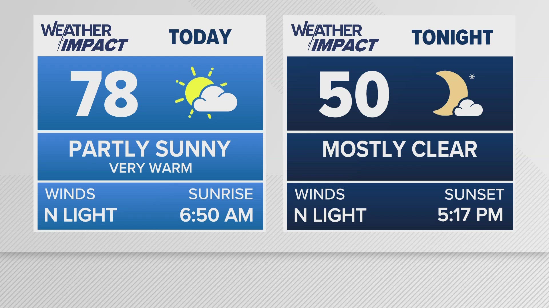
From here, the remnants of Nicole will move out leaving partly cloudy skies to start our Saturday. This will be the last warm day. It will be in the upper 50s Saturday morning, and we will warm into the upper 60s for Saturday afternoon. There is a cold front on the way for Saturday night which will bring some clouds and the threat of a stray shower here or there.
Behind this cold front, temperatures really drop for Sunday and the rest of the weekend. Winter chill will keep our high temperatures only in the upper 40s for Sunday. This cold weather will remain heading into next week. Highs in the 40s each day, with a chilly rain likely for Tuesday.
Timing
- Friday morning: Occasional heavy tropical rainbands. Few severe storms., tornado threat. Winds picking up. Humid.
- Friday afternoon/night: Continued scattered storms. Isolated tornadoes. Gusty winds. Humid.
- Saturday morning: Skies clearing and dry!
Wind
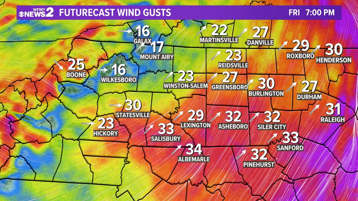
Nicole is a tropical depression, so winds will be weaker than what we saw when Ian moved through the Triad over a month ago. Still, gusty winds are likely through the day.
Wind gusts of 20-30 mph are likely during the morning and midday. The afternoon and evening will be the gustiest with winds of 35-40 mph possible.
Of course, in heavy rain bands and any severe t-storms that develop higher wind gusts will be possible but these would be more isolated.

Rain
Rain can often be a big worry with tropical systems. In this case, our dry days throughout the start of the month and the end of October make this rain threat not too much of a worry. Rain is forecast to begin late Thursday and continue throughout the day on Friday. It is not expected to be a continuous ongoing rain leading to widespread flooding. The showers and storms throughout Nicole's track in North Carolina will be intermittent with breaks in between. As of Wednesday afternoon, rain estimates are not forecast to exceed 2".

Tornadoes
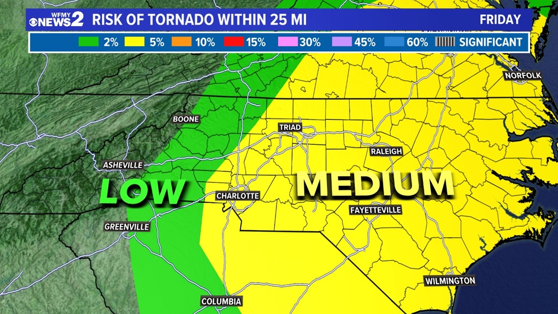
We will need to monitor the outer bands of Nicole skirting into the Triad. Some of these bands could spin up a tornado or two across the area. The Storm Prediction Center puts most of our area under a Slight Risk (Level 2) for severe storms on Friday due to Nicole. With tropical systems tracking into a very warm, humid environment, brief weak tornadoes are possible. The WFMY Weather Team will be on the watch for tornadoes from Thursday night to Friday night.

