GREENSBORO, N.C. -- Our storm system is here, bringing a lot of cold rain, and some icy concerns to the Piedmont and Foothills. Rain will continue through Thursday afternoon, and we won't see the sun shine until Friday. Here's what we're tracking.


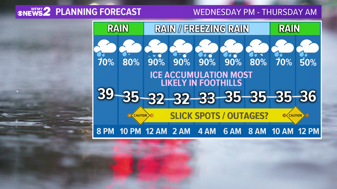
Rain will be continue to move into the area overnight, with temperatures falling into the 30s. As the temperatures get colder, it's possible for sleet to mix in from time to time. If and when temperatures fall to the freezing mark, 32°, freezing rain will begin and icing will become an issue.
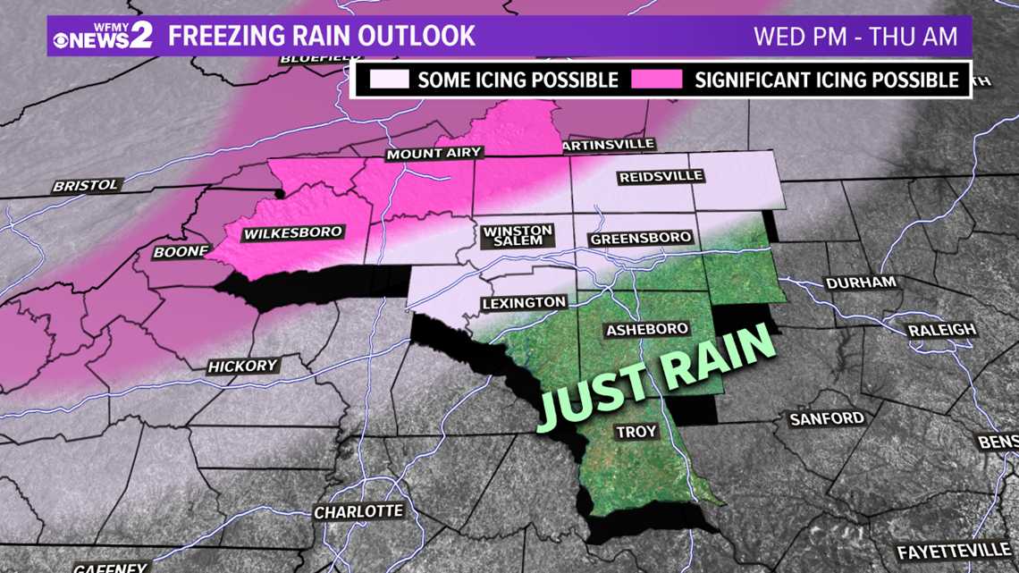
Icing is most likely in the northwest Piedmont and Foothills. A Winter Storm Warning is in effect for Surry, Patrick, Wilkes Counties, along with the Blue Ridge Mountains. As much as a quarter-inch of ice is possible in these areas.
Here in the Piedmont-Triad, icing is less likely and we will mostly see a cold rain. However, a light icy glaze is still possible. We should still be on guard in case issues do arise Thursday morning.
► For Quick weather updates Download the WFMY News 2 App: Apple Users, Android Users
Eventually, temperatures will warm above freezing by midday Thursday which will turn the frozen precipitation back to rain. This rain will truly be coming down heavy at times, and the winds could be gusty as well.


Main impacts will be for downed trees and power outages in the Foothill communities.
FOOTHILLS / NW PIEDMONT:
- Accumulating ice is more likely in these areas
- Concern for some downed trees or power outages
- Slick spots are possible on bridges and overpasses
TRIAD CITIES:
- Mainly just a cold rain, but temps could get cold enough for a brief period of freezing rain.
- Some icing is possible, especially on elevated surfaces or a bit on the trees.
- Power outages should be limited, but watching closely.
- No travel issues expected at this time, but watching closely.
SOUTH/EAST OF I-85:
- All cold rain.
- No icing issues expected at this time.
All areas will see a good amount of rain on Thursday with an additional 1"-2" on top of what we've already seen this week. Considering our recent flooding concerns, additional flooding is a possibility.

