GREENSBORO, N.C. — Hurricane Isaias came ashore in Ocean Isle Beach, North Carolina late Monday night and quickly dropped back down to a tropical storm. Hundreds of thousands of power outages were reported in most coastal counties, and Gov. Roy Cooper reported one person died as a result of the storm during an interview with Good Morning America.
TUESDAY, AUGUST 4, 2020
11:15 p.m. - A day after the hurricane hit, power is still being restored and crews continue to repair damaged buildings and roads in Wrightsville Beach.
6:30 p.m. - WFMY News 2's Alma McCarty with an update from Wrightsville Beach following Isaias recovery.
4:45 p.m. - Viewer Dave Cromer shares photos of Ocean Isle Beach pier before and after Hurricane Isaias.
3 p.m. - Gov. Roy Cooper gives an update and the latest on Tropical Storm Isaias.
2:40 p.m. - President of Samaritan's Purse and the Billy Graham Evangelistic Association, Franklin Graham tweeted that Samaritans Purse is headed to Bertie County after a deadly tornado damaged homes and left people injured.
11:50 a.m. - Two people were killed and at least three others were unaccounted for after a tornado destroyed several mobile homes in Windsor, North Carolina, said Ron Wesson, the chairman of the Bertie County Board of Commissioners. He said as many as 15 others were taken to hospitals with injuries.
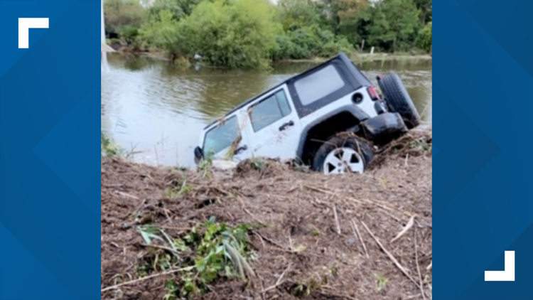
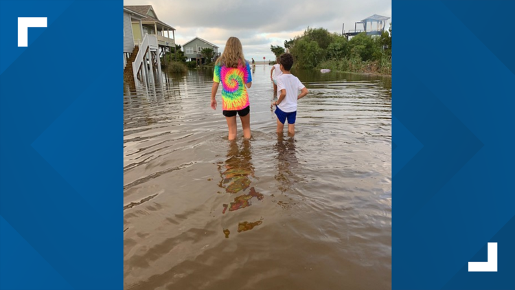
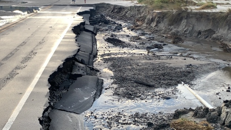
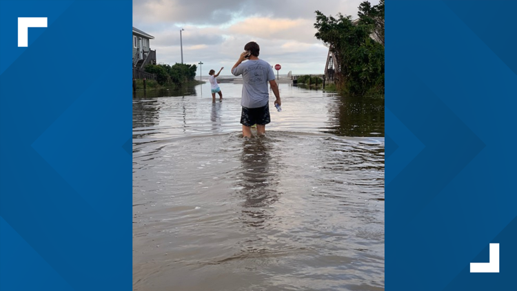
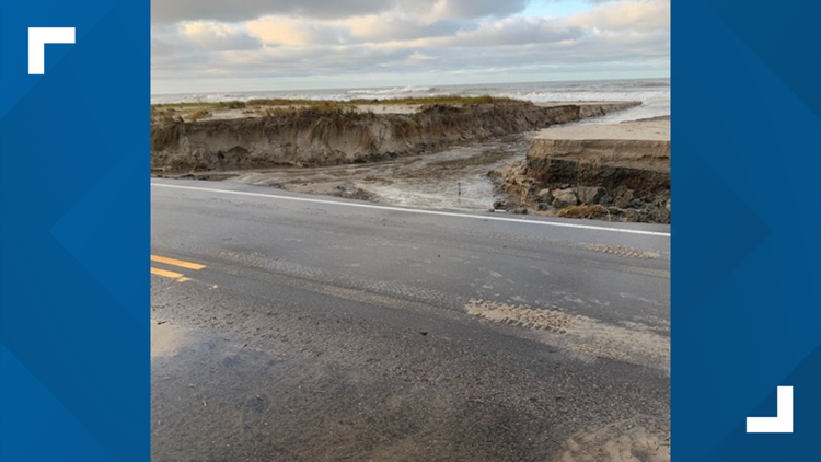
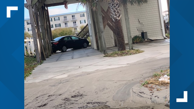
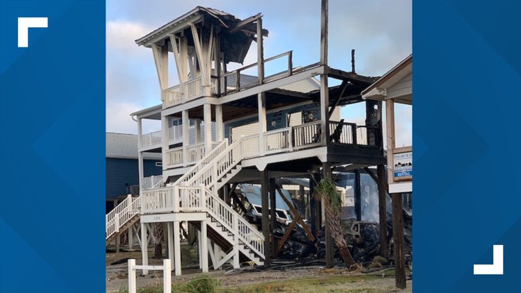
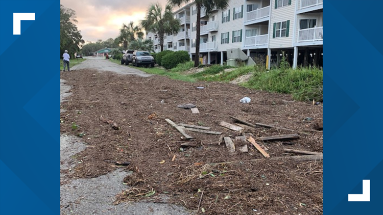
10 a.m. - Viewer Jamie Alston, of Randolph County, shared photos of damage in Oak Island where her family is vacationing.
PHOTOS: Oak Island after Hurricane Isaias
8 a.m. - In an interview with Good Morning America, Gov. Roy Cooper said one person died in Hurricane Isaias.
6:15 a.m. - All is calm in Wrightsville Beach during sunrise, but thousands are without power after the storm.
6 a.m. - There are more than 350,000 power outages across North Carolina, according to the state department of public safety. The outages are mostly impacting coastal counties.
4 a.m. - Rain is ending for the Triad as Isaias pulls away to the NE.
3:44 a.m. - North Carolina reports more than 300,000 power outages.
3:11 a.m. - Isaias weakens to a tropical storm.
2:27 a.m. - More than 235,234 power outages in North Carolina from Hurricane Isaias.
New Hanover County
92,181
Brunswick County
45,679
Onslow County
30,105
Pender County
27,099
Columbus County
6,714
Carteret County
5,731
Bladen County
5,604
Sampson County
5,072
Duplin County
3,385
Wake County
2,869
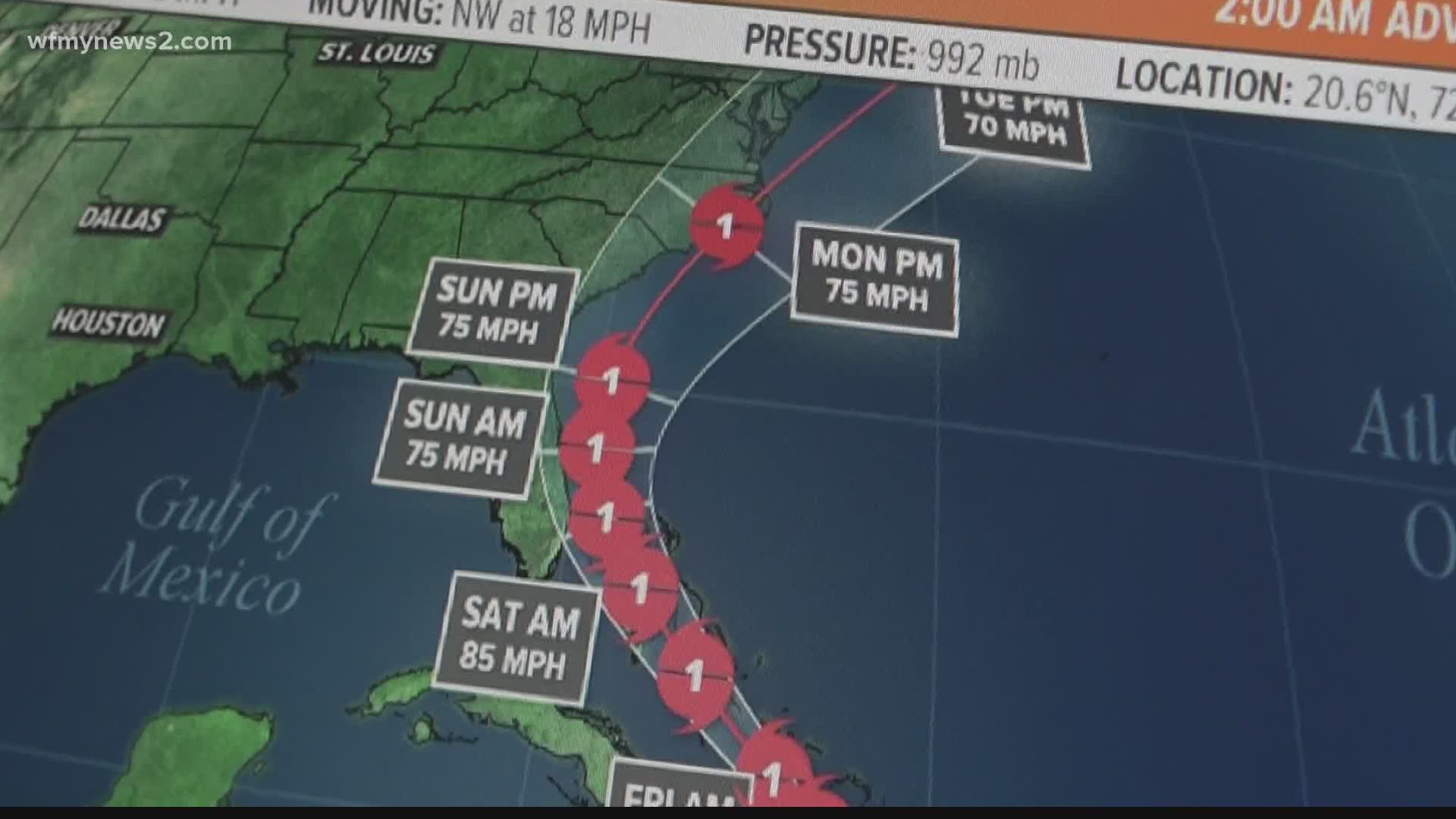
2:05 a.m. - Hurricane Isaias' wind speed is now at 75 mph and it's traveling NNE at 23 mph.
1:17 p.m. - Latest update on Isaias as it tracks north through Coastal NC.
1:14 a.m. - Ocean Isle Beach Mayor Debbie Smith reported a series of fires at beach homes after Hurricane Isaias made landfall.
12:05 a.m. - Fire reported on Ocean Isle Beach.
MONDAY, AUGUST 3, 2020
11:53 p.m. - More than 24,607 outages across Brunswick County.
11:28 p.m. - Hurricane Isaias makes landfall near Ocean Isle Beach, NC with 85 mph winds.
11:10 p.m. - A view of the moon peeking through the clouds in the eye of Isaias on Ocean Isle Beach, North Carolina.
11:05 p.m. - Isaias nearing a landfall soon close to Holden Beach with 85 mph winds.
11 p.m. - The 11 p.m. stats are in for Hurricane Isaias.
10:54 p.m. - Live from Wrightsville Beach as Hurricane Isaias moves closer to North Carolina. Rain and heavy wind continue to impact the NC coast.
10:51 p.m. Winds are gusting at 66 mph in Oak Island as they get in the eye-wall of Isaias.
10:25 p.m. Update: Chief Meteorologist Tim Buckley with an update as Hurricane Isaias makes its way towards the Carolinas.
10:17 p.m. Winds continue to intensify at Wrightsville Beach.
10:11 p.m. - Some radar estimated winds near the eyewall over 100 mph.
10:09 p.m. - Confirmed tornado near Cape Fear River just south of Wilmington.
9:50 p.m. - 93 mph wind gust recorded at Frying Pan Tower which is 40 miles off the coast of Southport.
They have a weather station mounted about 100 feet above the ocean which may account for the higher reading.
9:32 p.m. - Apparent tornado damage on Bald Head Island.
Just one of multiple possible tornadoes in the Cape Fear region tonight ahead of Isaias.
9:15 p.m. - Wilmington recorded a 51 mph gust recently with the bands of the storm.
9:05 p.m. - With winds at 85 mph, Hurricane Isaias is now heading for landfall in Brunswick County, NC in a few hours.
8:59 p.m. - Hurricane Isaias wind speeds now at 85 mph.
8:52 p.m. - Debris detection radar shows what could possibly be some debris lofted in the air from a possible tornado in Wilmington.
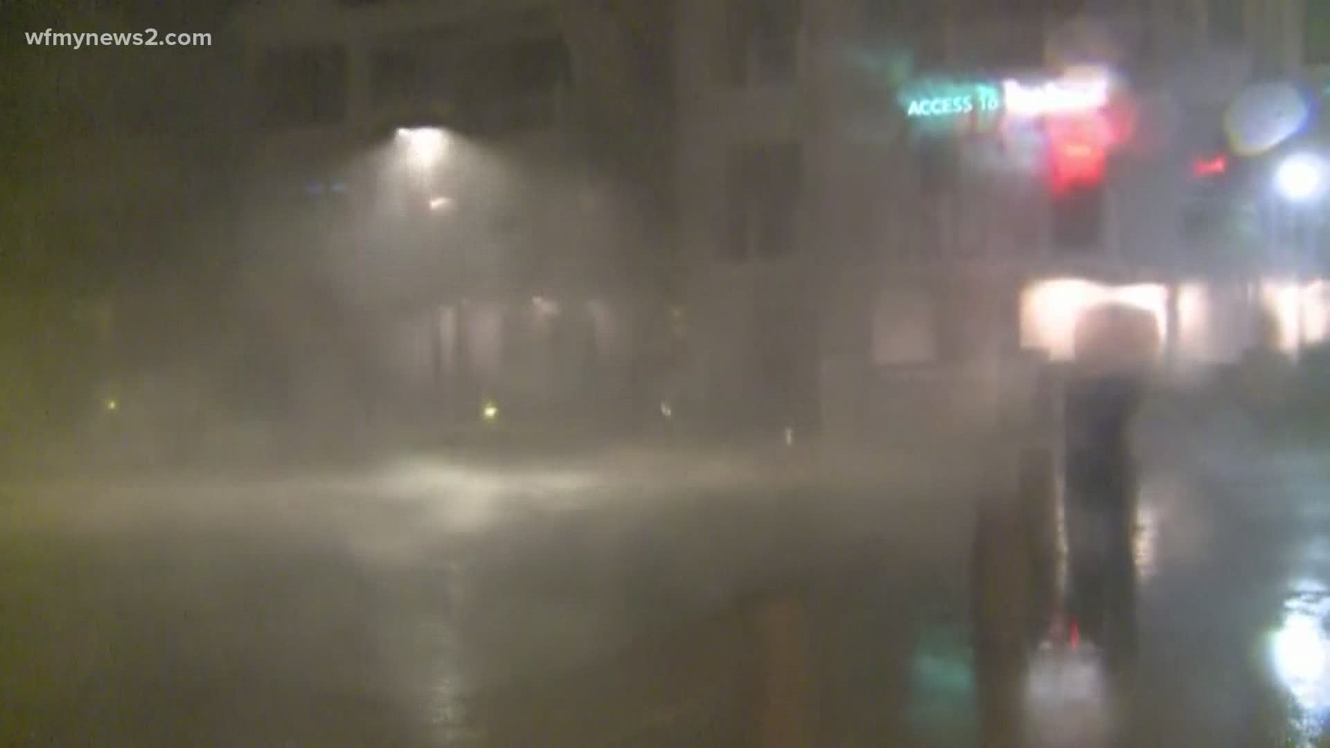
8:49 p.m. Check out this video from Wrightsville Beach captured by WFMY's Alma McCarty. It shows rain and wind picking up at the coast!
8:31 p.m. - Chief Meteorologist Tim Buckley with a live update as Isaias is upgraded to a category 1 hurricane.
8:20 p.m. - Multiple tornado warnings in Southeast NC right now. At least 3 areas of tight rotation.
This is a classic outer rain band that spins up these quick tornadoes. Last year we saw storms like these do big damage in Emerald Isle. Very dangerous.
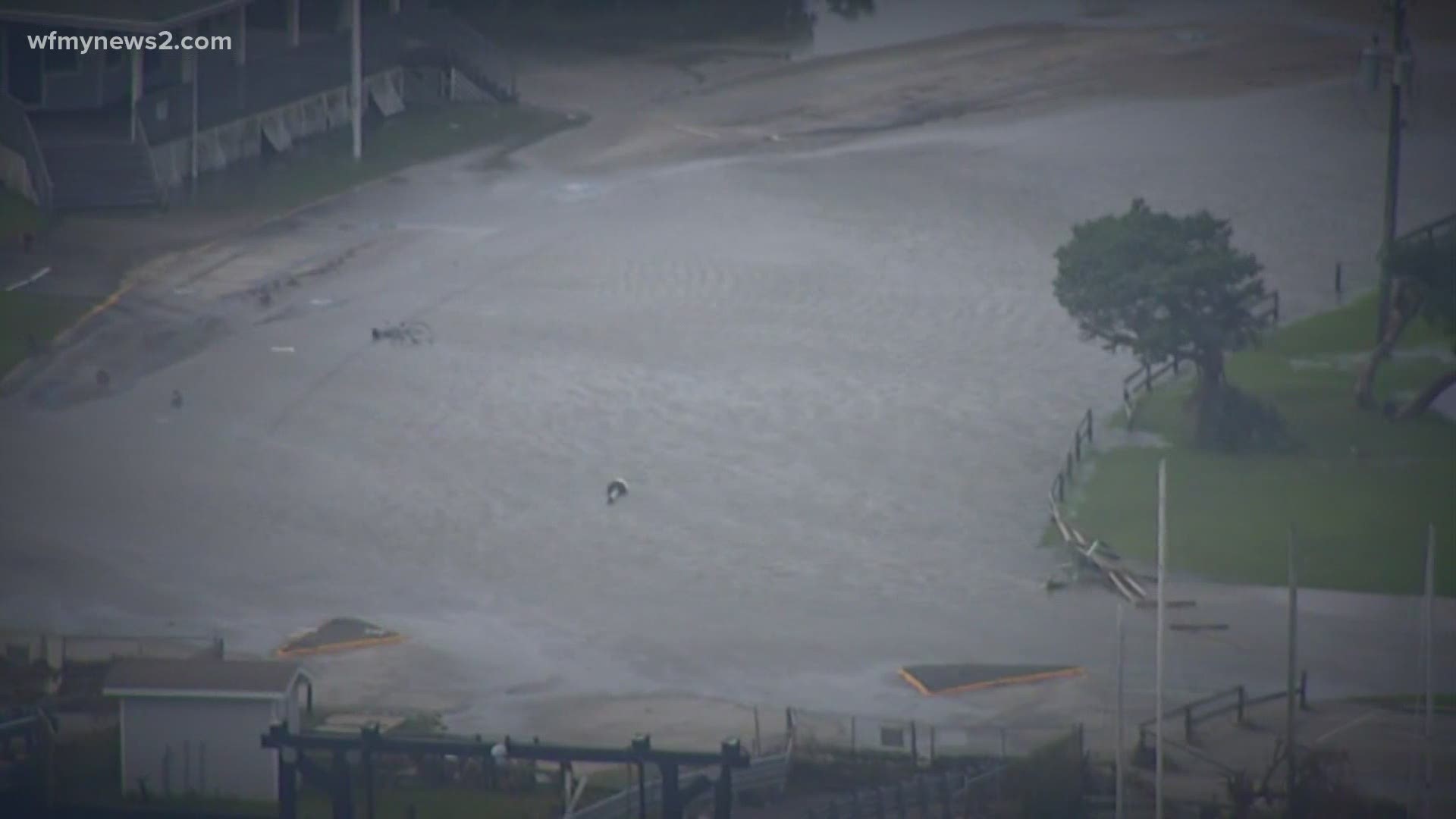
8:03 p.m. - High tide for Wrightsville Beach is at 8:10 p.m. The surf is coming up all the way to the lifeguard tower.
8 p.m. - Wind picking up in Wrightsville Beach as Isaias is upgraded to a category 1 hurricane.
7:52 p.m. - Isaias is now a hurricane again with winds of 75 mph.
7:51 p.m. - Isaias is about 60 miles off Charleston, SC.
New stats include: 75 mph traveling NNE at 16 mph.
7:17 p.m. - WFMY News 2's Alma McCarty shares the views from her hotel balcony at Wrightsville beach as Isaias continues to move en route towards the NC coast.
6:30 p.m. - It will be a close call to see which side of the border Isaias will hit later tonight when it comes ashore.
6:14 p.m. - The Lewisville Fire Department along with the King Fire Department is forming a six person swift water recuse team ahead of Isaias.
3:56 p.m. - Brunswick County has declared a State of Emergency in lieu of Isaias. The State of Emergency went into effect Monday at 3:30 p.m.
3 p.m. - Gov. Cooper gives an update on Isaias preparations.
1:45 p.m. - WFMY News 2 General Manager Larry Audas gives an update on conditions at Sunset Beach, North Carolina, just north of the South Carolina border.
12:15 p.m. - An outer rainband of Isaias is causing some wind gusts in the Triad.
11 a.m. - The outermost rain bands from Isaias are pushing into the Piedmont Triad.
7 a.m. Isaias is still a tropical storm and is 100 miles off the coast of Jacksonville, Florida. It is expected to hit the Myrtle Beach and Wilmington area around midnight into Tuesday morning, according to the latest models.
SUNDAY, AUGUST 2, 2020
8 p.m. WFMY’s Christian Morgan gives the latest updates on Tropical Storm Isaias via Facebook Live
7:45 p.m. WFMY's Brian Hall shares this video of rainfall in Greensboro amid sunny skies
7:30 p.m. Alma McCarty gives update on weather in Wilmington
7:15 p.m. WFMY’s Alma McCarty gives the latest updates on Tropical Storm Isaias via Facebook Live
5:09 p.m. There is still time for the storm system to become more organized as it continues to move from Florida, which means substantial wind and rain for much of North Carolina.
4:11 p.m. A line of thunderstorms are moving Northeast from the foothills. Christian Morgan reports heavy rain with some lightning and gusty possible.
4:10 p.m. WFMY's Alma McCarty said lifeguards are flying the red flag, noting hazardous conditions, with strong surf currents, a possibility.
4:03 p.m. WFMY's Alma McCarty gives a look at Wrightsville Beach a day before Isaias.
3 p.m. Governor Cooper gives update on preparations ahead of Isaias.
2:34 p.m. Alma McCarty along with Jeff Skordas on the road headed to Wilmington and Wrightsville Beach.
11:24 a.m. Alma McCarty along with Jeff Skordas pack up as they prepare to head to the NC coast for Isaias coverage.

