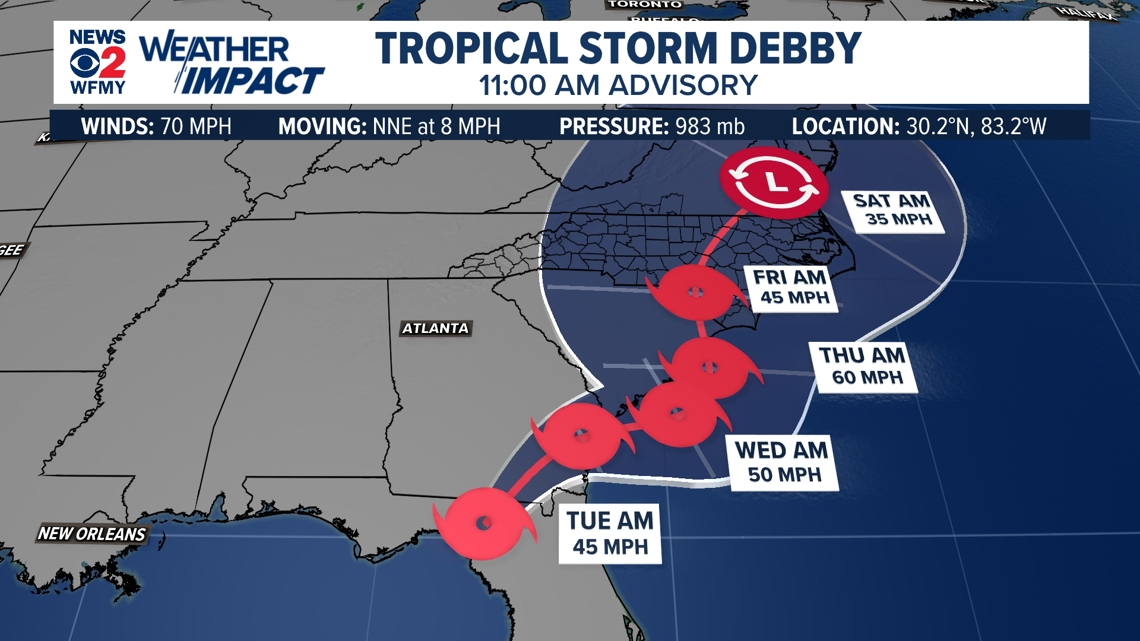
GREENSBORO, N.C. — Debby has been downgraded to a tropical storm as the system has moved inland today near the Big Bend of Florida. Debby will impact parts of the Southeast this week. Here in the Carolinas, we need to pay attention and monitor the forecast for changes. The WFMY News 2 Weather Team is tracking it as it slowly gets closer.
Hurricane Debby Forms
Sunday evening Tropical Storm Debby strengthened into a Hurricane in the Gulf of Mexico and made landfall along the Panhandle of Florida. The storm will move northeastward but will slow down as it does. The storm is likely to slow down stall near Charleston, SC by Tuesday, Wednesday, and Thursday. It is still unclear exactly where it will stall.


Bottom Line:
- It is likely to impact parts of the Southeast US early and middle of next week, Georgia and South Carolina looking likely to get the worst
- Flooding could be a major issue for some
- It is becoming more likely that the coasts from Florida to the Carolinas will have some impacts
- Rain and wind are possible for us here in the Piedmont, we will continue to monitor
- Keep checking up on the forecast as we learn more
"More uncertainty than usual"
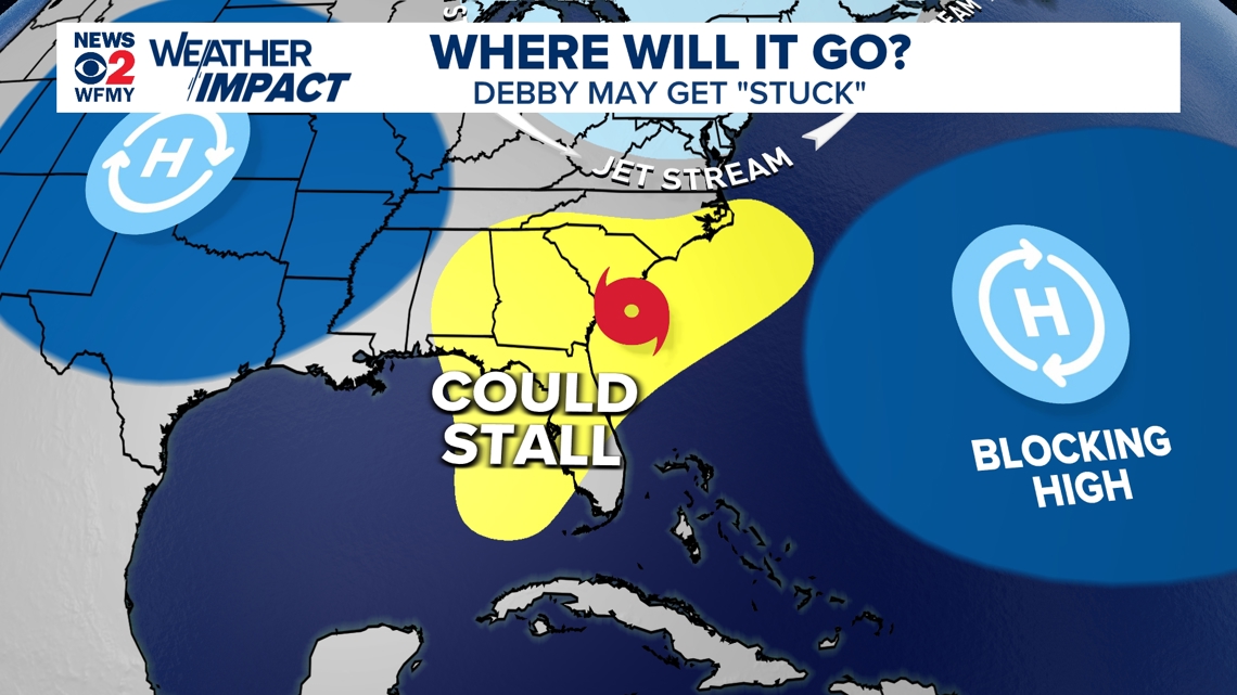
Typically with tropical systems there are a few clear factors that are "steering" the storm to its destination. This can be a front, or a high pressure or low pressure area that guide it along. In this case, Debby is likely to get stuck between a few weather features.
In the map below you'll see the forecasting challenge. After moving through Florida, Debby is likely to miss the jet stream north of us, leaving it stuck between two areas of high pressure; one to the west and one to the east. This means it will have very little momentum, and slow down dramatically.
It's possible it could meander slowly for several days between Georgia and the Carolinas, but it's difficult to say where until we learn more.


Heavy Rainfall is Likely for Some
Slow moving tropical systems are especially dangerous for inland flooding that they can bring. The biggest problem with Debby is likely to be flooding rainfall for the inland areas, even if we don't know exactly where yet.
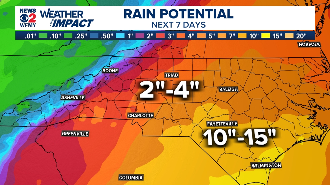
In the past, slow moving tropical storms or hurricanes have dumped over 10 inches of rain in the Carolinas on multiple occasions in recent years. This could be another one of those times.
Here is a very early rainfall forecast from the National Weather Service, which is certain to change as we learn more about the path.


Here in the Piedmont of NC as of right now we could see some rain or even wind if Debby is able to wiggle further enough inland. For now, we will keep eyes. If you're heading to the Carolinas coasts next week pay extra close attention. The weather could be wet or worse, but still too early to cancel or anything like that.


