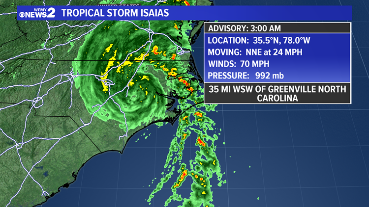
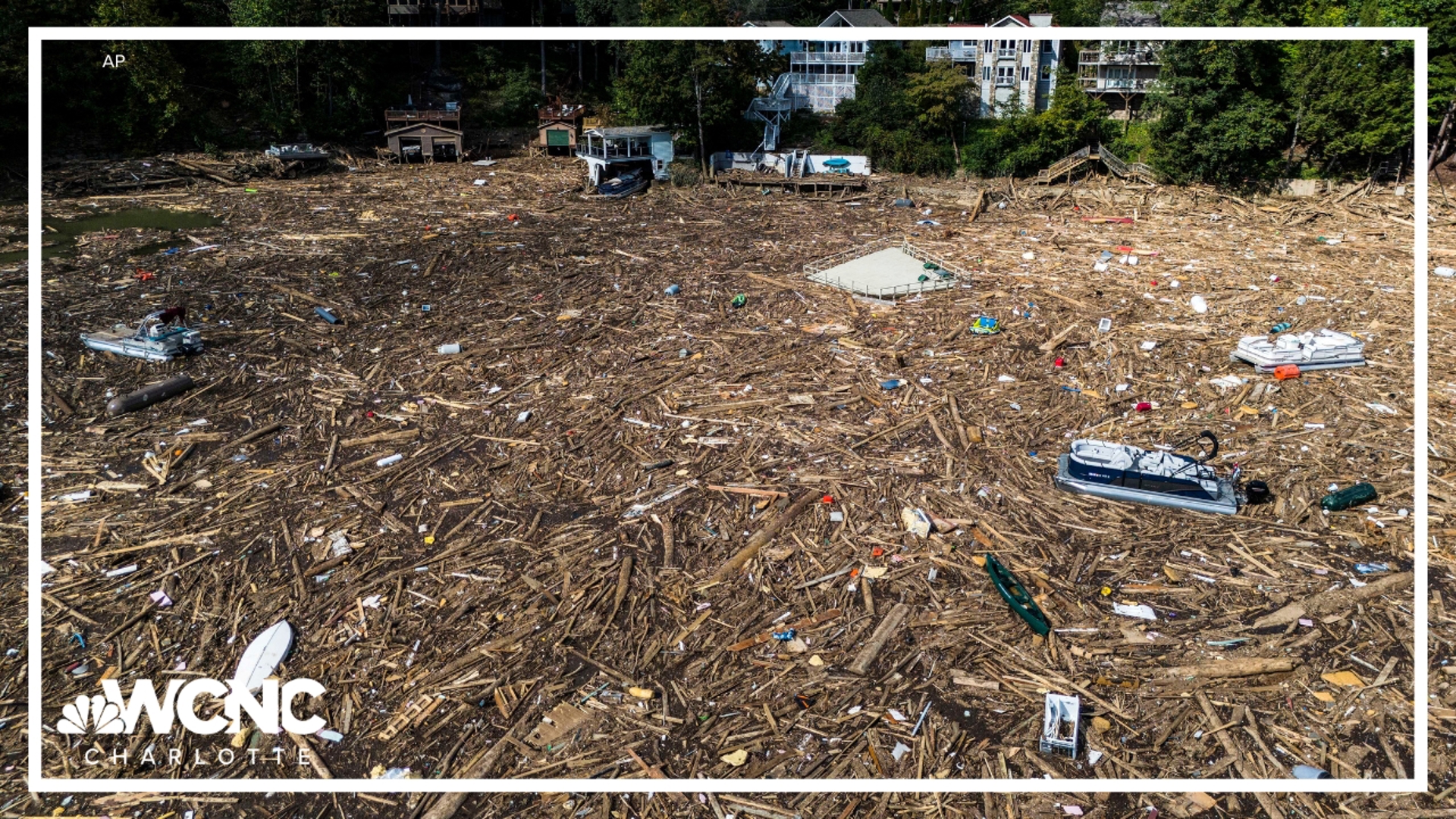
GREENSBORO, N.C. — Isaias is on the way and getting closer to North Carolina. It will hit the coast as either a strong tropical storm or a category 1 hurricane tonight. The worst conditions will be in Eastern North Carolina, but what about here in the Triad? The WFMY News 2 Weather Team is tracking it for you.
LIVE UPDATES
1:30 a.m. - Christian Morgan gives an update on Hurricane Isaias.
10:25 p.m. Update: Chief Meteorologist Tim Buckley with an update as Hurricane Isaias makes its way towards North Carolina.
9 p.m. Update: Chief Meteorologist Tim Buckley with an update as Isaias is upgraded to a category 1 hurricane.
At 11:10 PM Monday night, Isaias made landfall on Ocean Isle Beach, N.C. with 85 mph winds.
WHERE IS IT GOING NOW?
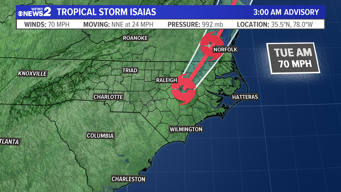
As Isaias continues to track into N.C. it will head inland with the center following a path along or just east of I-95 through Eastern North Carolina. This will spare the Triad the worst of the storm. It will continue to weaken as it tracks over land, moving out of N.C. by day break.

NORTH CAROLINA IMPACTS:
We're breaking down what different parts of North Carolina will see from the storm from the coast to the mountains. First, let's talk about wind speed.

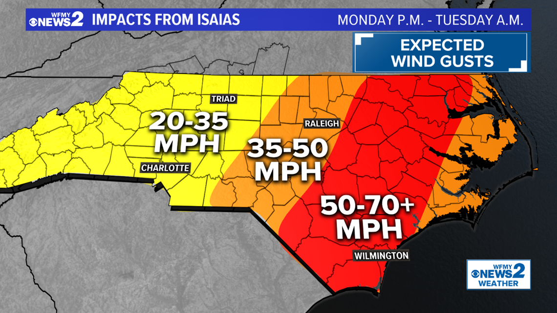
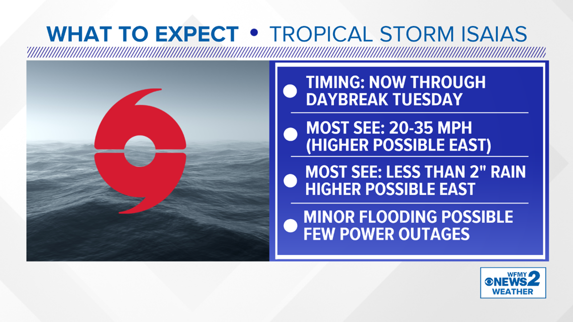
With the current track that looks likely for Isaias, the Piedmont is on the western edge of the storm. The effects will be much less on that side of the storm, but some gusty conditions will be possible with 20-35 mph wind gusts.
Stronger gusts near 50 mph will be possible to the east closer to Raleigh, while the strongest winds will be in Eastern and Coastal N.C. because that's where the center of the storm will likely track.

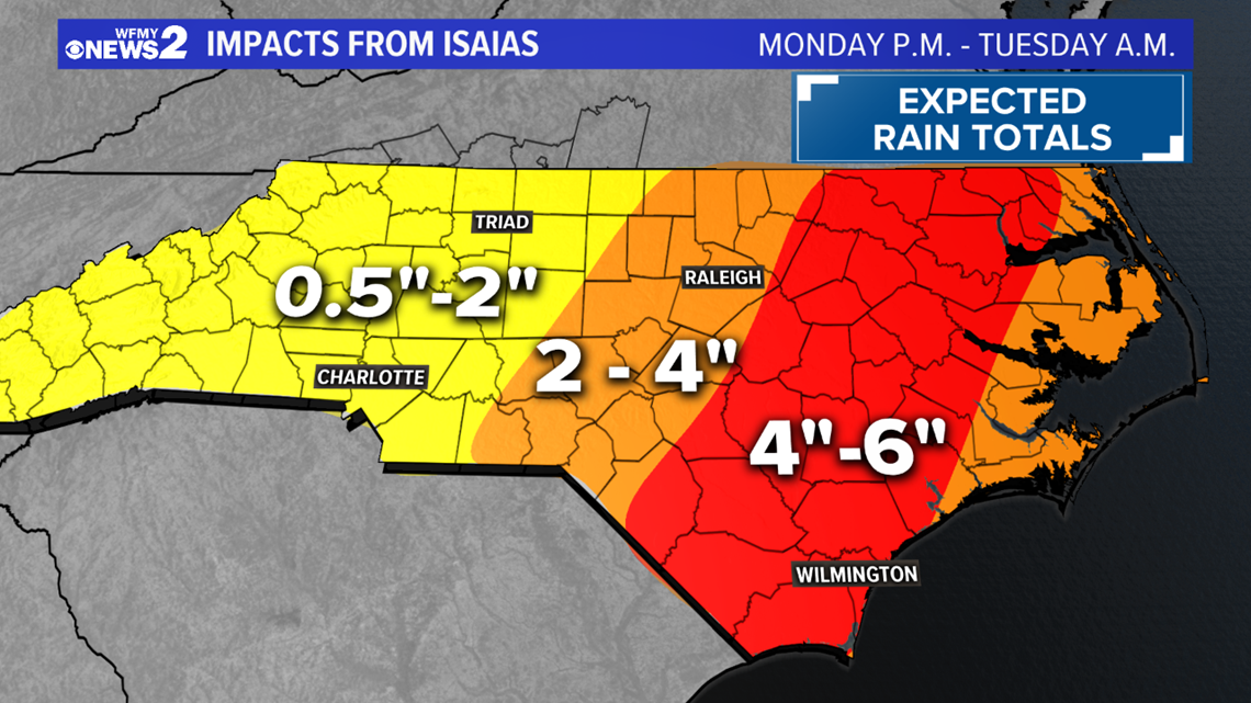
Tonight through Tuesday morning will be wet with 1/2"-2" of rain likely in the Piedmont. Higher totals will be east of the Triad and where the center of the storm tracks will see 4-6" of rain. On the coast, not only rain but storm surge and high surf will continue to cause flooding issues.

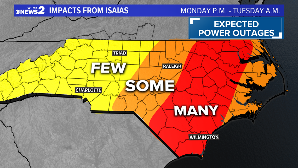
While impacts in the Triad will be limited, with enough rain and some gusty winds a few trees could fall causing a few power outages across the area. With more rain and stronger winds the more widespread power outages and concerns will be east of the Triad.
TRIAD IMPACTS BELOW:

WHAT TO DO:
Even though we are not expecting major impacts in the Triad, we recommend having phones and devices charged up, and having batteries for flashlights on hand.
It's a good idea to secure any loose patio furniture or items outside just in case a strong wind gust tries to blow them away.
We'll be keeping you updated on-air and online multiple times throughout each day and Isaias's approach to North Carolina.


