GREENSBORO, N.C. — Heavy rain from Sally has been hitting the Triad since this morning. So far, we haven't seen too many flooding issues with South Carolina bearing the brunt of the problems. Still, keep an eye out for additional rain through tonight that could cause some flooding. Improving weather on Friday.
HOW MUCH RAIN?
As of Thursday afternoon, a widespread area of 1-2 inches had already fallen across the Piedmont. This first batch of rain was largely light and moderate, with the heaviest rain staying to our south.
Rain will continue through the late evening hours, adding up to an additional 1-2 inches for most of us.
Storm totals should be in the 2-4 inch rain, which is pretty good considering we were concerned about possible higher totals yesterday.


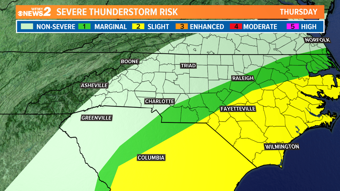
SEVERE WEATHER THREAT
There were several reports of tornadoes earlier today in South Carolina. Now, that threat heads to Southeast and Eastern North Carolina.
Here in the Triad, the threat of any severe thunderstorms or tornadoes is very low.


TIMELINE:
The timing and track of Sally is still a little bit uncertain based on it's slow speed and when it's likely to pick up speed after landfall. Here's the most likely scenario right now:
Thursday Afternoon-Thursday Night: Rain on/off heavy at times. Low tornado risk for southern Piedmont.
Thursday Overnight - Friday Morning: Rain tapering off by Friday morning.
Friday Midday: Rain comes to an end, clouds slowly clearing. Chilly air moves in for the weekend.
By the weekend, Sally is gone, and we'll be in store for some real fall-like air to move back in. Dry weather will be much needed to help us dry out after a big soaking.
As always, the WFMY News 2 Weather team will be tracking Sally and it's potential rainfall for the Triad around the clock on-air and online. Make sure to follow our team of meteorologists as they keep you updated.

