GREENSBORO, N.C. — Our first significant winter storm of the season has come and gone, but we're left with plenty of ice to melt and clean up to do. Some people are still in the dark and waiting for power to be restored.
Cold air locked in place on Saturday, setting the stage for any arriving moisture to fall frozen.
As our system tracked north across the state on Sunday, it started as a burst of heavy snow for a few hours before switching to sleet by midday and lasting for most of the day. Snow fell heavy and added up fast, but once sleet started to fall it packed the snow down some, adding an icy crust to the fresh powder. Our system started to pull away from us shortly after dinner time on Sunday and even brought an additional burst of snow to the Triad as it moved away.
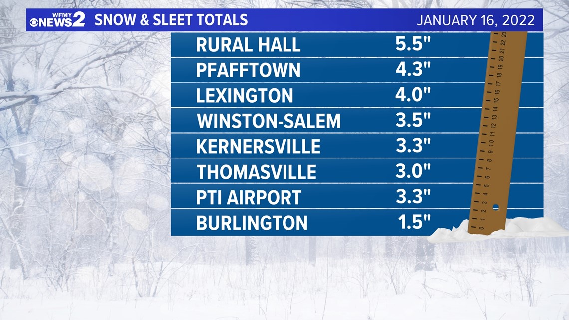
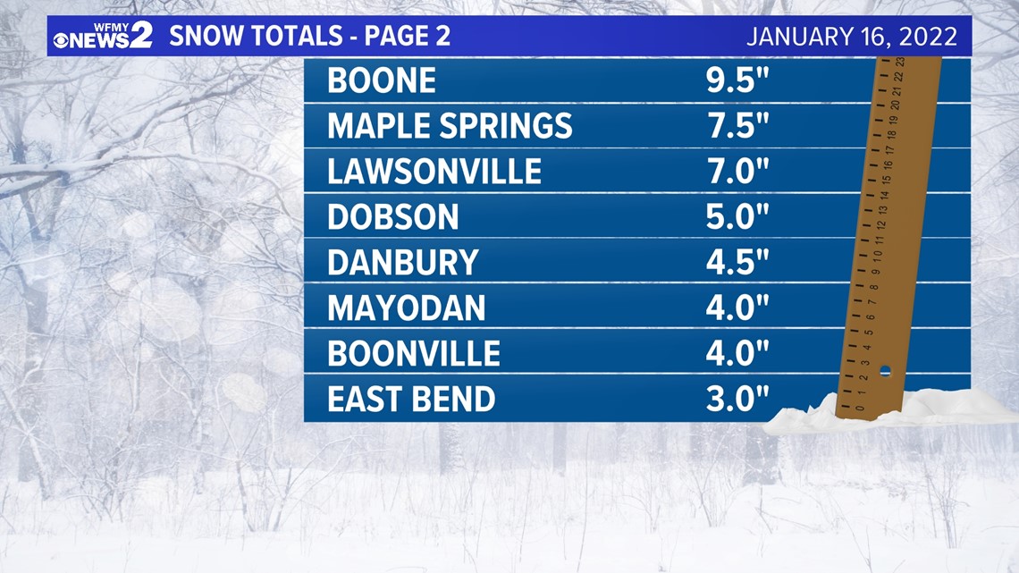
Here are some select snow and sleet totals from around our area:


RELATED: Dry, windy & cold today
Most of the Triad area fell in the 1-3" range, but there were some exceptions to the rule with Lexington picking up 4".
Generally, there were higher amounts to the north and west and lower amounts to the south and east. Areas to the north and west stayed snow longer and dealt with less sleet. The NC Foothills and mountains got a big batch of snow with over 9" reported in Boone.


Even though the snow was packed down with sleet, several hours of heavy sleet and an additional burst of snow in the evening brought the snow/sleet total for Greensboro at PTI Airport up to 3.3" making it the first day since December 9th, 2018 with more than 2" of snow in the Triad.


