GREENSBORO, N.C. —
Our Next Wet System Arrives
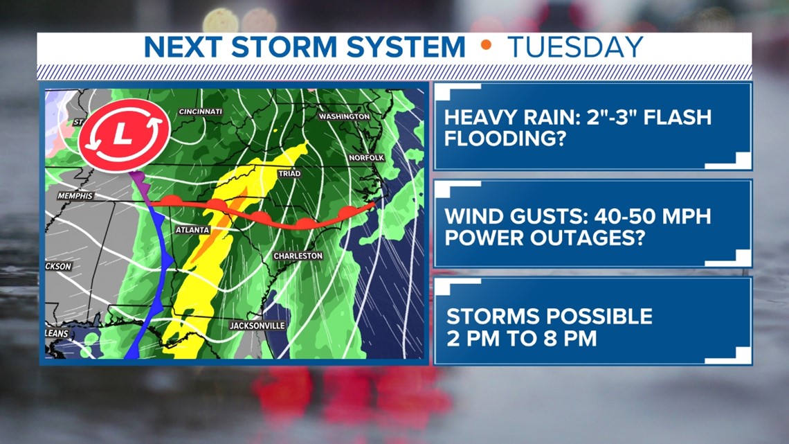
Tuesday is looking like a rather active weather day for the Piedmont. This wet, and stormy weather pattern is typical of the El Nino pattern bringing us very wet weather. Strong low pressure will track out of the Southern Plains and move through the Tennessee and Ohio Valley. Impacts on our area will begin early Tuesday morning and should end by Tuesday night. Here is what we can expect in our area.

HEAVY RAIN
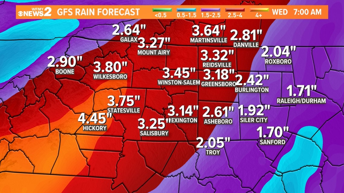
Forecast models indicate this will be a moisture rich system. With the low tracking to our west, the Gulf of Mexico and Atlantic will be wide open to pull deep moisture into our area. The moisture will lift over a warm front moving in from the south, then a cold front moving over our area from the west. The result will be heavy rain that could be lead to possible flash flooding. This will be aggravated by recent wet, El Nino systems that have crossed the Piedmont. Be aware that flash flood warnings could be issued during Tuesday. 2" to 3 " of rain are possible. Here's one model's prediction:

GUSTY WINDS
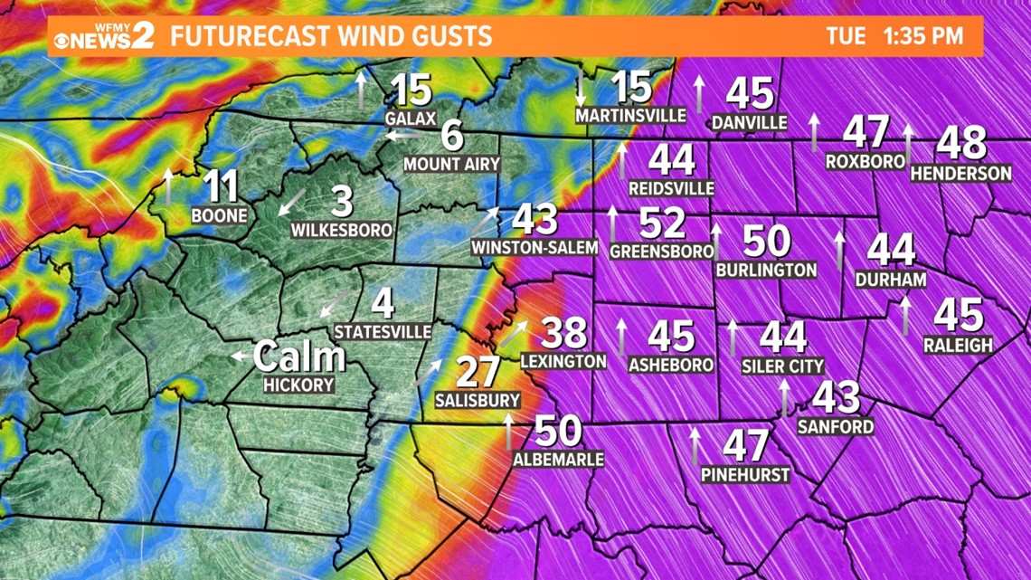
The low pressure will get stronger as it tracks to our west. It will have a large and strong wind field. By Tuesday afternoon and evening, wind gusts of 45+ mph are possible. This combined with a saturated ground could cause downed trees and powerlines. Scattered power outages are possible.

SEVERE THREAT
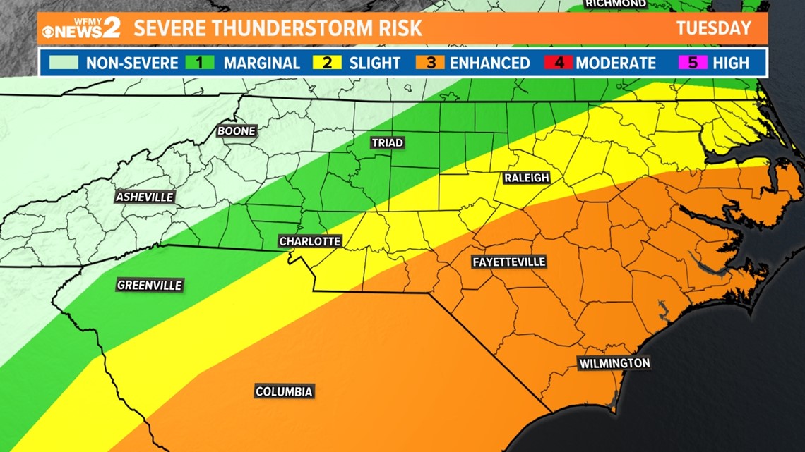
The large low pressure will draw warm, tropical air into our region. This will be especially true in Eastern North and South Carolina. Down east, high temperatures could warm into the 70s. This warm air, combined with strong winds aloft, will bring a chance of severe storms. Eastern sections, including the Sandhills and Coastal Plain will be under a "Slight Risk" (Level 2) for severe storms. Part of southeastern NC in in the "Enhanced Risk" (Level 3) for severe storms. Damaging winds, flash flooding, and a tornado threat will be possible.

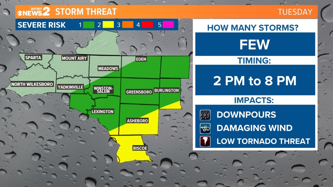
Part of the Triad will be in a "Marginal Risk" (Level 1) threat for severe storms.. there is a "Slight Risk" (Level 2) for areas south of the Triad. This will be mainly for Tuesday afternoon and evening. Heavy downpours could lead to flash flooding. Isolated severe storms could produce damaging winds. There will be a low-end risk for an isolated tornado.

Stay tuned to WFMY NEWS 2 and your WFMY Forecast Team for updates. We will fine-tune the forecast as we get closer to this weather event Tuesday through Tuesday evening.
WAYS TO GET WFMY NEWS 2
Subscribe to our daily newsletter Let’s Get 2 It!
Download the WFMY News 2 APP from your Apple or Google Play store.
ADD THE WFMY+ APP TO YOUR STREAMING DEVICE
ROKU: Add the channel from the ROKU store or by searching for WFMY.
Amazon Fire TV: Search for WFMY to find the free app to add to your account. You can also add the app directly to your Fire TV through your Amazon account.
TEXT US!
Text the word WEATHER to 336-379-5775 to get the daily forecast.
Text the word APP to get a link to download the free WFMY News 2 app to your phone.
Text the word TRAFFIC to get the latest road conditions in your area.


