GREENSBORO, N.C. — Ice is set to hit the Triad again, moving in overnight Wednesday and bringing a heavy glaze of ice to trees and power lines Thursday morning and midday.
Winter Storm Warnings are in place across the entire Triad area. It's time to prepare for tree damage and power outages that could last for several days.
Here's the forecast from our WFMY Weather Team.
THE SETUP:
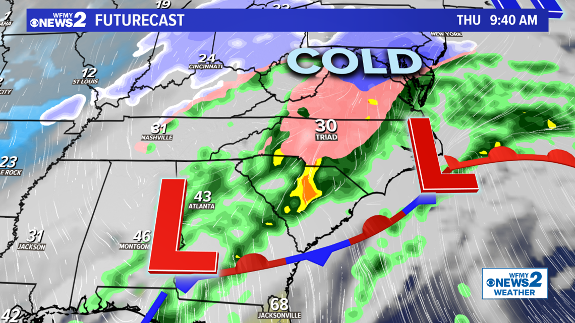
High pressure has locked cold air into the area and our weather system bringing the moisture is on the way tonight, tracking NE from the Gulf of Mexico.
As the area of low pressure moves into the Piedmont tonight it will be moving into our cold air that's already here and produce a period of freezing rain for several hours as temperatures stay below freezing, before hopefully warming up enough to change us back to regular rain in the afternoon. It could start after midnight with some sleet before changing to freezing rain for several hours.
The system looks to pull away from us heading into Friday with high-pressure building in and sunshine returning for Saturday and Sunday, which is much needed and will allow for melting and drying out.


TIMING:
- Wednesday Afternoon - Thursday 1 AM: Mainly dry, clouds thicken up, temperatures drop to near freezing.
- Thursday 1 AM - 1 PM: Temps below freezing. Precipitation arrives, could start as sleet then changes to freezing rain. Ice accumulations likely of 1/4" to 1/2". Trees begin to fall by midday. Power issues begin.
- Thursday Afternoon - Night: Precipitation tapers off some, could change to regular rain temperatures warm enough.
- Friday Morning-Midday: Rain comes to an end. Slick bridges possible. Trees could still Fall. Storm moves away, slow clearing temperatures in the 40s.
HOW MUCH:
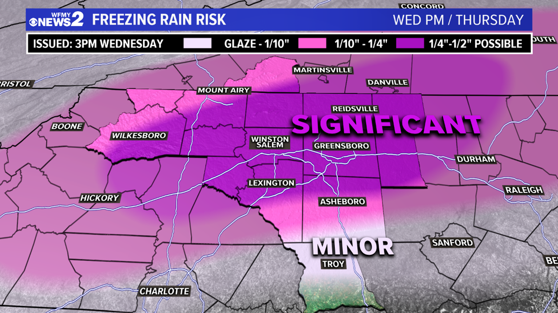
This is starting to trend toward being another concerning ice storm for the Triad, with significant ice totals possible.


- 1/4"-1/2" of ice is possible for much of the Triad area, for points along and north of I-40. This would be enough to bring down trees and cause damage and power issues. (Locally higher amounts possible.)
- South of I-40 generally 1/10" to 1/4" is possible which could still make for slick spots or bring down a few trees and make for some scattered power outages.
- South of Asheboro, generally just a glaze is possible which likely won't cause too many issues but could make for a few slick spots on bridges and a light coating on trees.
Temperatures will be below freezing overnight Thursday into the morning staying around 29/30/31°. How long we stay below freezing will make the difference on how long we can accumulate ice on trees. We'll likely be slow to warm above freezing but we should get above 32° by the afternoon and change over to regular rain.
WHAT TO DO:
It's a good idea, while the weather is quiet today to go ahead and make preparations in case you were to lose power. If so, it could be out for a couple of days before it's restored.
Have extra batteries on hand and keep electronic devices charged up heading into Wednesday night. Have a way to receive weather information if your power goes out.
Keeping minimal groceries in the refrigerator or freezer is best so that if the power goes out, you don't lose a lot of food.
By Friday, we're clearing out and bringing the sunshine back which will be good news and give us a chance to melt the ice and dry things out some.
It's best to pay attention to the forecast and watch for updates. The WFMY Weather Team will be tracking it and keeping you updated on-air and online over the next few days.
STAY CONNECTED:
Text APP to 336-379-5775 to download the free WFMY News 2 app and keep track of severe weather right from your phone.
Subscribe to our YouTube channel, where we'll bring you live updates during the ice storm.
Follow the WFMY News 2 Weather team on Twitter:
- Chief Meteorologist Tim Buckley: @TimBuckleyWX
- Meteorologist Terran Kirksey: @tkweather
- Meteorologist Ed Matthews: @EdMatthews2
- Meteorologist Christian Morgan: @CMorganWX
- Meteorologist Eric Chilton: @EricChilton
- WFMY News 2 Weather: @wfmyweather


