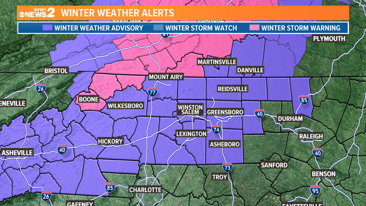
GREENSBORO, N.C. — We're getting hit with our first winter weather of the season. A wintry mix of freezing rain, rain, and some sleet is hitting the Triad, and it will take until the afternoon for us to switch completely over to all rain. A Winter Weather Advisory is in effect for icy accumulations and possibly slick bridges and overpasses.

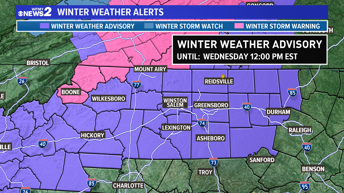
The WFMY News 2 Weather Team is tracking this developing situation.
The setup for our Wednesday system is pretty classic for a North Carolina ice event. We have cold, dry high-pressure that has set up shop across the region on Tuesday, essentially "locking in" some cold air on our side of the mountains.
We're getting moisture from the south, but with warm air moving in above the ground, it's melting any snowflakes meaning that we're stuck with freezing rain for the majority of the event. We could have a burst of sleet from time to time midday, but this is mainly an ice event and a rain event for us.
TIMELINE:
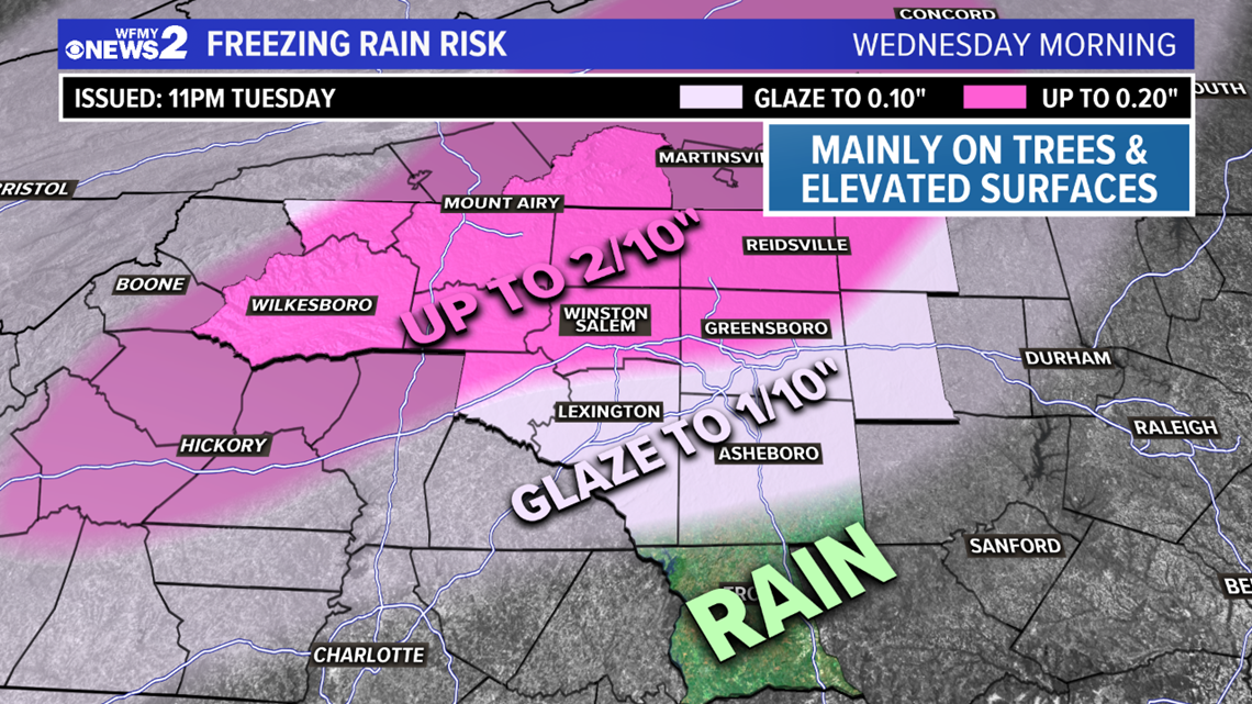
- Wednesday AM (Through Noon): Light to moderate freezing rain. Light glaze of ice likely. Some areas north and west of I-85 could see more up to 2/10"
- Wednesday Midday: Temps warm slightly. Freezing rain comes to an end but regular rain continues. A burst of sleet is possible midday that could quickly accumulate. Roads could be slick.
- Wednesday Afternoon: Rain tapers off.
- Wednesday overnight: Dry and cold. Patchy black ice possible.

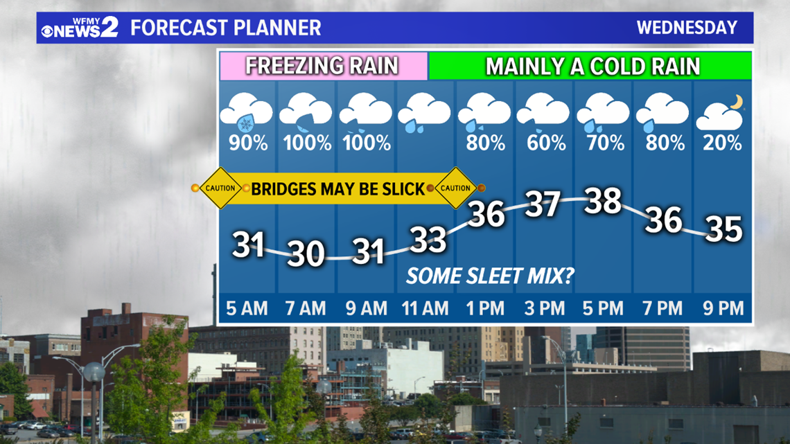
Right now it looks as if the best timing for seeing freezing rain will be from Wednesday morning until about midday. This happens as our temperatures hover between 29 degrees and 31 degrees. By lunchtime, we should be warming ever so slowly to at or above 32 degrees, with mainly regular rain for the afternoon. A burst of sleet is possible during the midday hours which could lead to slick travel.
HOW MUCH, AND WHAT IMPACT:
- North and west of I-40, including the Foothills and parts of the Northern Piedmont including northern Forsyth and Guilford County, could see a glaze of ice up to 2/10th of an inch thick.
- South and east of I-40, a light glaze of ice is possible mainly on trees and elevated surfaces up to 1/10th of an inch thick.
- South of Asheboro, just plain rain is expected without any ice accumulation

- There could be some scattered power outages, especially in areas that see the most ice
- Downed trees, or at least weighed down trees, may be possible in areas that see the most ice.
- Slick spots on bridges are possible. Most roads will remain wet though.
Bottom line, it's a good idea to be ready for a power outage just in case on Wednesday. If you're traveling, be extra careful on bridges and overpasses in case they're slick. The News 2 weather team will be on top of it for you on air and online.


