We ended the weekend on a dry note, and it looks like the dry weather will continue well into the work week.
An upper-level low pressure system that brought clouds and showers to the Piedmont on Saturday will slowly track northeastward away from our area. This means more sunshine and warmer temperatures are on the way.
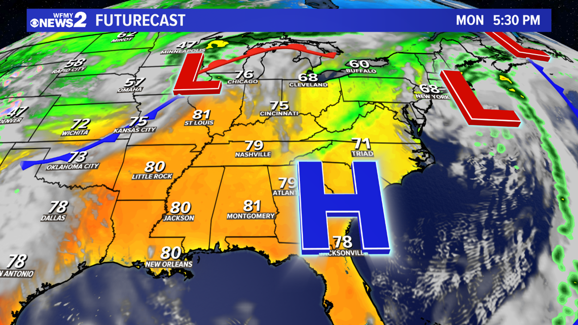
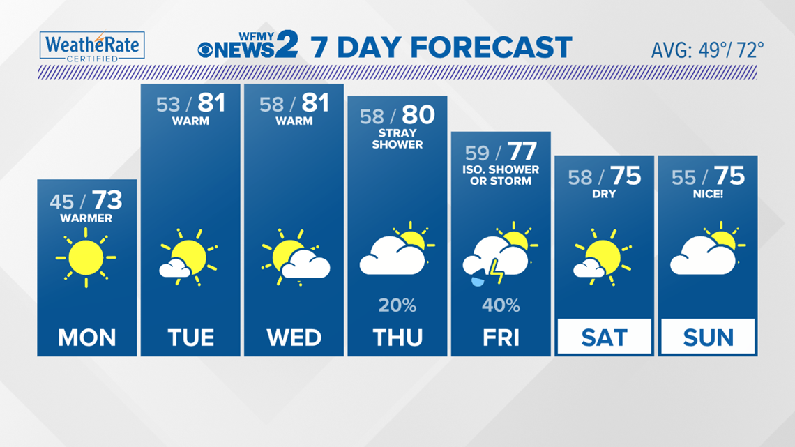
As high pressure at the surface and in the upper atmosphere builds over the East Coast, temperatures will warm quickly and we will see highs in the mid 70s Monday.


By Tuesday and Wednesday, highs will warm into the upper 70s to low 80s. A cold front will approach Thursday and move into the Piedmont Friday. A few spotty showers can't be ruled out late Thursday afternoon or night. By Friday, as the front moves into the area we'll see a few more pop up showers, or even a storm or two. Right now, the coverage of rain is expected to be fairly isolated Friday afternoon. Organized severe weather isn't expected. We'll continue to adjust Friday's forecast as we go through the week, and we'll keep you updated on any changes both on air and online.


