GREENSBORO, N.C. — Wild weather on the way over the next 24 hours. The WFMY Weather Team is tracking a system that will wipe away our warmth. It may even give us a burst of sleet and wet snow early Monday morning.
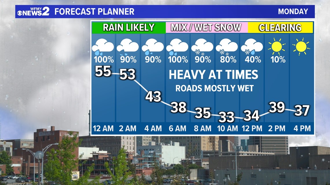
A cold front is slowly moving through the area today, but it won't make much progress. We will stay warm in the 60s with occasional daytime rain. A new low pressure system will develop across the Southeast and ride along that cold front as it heads our way Sunday evening and overnight into Monday. This low will strengthen the system and give it more moisture. This will help for a large area of heavy rain that will last much of the overnight. At the same time, temperatures will drop dramatically as cold air rushes our way from the north. Temperatures will go from 50s at midnight to 30s by sunrise. It will rain through 5am or so, but it's possible that we'll switch over to some sleet pellets between 5am to 7am or so. Following this, it's possible that we will see a switchover to big wet snowflakes even though we're above freezing. This burst of snow could last a few hours into the morning, before tapering off midday, but we will clear out by Monday afternoon. Since temperatures are forecast to drop into the 20s Monday night, we could see some black ice problems if any roads are wet.
WILL IT STICK?
- Big snowflakes are usually good at sticking, but our ground temperatures are expected to still remain at record-warm temperatures.
- If it snows hard enough we are likely to see some snow sticking to grassy surfaces / the roof of your car / etc.
- Snow is not likely to stick on roads that will be wet and relatively warm.
- In a worst case, it's possible some bridges could accumulate a little slush.


HOW MUCH?
- Even if it snows several hours, I wouldn't expect much.
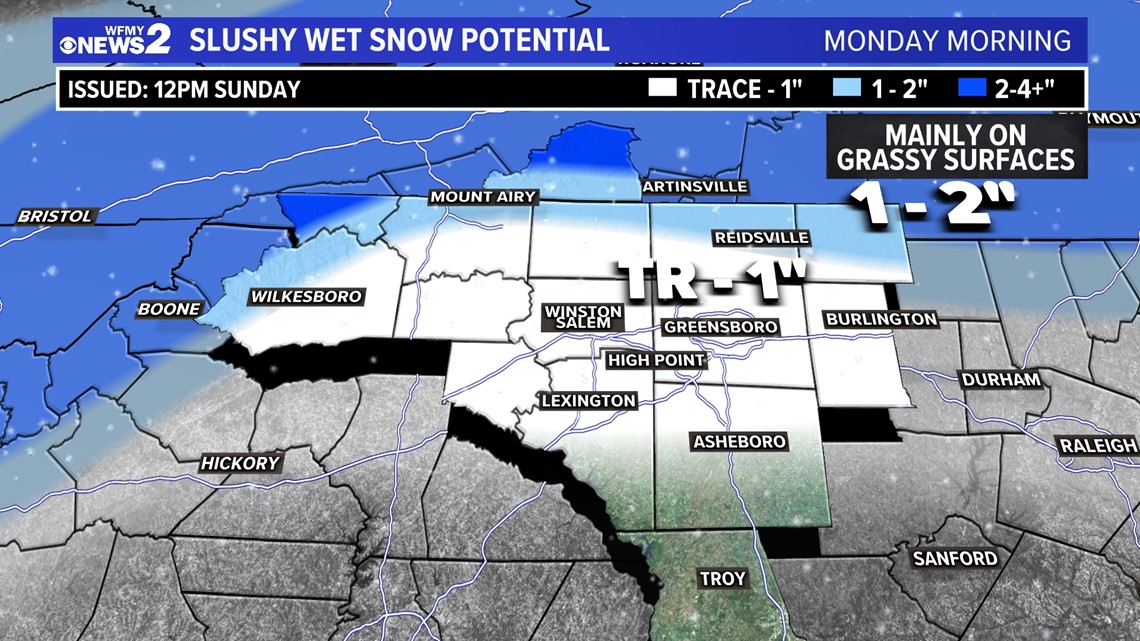
- A trace (just flakes) to possibly a slushy half inch to one inch is possible on grassy areas in the Triad Monday morning.
- Farther north around the VA border more than 1" could be possible.
- A true snow storm event is possible much farther north in Central VA and up in the NC mountains.


IMPACTS
- Travel should be mostly just wet, so take it easy.
- Black ice could be possible Monday night as temperatures drop below freezing.
Could be fun to watch some snow fall even if it's not a 100% guarantee!


