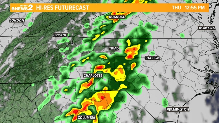
GREENSBORO, N.C. — Significant weather is on the way for this afternoon. Winds will be high throughout the day, and we'll have a severe storm risk at times along with rounds of rain. It can be a bit confusing so let's break it down.
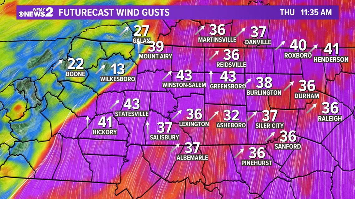
1. Gusty winds all day. This is a windy system. Wind gusts of 35 to 45 mph are already happening and will continue to happen through the afternoon hours. Winds will be higher in any thunderstorms that form. Winds will subside after sunset late in the evening.
2. Rain and thunderstorms. There is a line of rain and storms moving through Piedmont. That line will bring heavy rain and times and higher winds. The rain and storm threat will wind down by 4 pm. Dry for the evening.
3. Severe thunderstorms and tornadoes. When the line of rain and storms is here, some scattered severe thunderstorms are possible. Damaging wind gusts could happen. It's also possible there could be a tornado or two across our area. We will have coverage of any warnings for you on WFMY on-air, on your phone, and online.
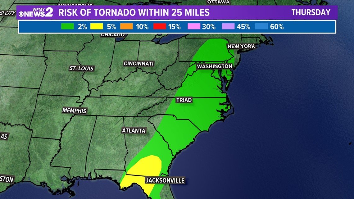
1. Tornado
Central Piedmont is on the low end of the tornado threat for Thursday. The weather parameters are not the ideal case for thunderstorms that produce tornadoes; however, this doesn't mean that we can rule out the possibility entirely. We must always be weather-ready in the event that a strong storm does produce a twister!

2. Wind
Unlike the tornado threat, we are in the pocket for potentially seeing some strong, damaging winds Thursday. It is important to note that the strong winds are possible throughout the entirety of the period well before the storms arrive and will linger thereafter into Friday. Winds will peak in the early afternoon. With any severe storm, there is a strong likelihood, we could get wind gusts that exceed 57 mph in association with the passing storm.

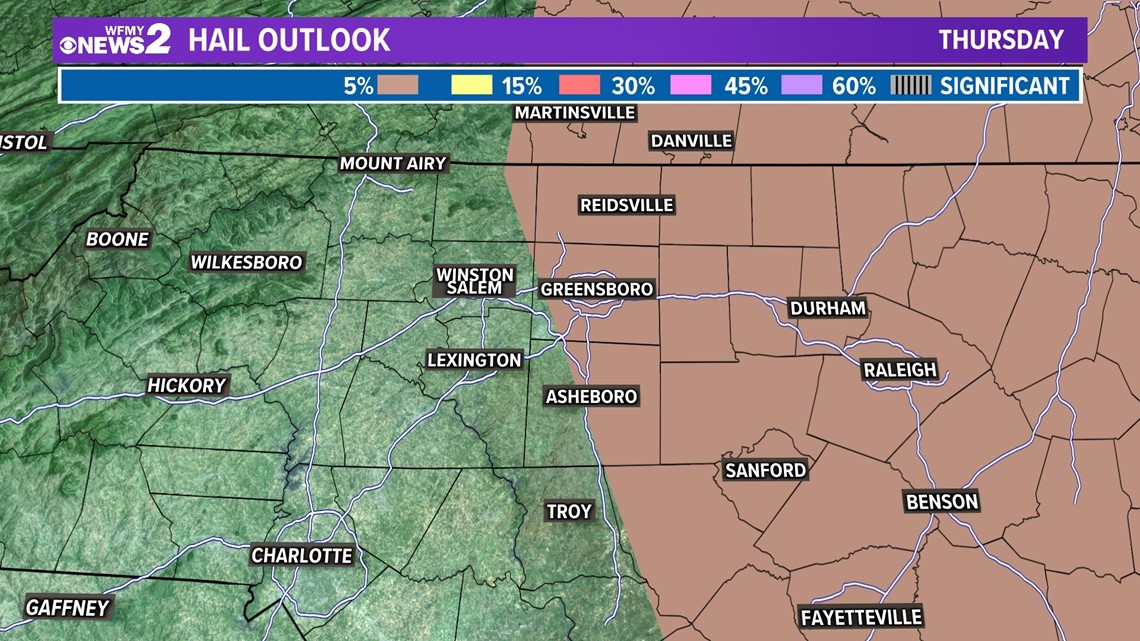
3. Hail
The hail threat in association with any severe storm matches that of the wind threat making this just as equally likely for us to see hail with a storm as that of a thunderstorm producing damaging winds for everyone north and east of Greensboro.

4. Flooding
The flash flooding likelihood is very low. The Weather Prediction keeps the flash flood risk well to our south across Georgia and South Carolina for Thursday. In terms of rainfall totals, we should stay less than an inch with some local places getting more.


