
GREENSBORO, N.C. — We may not have any snow on the way, but that doesn't mean it's not going to get cold. Some bitter Arctic air is sweeping across the country this week and the Triad won't be spared. Our WFMY News 2 Weather team is tracking the chill, when it will arrive, and what you should do to prepare.
ARCTIC AIR MOVING ACROSS THE COUNTRY
You've seen the headlines. Winter is gripping most of the country this week. From snow and ice, to the bitter air, we resisted it here in the Carolinas for a few days. Now, that weather pattern is shifting.
A cold front will be swinging through our area on Tuesday night. Behind it, frigid high pressure from Canada will build into the region. It will send our temperatures down quickly, dropping us from the 40s to 10s Tuesday night and Wednesday morning.
This is just the start of cold air for us. After the initial burst of chill another stronger push of colder air will arrive this weekend. Saturday and Sunday will be the coldest days.

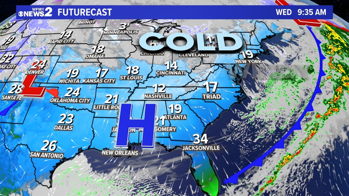
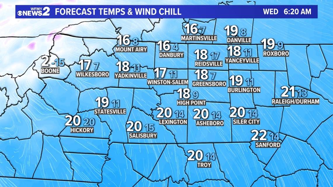
IT STARTS TUESDAY NIGHT / WEDNESDAY MORNING
The first morning to look for will be Wednesday morning. We're expecting low temperatures in the 10s but it will feel colder than that when you consider the breeze.
It's a good idea to bundle up using your best winter clothing, limit time outside, and consider protecting any exposed pipes or even dripping faucets.

COLDEST WILL BE THIS WEEKEND
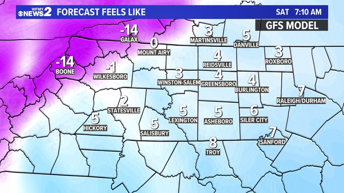
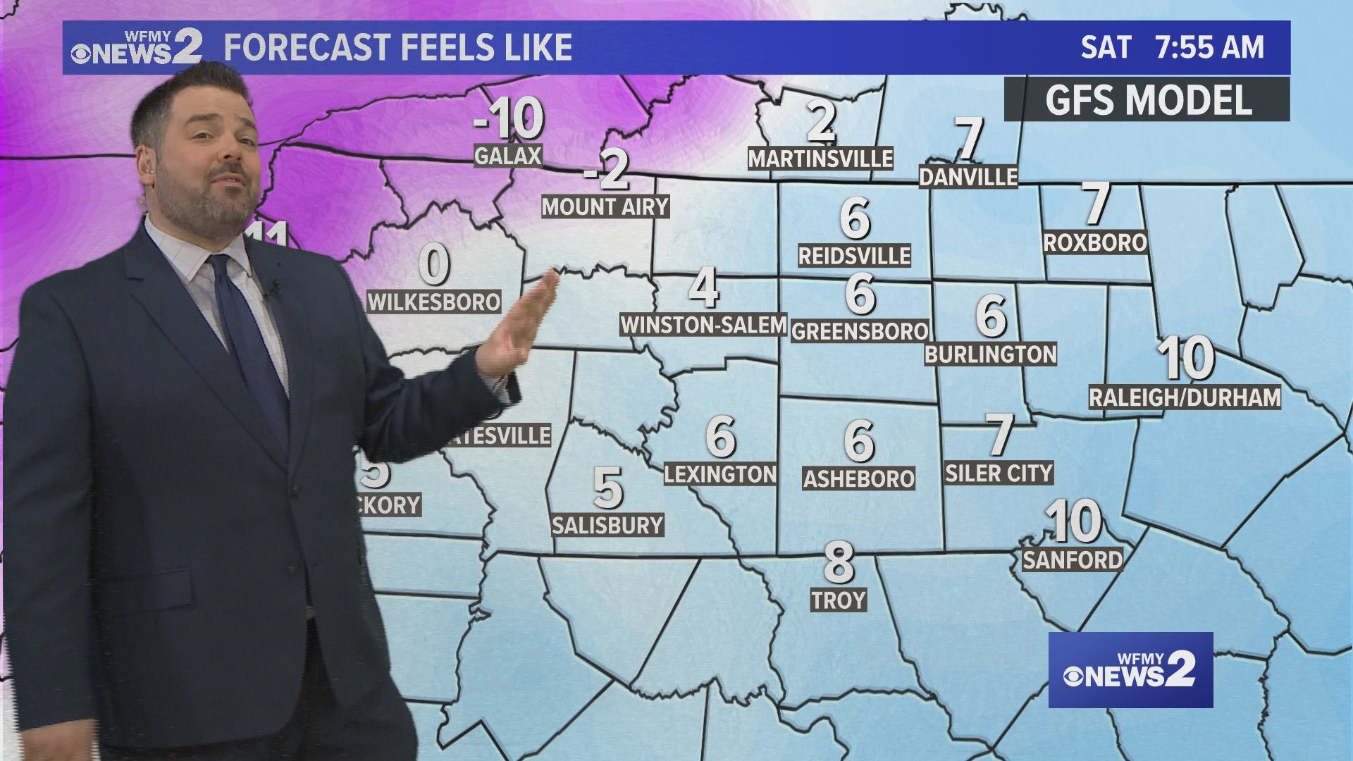
After a brief break from the big chill on Thursday and Friday, even colder air will be arriving for the weekend. A new Arctic front will be crossing into the Carolinas Friday night into Saturday morning. It will bring some whipping winds and very cold air.
Expect temperatures to dip into the mid-10s for Saturday morning and low-10s for Sunday morning. Both mornings will have a wind chill in the single digits.
This type of cold does happen in the Carolinas, but usually only a few times each winter.

