GREENSBORO, N.C. — Fred is no longer a major threat to the Triad as the storm's remnants trek north Wednesday morning. However, the flooding risk is still high. If you spot any severe weather in your area, text a photo or video to 336-379-5775 and include your name and location. Please only share photos and videos if you are safe to do so.
WEDNESDAY, AUGUST 18, 2021
4:42 a.m. -- The brunt of Fred is bringing heavy rainfall to West Virginia. Here in the Triad, things are mostly clear. Once this line of storms gets into Virginia, mostly all of NC will be in the clear from Fred.
2:40 a.m. - As Fred remnants continue to move north, the tornado watch expands including Stokes, Rockingham, and Caswell counties through 4 a.m.
1:54 a.m. - Heavy lightning and rain reported in southern end of rainband moving into Randolph Co.
1:57 a.m. - Guilford, Randolph, Montgomery counties will see strong storms next through 3 a.m.
1:47 a.m. - Strong storms pushing through parts of the Piedmont Triad.
1:30 a.m. - Tornado warning expired for Surry Co.
1:11 a.m. - Tornado warning issued for Surry Co. until 1:30 a.m.
1:00 a.m. - Tornado warning expired for Surry Co.
12:40 a.m. - Possible tornado touchdown on I-77 near mile marker 96 in Surry County.
Reports of flooding near Poplar Springs and trees down near Low Gap.
12:30 a.m. - National Weather Service issues two tornado warnings for Surry Co. one until 12:45 a.m. and the other until 1:00 a.m.
12:27 a.m. - Tornado warning issued for Surry, Carroll counties until 1 a.m.
TUESDAY, AUGUST 17, 2021
11:26 p.m. - Tornado warning expired for Surry, Yadkin, Wilkes counties.
10:48 p.m. - Tornado warning issued for Surry, Yadkin Wilkes counties.
10:13 p.m. - Tracking strong thunderstorms into the Foothills. WFMY News 2's Tim Buckley has an update.
10:05 p.m. - Flooding in Canton, North Carolina has washed out roads and bridges.
9:00 p.m. - Mudslides are happening in the North Carolina mountains.
8:30 p.m. - Triad weather could become active after 11 p.m.
7:45 p.m. - Weather activity in North Carolina calms down for a little while but will be more active later tonight and overnight.
7:00 p.m. - Tornado Watch until 2 a.m. for the Foothills and western Triad.
5:20 p.m. -- Storm damage in Ronda County left this barn destroyed.
4:45 p.m. -- Another video captured of the tornado in Ronda in Wilkes County. Ryan Holgerson and Riley Alden captured the video as it moved through town.
4:20 p.m. -- Our severe weather risk has been upgraded to a level 3 out of 5 for the Foothills this evening and overnight.
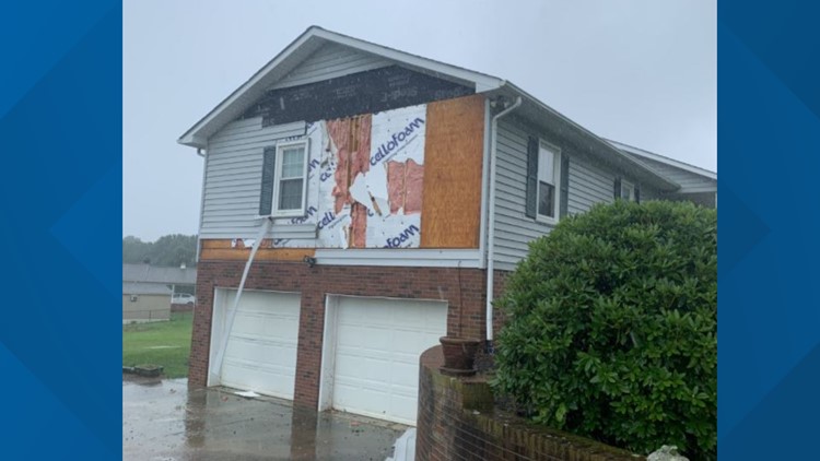
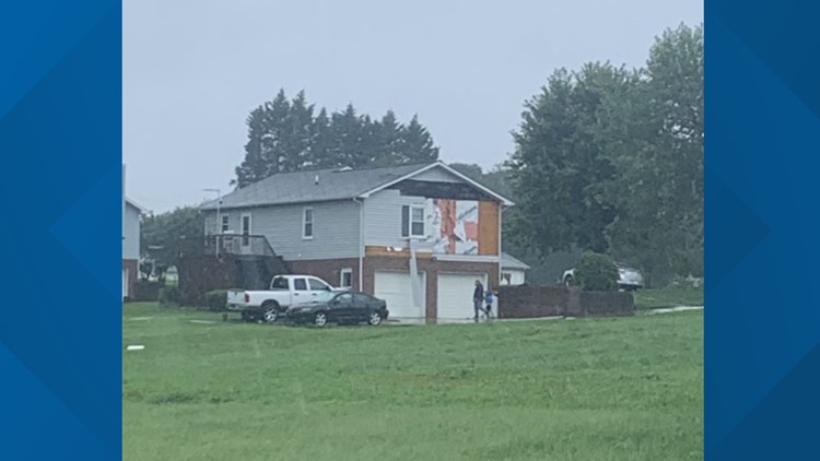
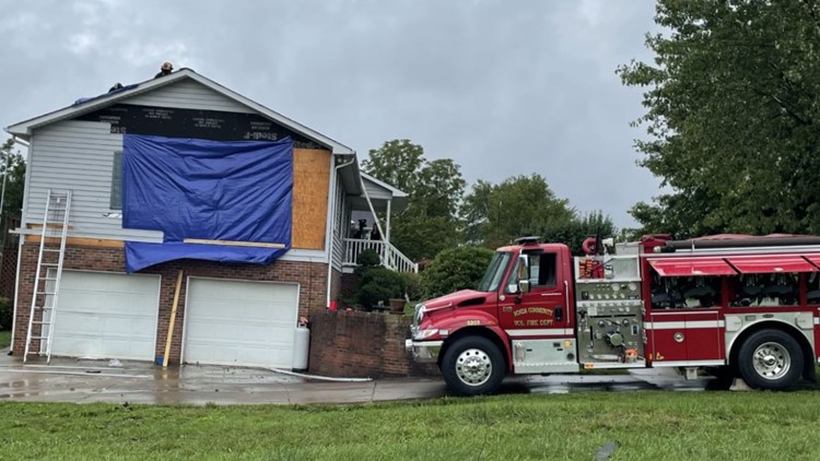
4:15 p.m. - Home damaged in Wilkes County near Clingman Road following tornado warning.
PHOTOS | Storm damage from Tropical Storm Fred
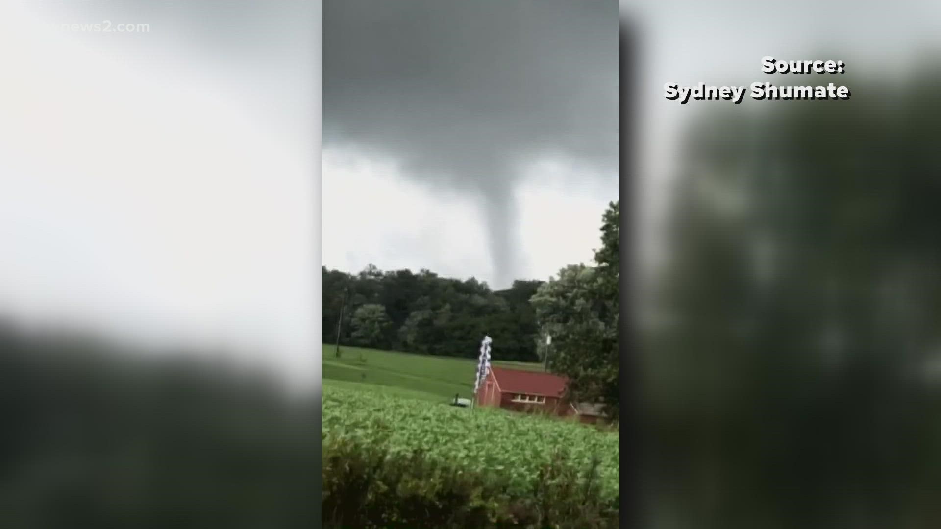
3:30 p.m. -- Jerritt Grimes captured funnel cloud video in Wilkes County this afternoon. That's definitely a tornado!
2:45 p.m. -- Tornado warnings are in effect for Rockingham, Stokes, Patrick, and Henry Counties until 3:15 p.m.
2:45 p.m. - Winston-Salem Fire Department Water and Rescue and Greensboro Fire Urban Search and Rescue teaming up and deploying to NCEM western branch to help with Tropical Storm Fred. The crews will be staging in Conover while waiting until they're sent out to help with rescue efforts.
2:15 p.m. -- Iredell Firewire tweeted video of a funnel cloud swirling through the Union Grove area. This is south of Wilkes, Yadkin, and Alleghany Counties where tornado warnings have been issued today as well.
2 p.m. -- Tornado warnings for Wilkes and Alleghany Counties are in effect until 2:30 p.m.
1:30 p.m. -- Here's a look at what appears to be a funnel cloud on the ground near Elkin, North Carolina. These photos are credited to Riley Alden and Ryan Holgerson.
1:30 p.m. -- Wilkes County is under a tornado warning until 2 p.m. This is the second time a tornado warning has been extended for the county.
12:30 p.m. -- A funnel cloud was spotted off Old Mountain Road in Iredell County. A warning was issued for the county around the same time.


