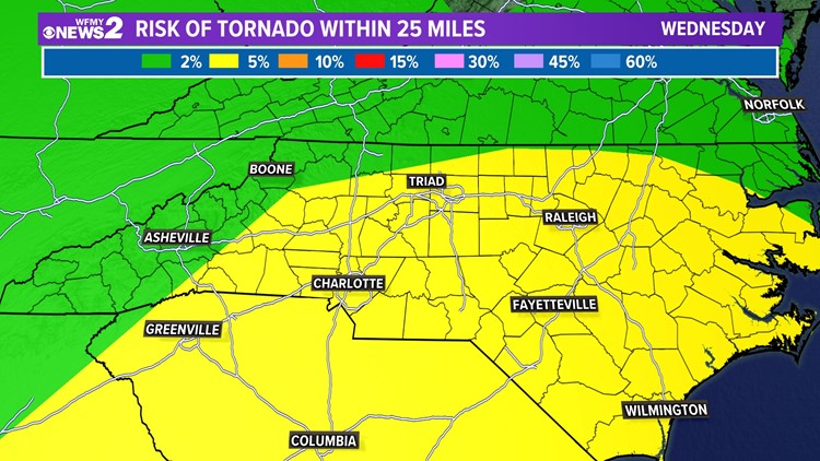
GREENSBORO, N.C. — A strong weather system is tracking across the country. It already brought tornadoes to Texas and could bring severe thunderstorms - or even a tornado - to the Carolinas on Wednesday.
Quick notes:
- Timing: 1-7 p.m. Wednesday, rain and thunderstorms
- Threats: Damaging wind gusts and can't rule out a tornado
- What to do: Know your safe spot. Download the WFMY News 2 app for latest weather updates
The forecast models that we use as meteorologists to guide us in putting together our forecast have consistently shown this strong developing low across the Deep South. As it travels east, its associated warm front will lift north and put us in a great spot for storms tomorrow. Behind warm fronts, the warm and moist air is the right setup for thunderstorms to develop.
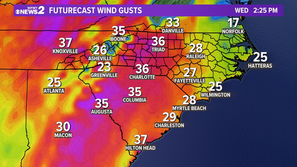
By Wednesday afternoon, a cold front will cross and this will be the lifting mechanism this warm and moist air needs to help the thunderstorms to grow. But, the forecast models are showing a major severe weather concern for us with this weather system on Wednesday. Not only will we see showers, but it is very likely that we will see storms that produce damaging winds, isolated tornado(s), and flash flooding. Despite the localized impacts from individual storms, it will be a windy Wednesday. Wind gusts are forecast to reach up to 40 mph across the area. Below is an in-depth discussion of what we can expect on Wednesday:
Strong Winds
Winds are forecasted to exceed 40 mph by Wednesday afternoon. Wind gusts will remain strong through Thursday -- reaching up to 30 mph throughout the day.

Isolated Tornadoes
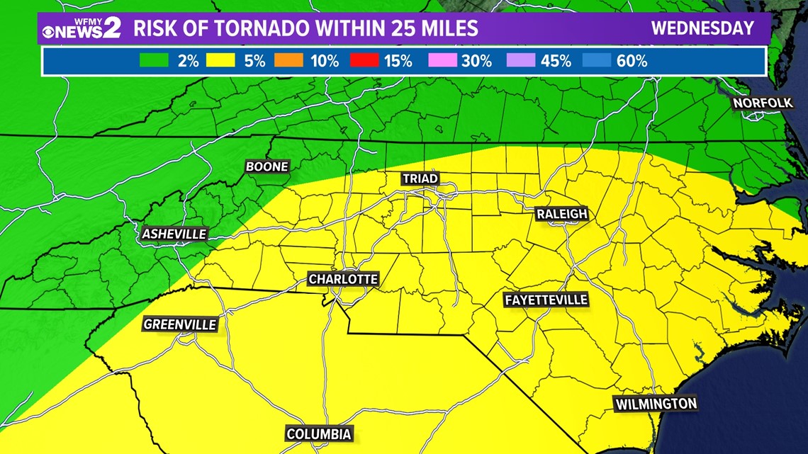
The major takeaway is that we cannot rule out the possibility of a few isolated tornadoes with any strong storms Wednesday afternoon. The Storm Prediction Center has us at a 5% chance for tornadoes. The severe weather outbreak threat will be much lower for our area as compared to the Deep South, but we must be on alert.

Rain, rain, and more rain!
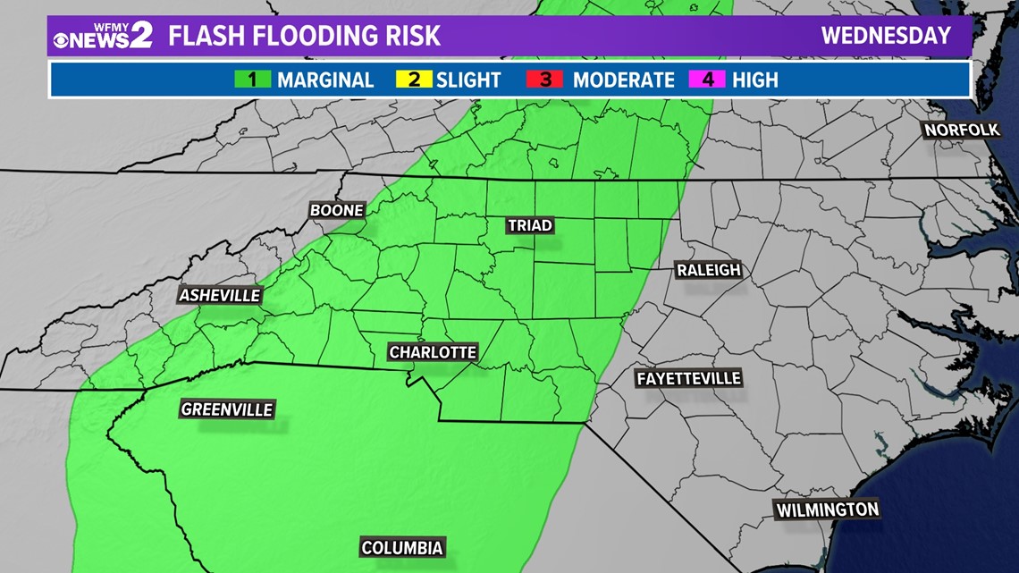
Flash flooding cannot be directly forecasted and the weather parameters used to suggest flash flooding potential are a bit tricky to explain; however, the models can reveal how much rain we can expect from the event. The big idea when it comes to rain is that some of these storms will have abundant moisture with them and will be able to dump a lot of rain in some spots. This will lead to some local flash flooding. You know the phrase: turn around don't drown. Don't wait for an alert, if you see water rising!

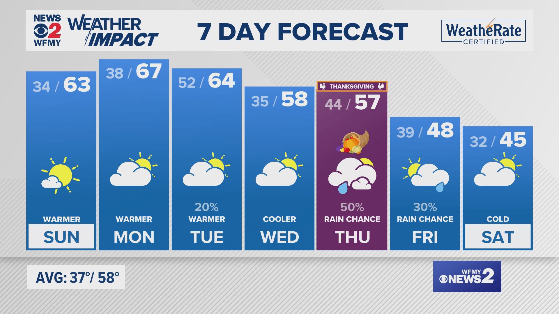
The good news is that by early Thursday, the front should be offshore and by the afternoon, we may get to see some sunshine. The rest of the workweek will be dry and the weekend will be mostly dry and cool.

