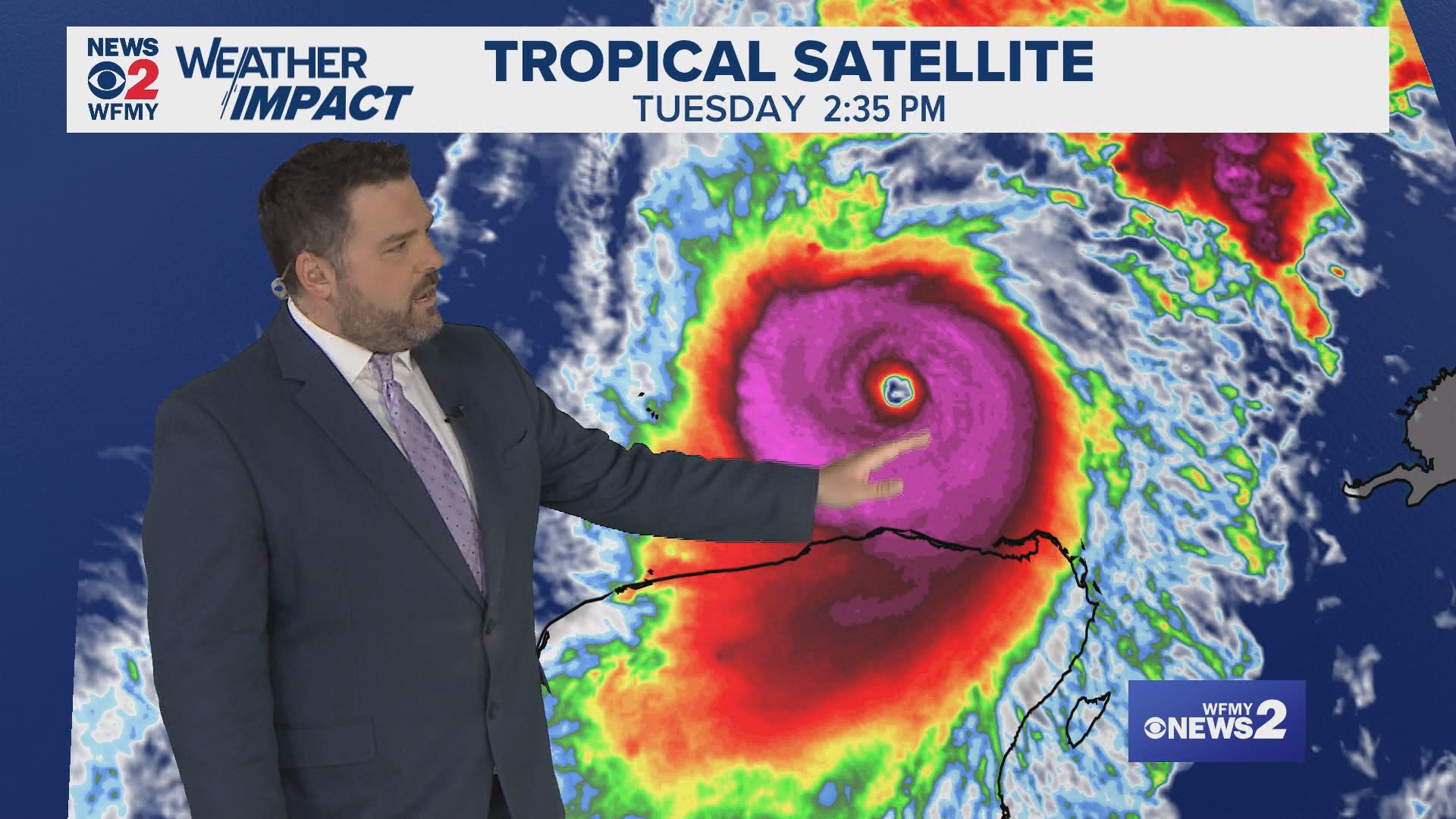
GREENSBORO, N.C. — Hurricane Milton is one of the strongest hurricanes on record in the Atlantic Basin. The storm became a category 5 hurricane on Monday afternoon, and is still a category 5 as of Tuesday afternoon.
This is a mind-blowing amount of intensification. Remember, Milton was only a tropical storm on Sunday morning. It became a category 5 hurricane in just a little more than 24 hours.
Near Record Wind Speeds
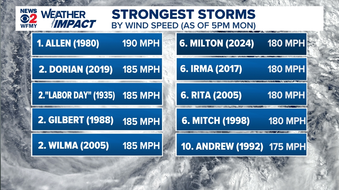
Milton is one of the strongest hurricanes by wind speed in the Atlantic Basin (which includes the Gulf of Mexico, Caribbean Sea, and Atlantic Ocean) on record. As of 5pm Monday, the storm packed 180 mph sustained winds estimated by the National Hurricane Center.
These type of wind speeds aren't often seen in hurricanes. In fact, there have only been five Atlantic hurricanes on record that have had wind speeds higher than Milton. The record for that is 190 mph winds in Hurricane Allen in 1980. Other storms on the list include Hurricane Dorian in 2019 with 185 mph winds. Wilma in 2005, Gilbert in 1988, and the Labor Day Hurricane in 1935 also had wind speeds of 185 mph.


Where is Milton Going?
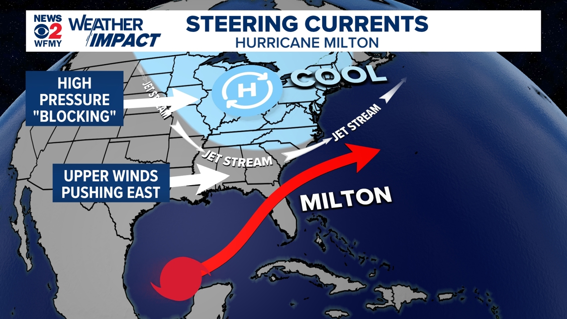
Milton is heading through the Gulf of Mexico to the east and will be hitting Florida as early as Wednesday night into Thursday morning. The current forecast keeps the storm a major hurricane through landfall.
It is possible that it loses some of its peak intensity, but it will be an extremely strong storm no matter what at this point.
Everybody in Florida should be taking Milton very seriously, especially along the west coast.


Why is it taking a strange path?
Milton is being steered by a few factors. Strong high pressure building into the East Coast of the United States will be acting as a blocker. Low pressure systems like hurricanes go right around high pressure systems. Milton won't be able to move north into the Carolinas.
There's also a cold front sweeping through the Southeast and an upper level jet-stream that provide a wind that will push the system to the east once it gets to Florida.


