
GREENSBORO, N.C. — Hurricane Lee is the most powerful storm of the year now after some ferocious strengthening. It is in the middle of the Atlantic Ocean now and heading west. The WFMY News 2 Weather Team is tracking it for you.
First Category 5 This Year
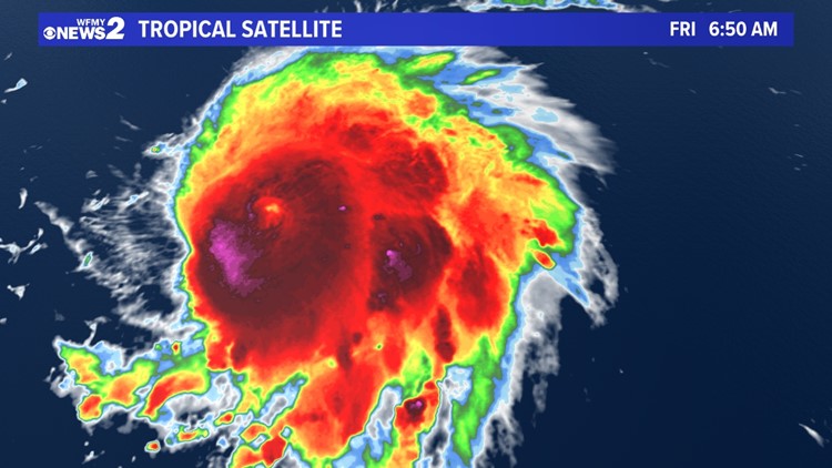
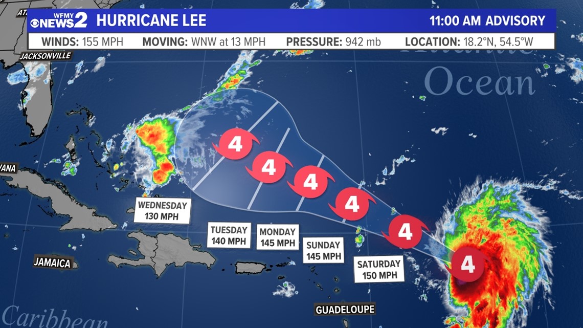
Lee is still plowing across the Atlantic Ocean. It has incredible power as it became the season's first Category 5 hurricane last night. The remarkable thing is that is was only a tropical storm on Wednesday morning. A strong eye has developed on satellite meaning it is a very well-organized storm and is likely to continue to strengthen.
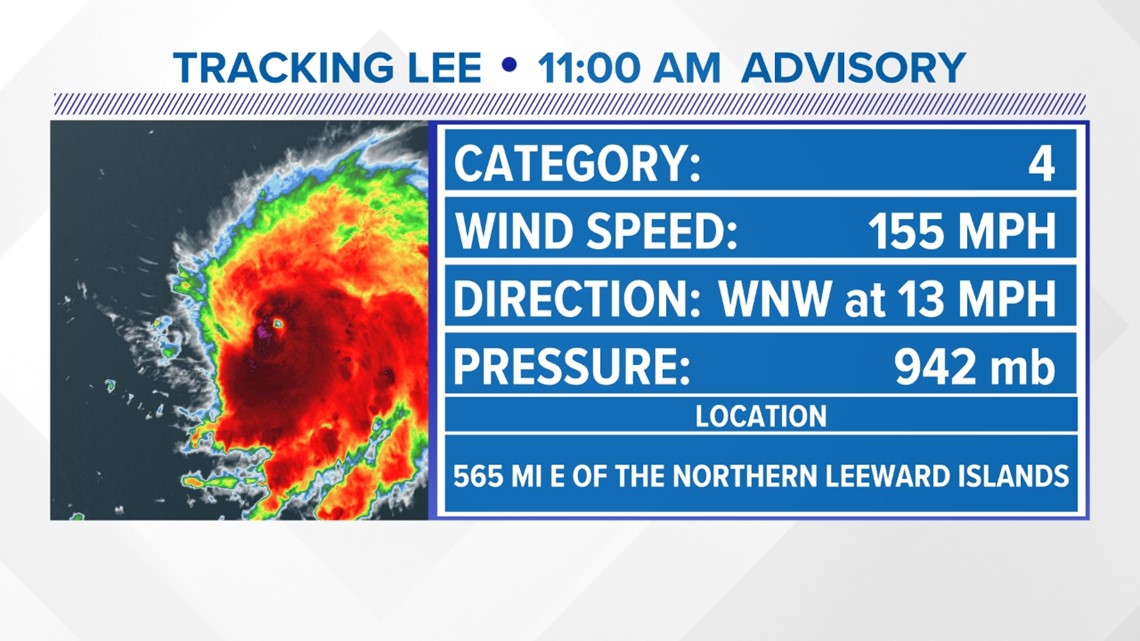
Right now the storm is a little over 600 miles to the east of the Leeward Islands. It is not currently a threat to any land, but it is getting closer.
The current strength has the hurricane as a Category 4 hurricane with winds of 155 mph. at 2 PM Friday. It was beaten up a little this morning with stronger winds out in the Atlantic.

Where is Lee heading?
The latest forecast for Lee continues to take the storm northwest over the next 5 days. That is the easy part of the track. We know it will get stronger and track northwest safely away from the Caribbean Islands through the weekend. Those in Puerto Rico will be close enough to get high surf, but not close enough to feel the wind and rain from the storm.
Beyond 5 days, the forecast gets a little bit more uncertain. By early next week, the storm is likely to start to slow down. After slowing, it's likely that there will be a northward turn of the hurricane. Forecasting these turns are tricky. We need to know how quickly it will turn and at what angle to determine who is at risk, if anybody.
Right now, it looks likely that it will turn north and stay away from the East Coast of the United States and pass in between the Carolinas and Bermuda. This is not locked in, so we aren't in the clear just yet. Forecasts beyond 5 days aren't very reliable.

Computer Model forecasts:
Computer models have been consistently projecting Lee to take that northerly turn before impacting the East Coast of the United States. That's a good trend for us. Here are the latest "spaghetti models" below:

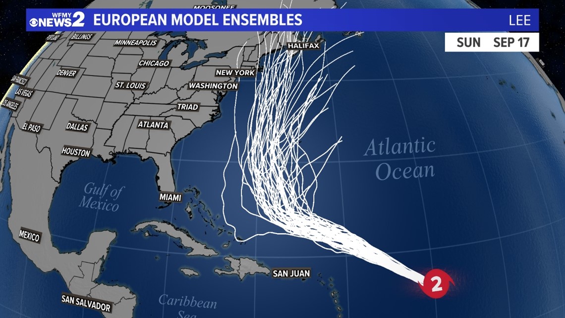
The reason for this sharp turn to the north next week has to do with what we call the steering flow; just another word for atmospheric winds. The way the setup is, high pressure to the north of the storm will act as a block, keeping the storm south for a few days. By early next week, a dip in the jet stream over the East Coast will start to push the storm north and then northeast. That's why it is expected to turn around before hitting us.
Of course, all of this is simply a forecast. Small adjustments could have big impacts. We need to keep an eye on the trends over the next 5 to 7 days.
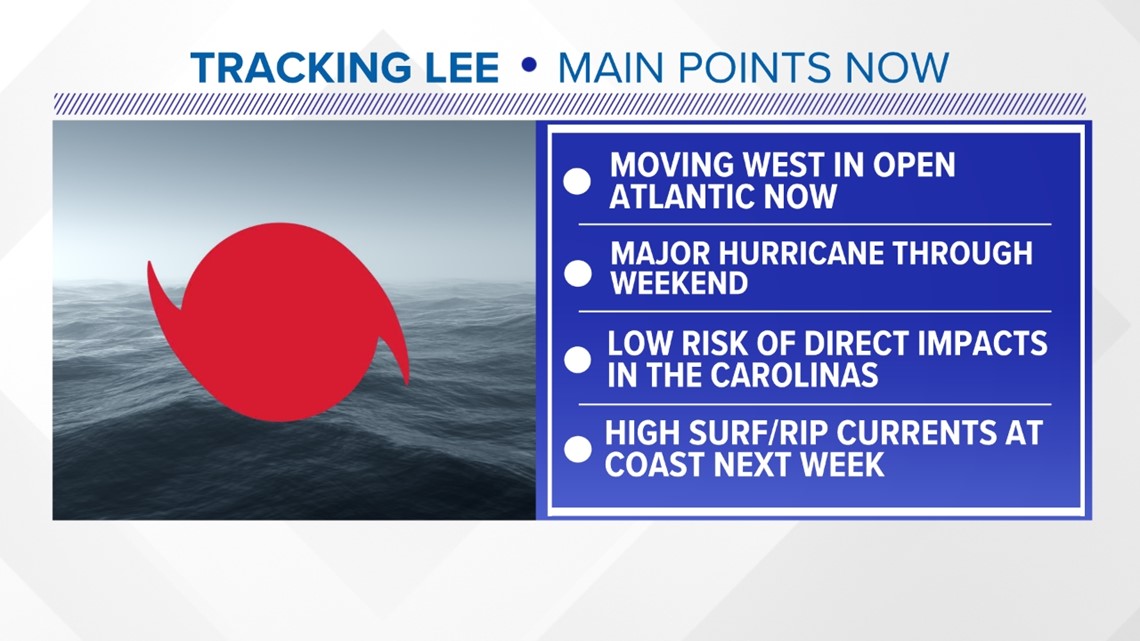
Main Points for us in North Carolina:
Right now, we don't need to worry or panic in North Carolina. Simply keep an eye on Hurricane Lee as it continues on its path and we get more confident in the forecast.
As of right now, the storm does not look like it will get close to the East Coast. Of course, we will let you know if that changes. Regardless, high surf and dangerous rip currents are likely at the Carolina coast starting Sunday through next week.