

GREENSBORO, N.C. — Be weather alert this evening. It is not a day where you want to go about your daily routine without checking in with the News 2 Weather Team. We're tracking the potential for nasty thunderstorms moving across North Carolina. While it isn't a guarantee you'll see one in your area, you should be ready.
Severe storms marched across the Midwest and Midsouth on Sunday, and now they're heading east. This means the threat area shifts to North Carolina and the East Coast for our Monday. In fact, this is the biggest risk of damaging thunderstorms our area has faced this year.
A Severe Thunderstorm Watch is posted until 10pm.
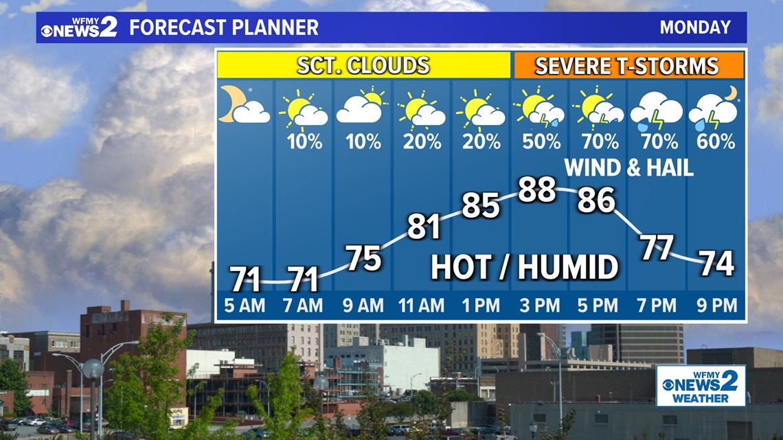
This storm system is essentially a quick-moving cold front. It will be moving from the northwest into our area by Monday afternoon and evening. Ahead of it, it will be quite hot and humid. This sticky, steamy air is the perfect fuel for thunderstorms. In fact, it should make it easy for any storms that form to create high winds and even large hail.
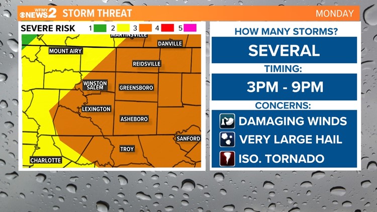
When we talk about severe thunderstorms, we use a 5 level scale. Monday rates a 3 out of 5 on that scale. These "level 3" risks are pretty rare for us, with only a handful issued each year. This is our first level 3 risk of 2023.


One thing to keep in mind on Monday is that even though we have tons of fuel for nasty thunderstorms, there is uncertainty on exactly where they will form and how many there will be. There is a good chance your town will be missed, so be prepared - even while knowing you may be missed.
Timeline:
Monday morning will be free of any severe weather. The day will start with scattered clouds, and possibly a lingering shower from storms that moved overnight to our west.
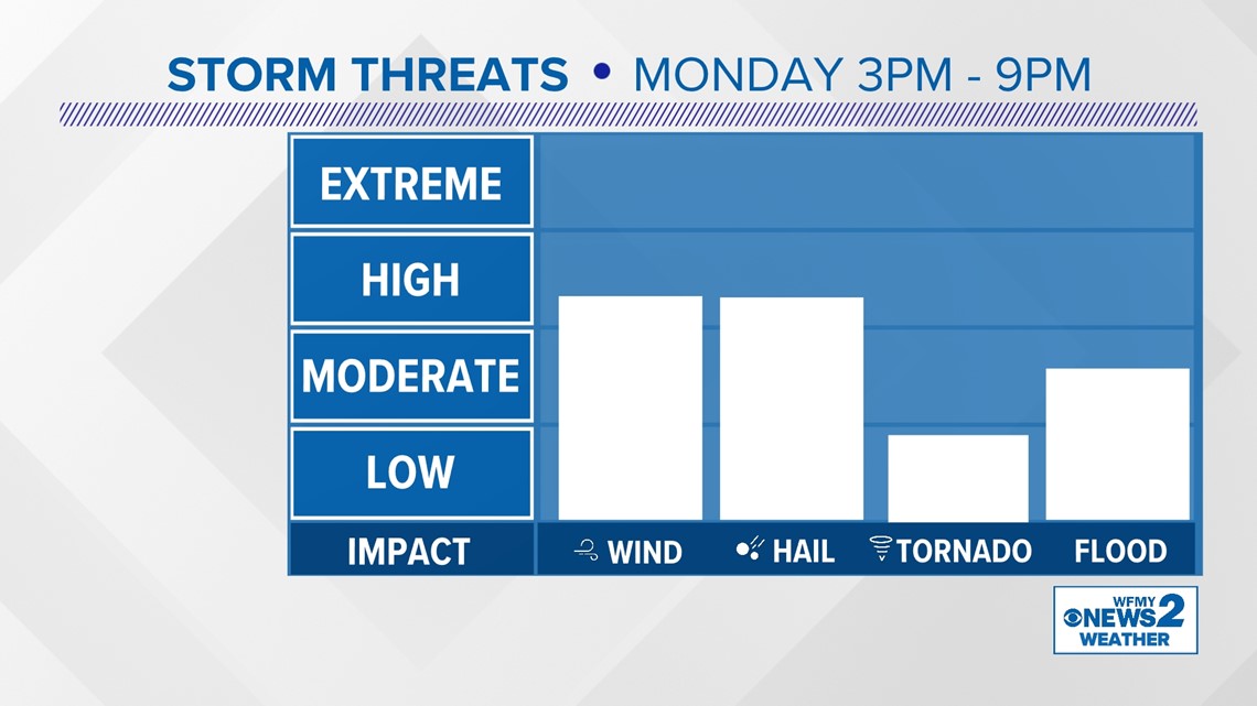
The main time to watch will be the late afternoon and the evening. We're focusing on the 3pm to 9pm timeframe from west to east in our region.
- Morning: Scattered Clouds. Low Shower Chance.
- Midday: Hot and Humid. Storm-free.
- 3pm - 5pm: Few thunderstorms forming in the Foothills and moving east.
- 5pm - 9pm: Thunderstorms moving across the Triad and pushing east. Best chance for severe weather

Storm Threats:
With thunderstorms that form on Monday, the main concerns will be damaging wind gusts that could down trees and power lines, and also some very large hail.
Hail on Monday could get large enough to dent cars in some of the strongest storms across the state. That's not very common in North Carolina.
Tornadoes aren't the main threat from this system. Still, one or two can't be ruled out across the state.
Heavy rainfall in storms could pose a flood threat to some.

What to do:
The main thing is to stay informed on Monday as you go about your day. Keep checking up on the forecast through the WFMY app and on our newscasts and social media. Use our interactive radar to see if storms have popped yet and if they're hading your way.
Have a plan for you and your family on where to go / what to do in the event of a severe thunderstorm or tornado in your area.
Having a plan in place ahead of time makes it easier to spring into action.
- Check the forecast
- Use the News 2 Interactive Radar
- Watch News 2 weather reports in the evening / afternoon
- Park car in shelter from hail if possible